WEATHERAmerica Newsletter, Saturday, May 13, 2023 at 11:00 PM CT; Near Term Forecast
28 views
Skip to first unread message

Larry Cosgrove
May 14, 2023, 12:08:42 AM5/14/23
to weather...@googlegroups.com
SHORT RANGE OUTLOOK
(Through The Next 72 Hours)
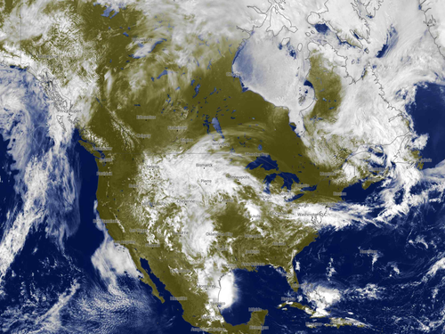
Dry West Coast....Dry East Coast...And Wet With Thunderstorms In The Middle!
METEOBLUE
UQAM Meteocentre (3)
TwisterData.Com (3)
University Of Wisconsin Weather Server (3)
College Of DuPage Weather Laboratory
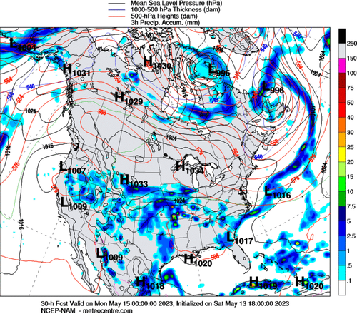
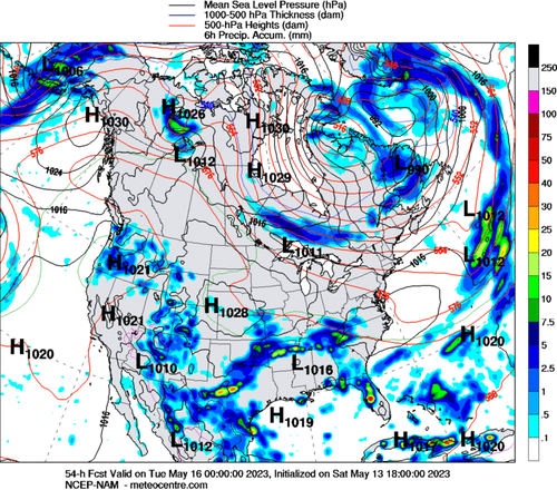
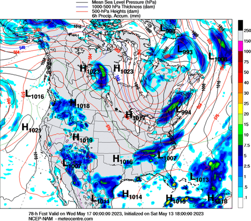
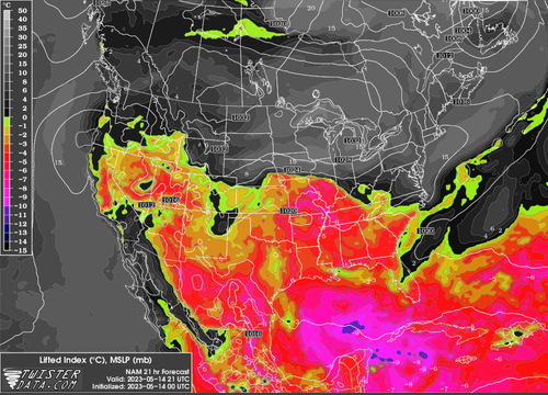
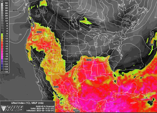
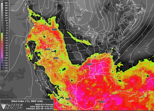
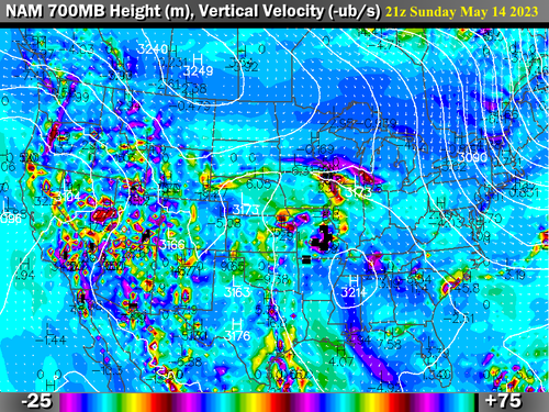
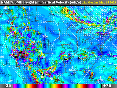
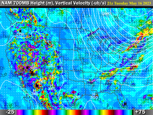
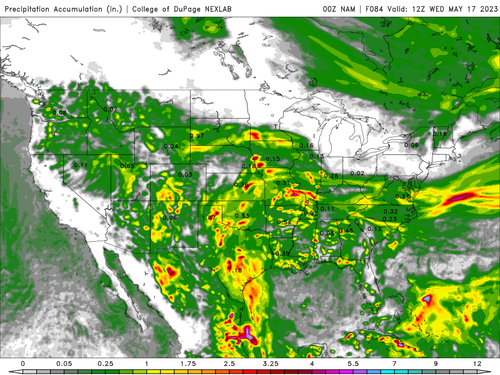
The input of high humidity from the Gulf of Mexico will prove hard to shake, as the fetch shows up through May 23, and likely beyond. Mesoscale disturbances will present thunderstorm risks from the Deep South through most of Texas and the High Plains/Rocky Mountains. This disturbed area will lie in between the relatively mild and dry conditions along the West Coast and the Eastern Seaboard. Some of the convection could be in the heavy-to-severe range, especially in the Lone Star State where impulses from below the Rio Grande Valley will migrate north along the Interstate 35 and 45 corridors.
Searching For Heat Ridges, And Finding None!
METEOBLUE
PivotalWeather.Com (3)
ECMWF
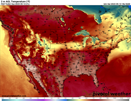
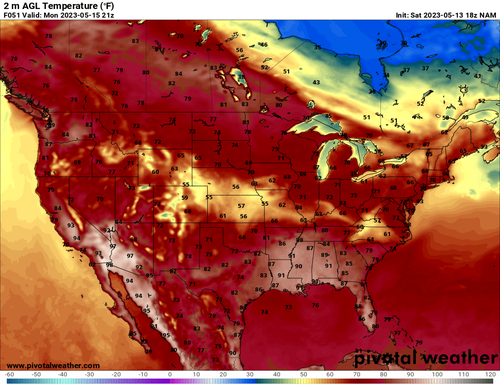
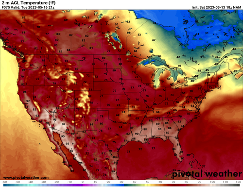
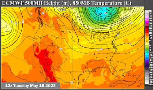
This being the middle of May, we should be seeing some areas of hot weather. Now while some irregular patches of tropical air may push readings past the 90 deg F mark in the Desert Southwest and the Mid-South, the weather maps do not have that look of "heat around the corner". A subtropical jet stream continues in play across the southern third of the U.S., and the only extant heat ridge of note lies over southern Mexico. While the near term and medium range are by no means cool or chilly, you will not be inclined to head for the beach or pool. This is still Spring.
Reply all
Reply to author
Forward
0 new messages