WEATHERAmerica Newsletter, Saturday, April 30, 2022 at 11:15 P.M. CT; Near Term Forecast
28 views
Skip to first unread message

Larry Cosgrove
May 1, 2022, 12:18:37 AM5/1/22
to weather...@googlegroups.com
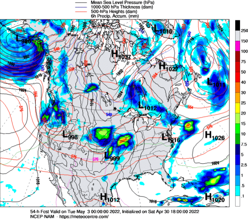
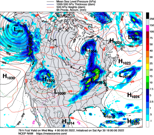
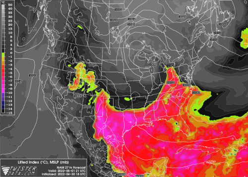
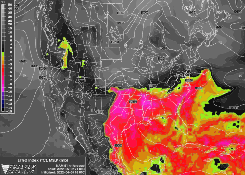
SHORT RANGE OUTLOOK
(Through The Next 72 Hours)
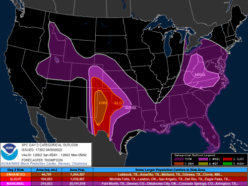
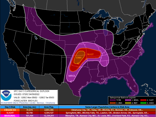
Another Severe Weather Threat For The Great Plains....
NOAA/SPC
NOAA/NESDIS
UQAM Meteocentre (3)
TwisterData.Com (3)
University Of Wisconsin Weather Server (3)
College Of DuPage Weather Laboratory (2)
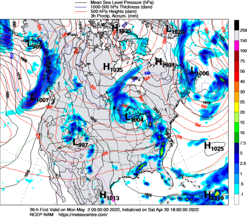
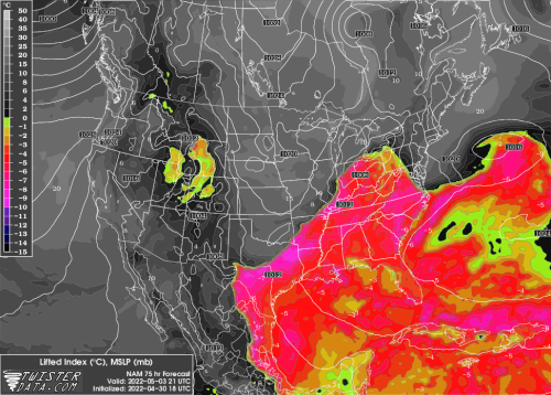
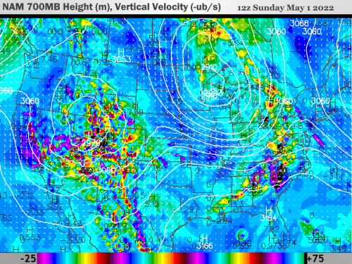
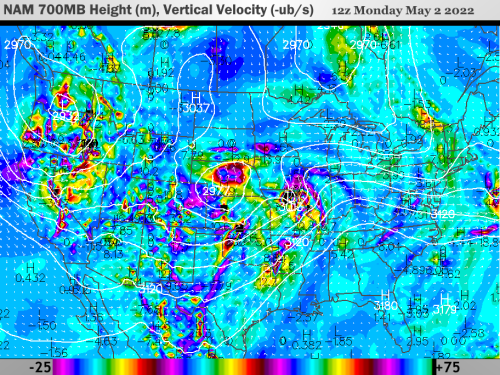
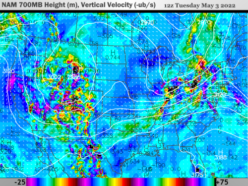
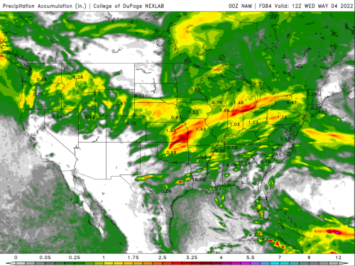
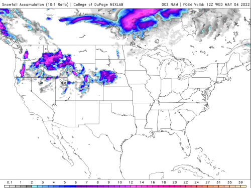
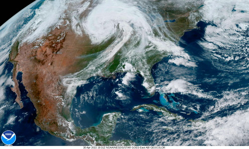
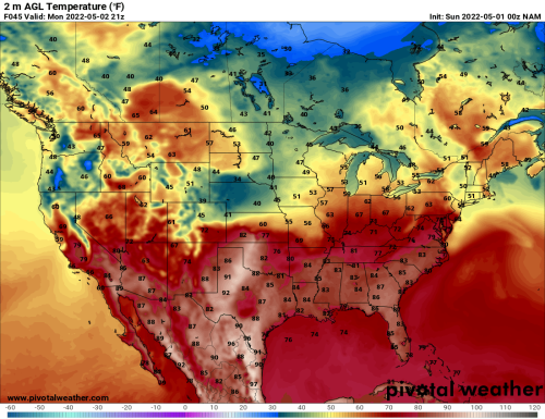
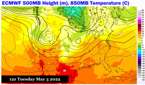
As I have been alluding to in recent discussions online, we are in the midst of a very active pattern for intense convection across the middle and southern chambers of the lower 48 states. But instead of synoptic scale troughs, these are well-developed shortwaves that eject out of the Gulf of Alaska and later take a typical Colorado/Trinidad A path. The heat ridge complex over Mexico occasionally percolates north, capping the atmosphere over parts of Texas and the Gulf Coast. But risks for N TX, OK, KS and NE through the Ohio and Tennessee Valley will be quite high through mid-May.
I have concerns that, like Friday, tornadic and large hail bearing supercells will occur over the lower High Plains into the central and lower Missouri Valley on Sunday and Monday. The NAM version suggests isolated severe weather cases may arise in between Interstates 10 and 20, forming along a boundary that settles roughly from Austin TX to Alexandria LA and starts to bulge northward in response to the southwest flow ahead of the impulse arriving in the Texas Panhandle. This is a serious situation and requires close scrutiny roughly every three days during wave train passage. Even the Mid-Atlantic region will likely be affected if the warm sector reaches S NY and New England by Monday.
.....While Eastern Third Of Continent Slowly Warms Up
NOAA/NESDIS

PivotalWeather.Com (3)
ECMWF
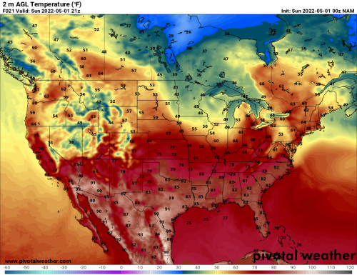
I have heard many complaints about cold weather over the past week or so, surprisingly from people on the East Coast where temperatures have occasionally risen to very warm highs. The aggravation of cold air forming over the late-season snowpack in southern Canada and the north central U.S. is over now, largely because the higher sun angle is eliminating the snow cover, and winds aloft are trending west-to-southwest from the Great Plains into the Eastern Seaboard. Rain and thunderstorms will occasionally interfere with the warming trend, but any return to freezing temperatures in the lower 48 states will largely be limited to the higher elevations of the Intermountain Region.
Reply all
Reply to author
Forward
0 new messages