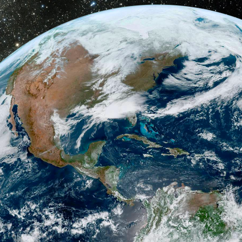
WEATHERAmerica Newsletter, Saturday, April 2, 2022 at 11:05 P.M. CT; Near Term Forecast
33 views
Skip to first unread message

Larry Cosgrove
Apr 3, 2022, 12:07:38 AM4/3/22
to weather...@googlegroups.com
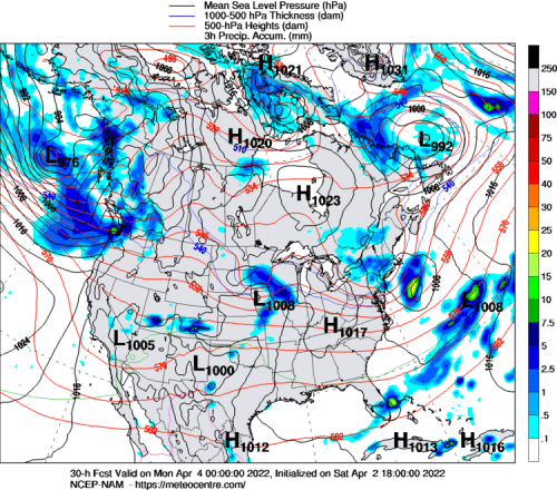
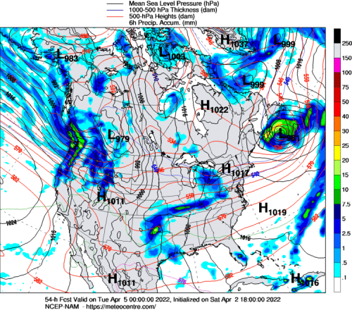
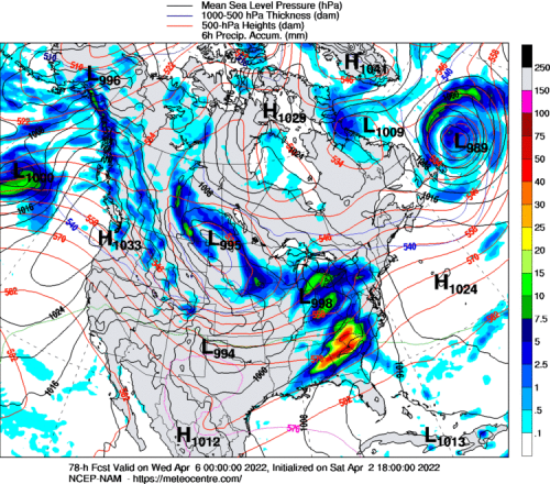
SHORT RANGE OUTLOOK
(Through The Next 72 Hours)
Is It Time For Another Severe Weather Outbreak?
NOAA/NESDIS
UQAM Meteocentre (3)
TwisterData.Com (4)
University Of Wisconsin Weather Server (3)

College Of DuPage Weather Laboratory (2)
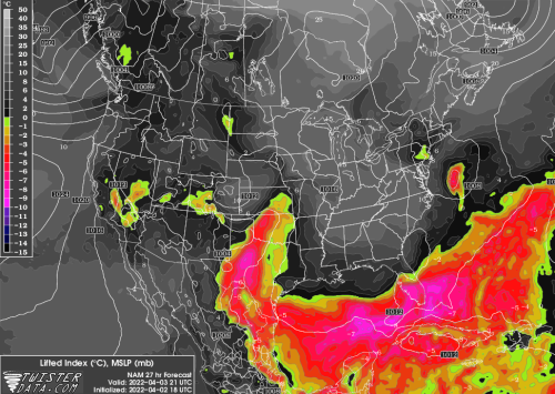
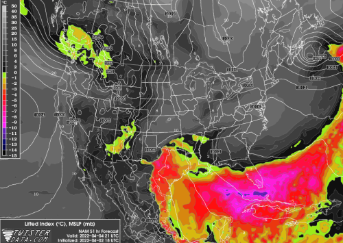
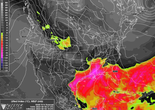
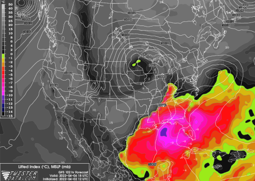
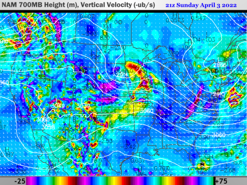
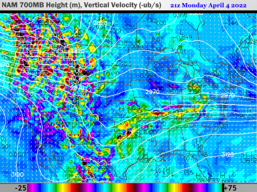
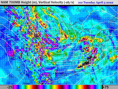
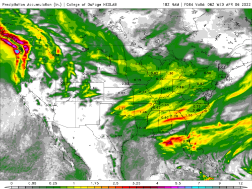
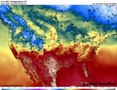
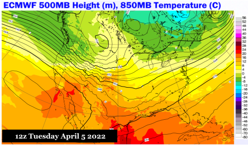
The short answer is yes, but the whole convective setup is complicated enough to give one pause about using the word "outbreak" vs. the term "event". I will argue for the former, since the dynamic action in play of a larger cold storm or vortex upstream, may both enhance chances for intense convection from Texas and the Deep South up along the Eastern Seaboard. Then as the main system deepens and heads through the Midwest and Great Lakes, the still warm and unstable atmosphere in the Ohio and Tennessee Valleys may see a second, independent round of hail and tornado threats late Wednesday and Thursday. The driver in this scenario is an infusion of mTw air, with high dewpoints and instability that surges into Texas and Oklahoma, then gets drawn north and east by the track of the low pressure center into Pennsylvania and New Jersey. The relative coldness of the upper atmosphere, with steep lapse rates involved, points to the risk for large and plentiful hail in convection along the Interstate 10 and 20 corridors, then perhaps into the Carolinas and Virginias on Wednesday. Vertical velocity array at 700MB points strongly to supercell and bow echo production with the southern branch system. Tornado potential with the larger 500MB feature will rise in the Midwest and western slopes of Appalachia, ahead of a cold front, on Wednesday night and Thursday.
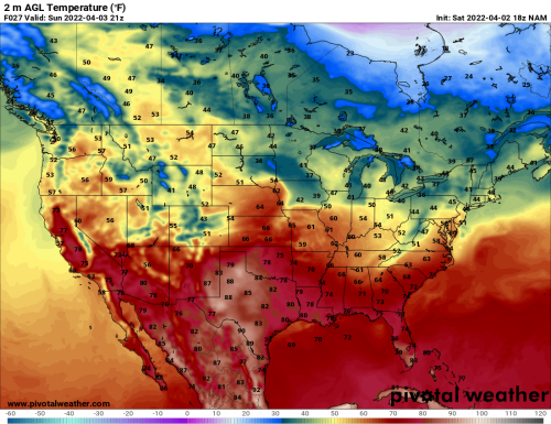
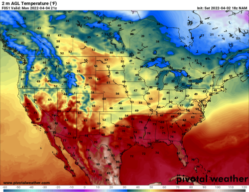
Warm, Dry Layer Over Western States Will Be Eroded By Midweek
NOAA/NESDIS
PivotalWeather.Com (3)
ECMWF
The position of a heat ridge in California and the Desert Regions may save the Southwest from the cold mPk values now aimed at the Pacific Northwest. The vortex now over the western Gulf of Alaska will reach Montana on Tuesday morning, with the attendant polar jet stream aligned from Oregon into Colorado. If so, there may be a dry, downslope flow into the Golden State, allowing for a very early in the year fire episode. Precipitation chances will increase over the Intermountain Region but not the arid Great Basin and Salt Lake Valley.
Reply all
Reply to author
Forward
0 new messages