WEATHERAmerica Newsletter, Saturday, April 16, 2022, 9:55 PM CT; Longer Term Forecast
75 views
Skip to first unread message

Larry Cosgrove
Apr 16, 2022, 11:00:03 PM4/16/22
to weather...@googlegroups.com
EXTENDED PERIOD FORECAST
(Between Day 11 And Day 15)
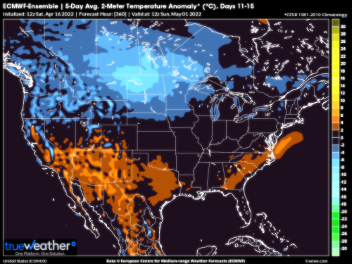
Shaping Up To Be A Warmer Remainder Of Spring As Ridges Take Over In Sonoran And Bermudan Positions
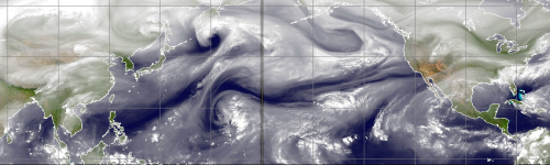
CIMSS
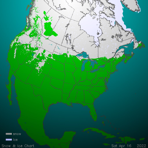
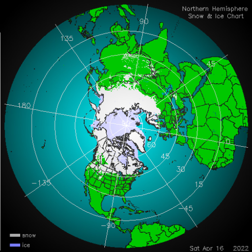
NOAA/IMS (2)
TropicalTidbits.Com (Dr. Levi Cowan) (3)
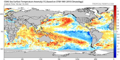
NOAA/PMEL
NOAA/CPC
HPRCC/University Of Nebraska (2)
Environment Canada
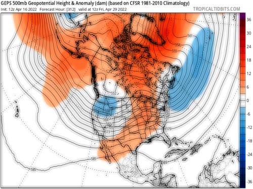
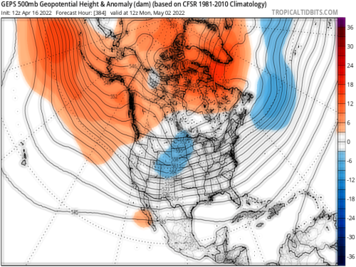
TropicalTidbits. Com (Dr. Levi Cowan) (5)
TrueWx.Com (3)
NOAA/CPC
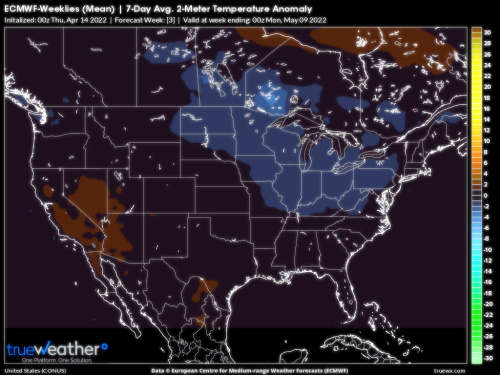
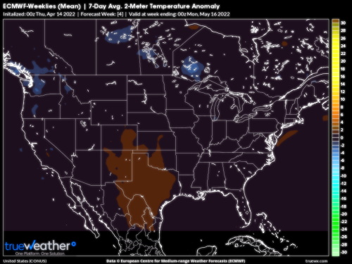
Slowly but surely, the last vestiges of winter will start to disappear from North America. That Southeast ridge formation in the medium range offers a clue as to how the remainder of spring will turn out.
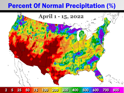
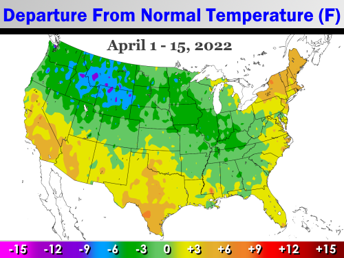
It is funny that just like last December, when rumors of a sudden, ominous appearance of winter were flying on the Internet, so was talk of a "cold spring" with snow hitting the big cities. And yes, even a few sprinklings of 1816 (even though the Tonga volcano put out much less particulate and sulphur than Mount Tambora did) chatter. But while cold air so far in April has been a force in North America, the heavy snow and chill has been mostly over Canada and the northwest/north central portion of the lower 48 states. The eastern and southern tier of the continent has been above normal, just like March was. And the negative temperature anomalies have nowhere to go, because the rising sun and gradual disappearance of snow cover will chip away at potential for polar air mass formation.
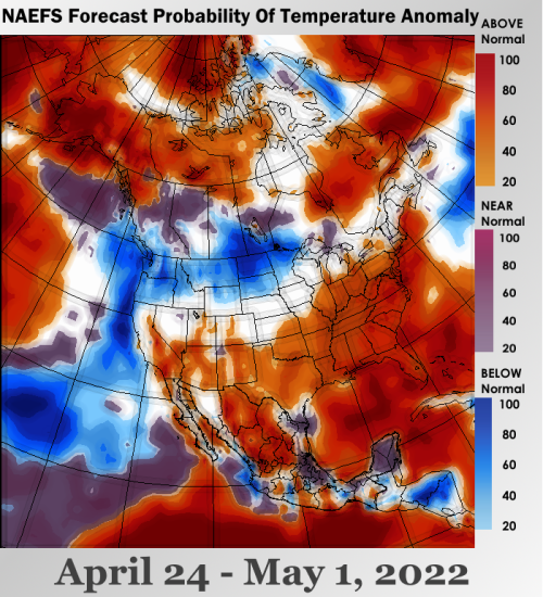
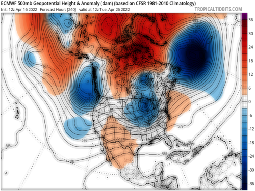
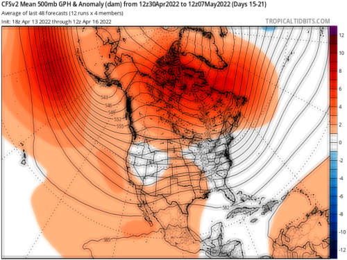
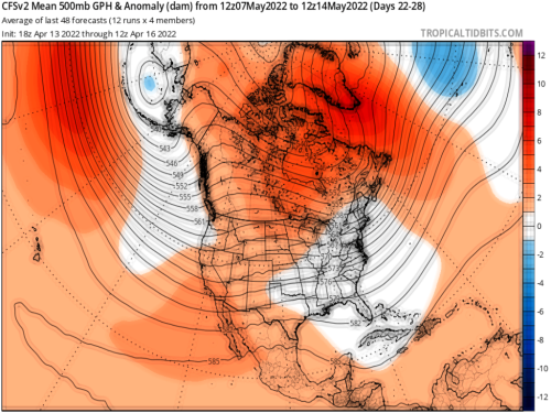
Another factor to mention is the gain in latitude of the storm track. The convection seen along the Gulf Coast on Sunday may well be the last of the spring season. Note that while there are well-defined shortwaves at 500MB in the extended forecast maps through mid-May, each impulse is moving along or above 40 N Latitude. This is a severe weather pattern, which allows warmer air to come further north. The area from the typical Tornado Alley must be watched carefully for intense convection forecasts over the next 6 weeks. There may be a miserable chill in the northern U.S. and southern Canada. But warmth is supported in the Southwest and central regions, with soil dryness a harbinger of coming heat this summer.
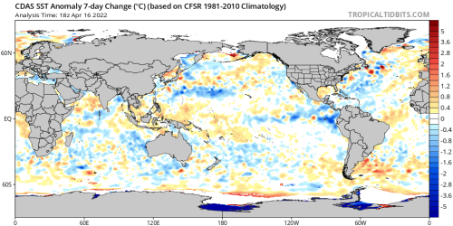
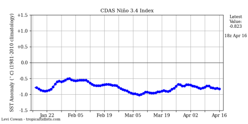
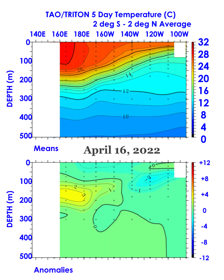
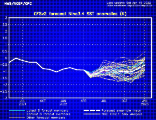
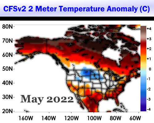
The warming in the western Pacific Basin also offers a clue or two about how summer (JJAS) will turn out in the lower 48 states. For that, stay tuned!
Prepared by Meteorologist LARRY COSGROVE on
Saturday, April 16, 2022 at 9:55 P.M. CT
Disclaimer:
The previous statements are my opinions only, and should not be construed as definitive fact. Links provided on this newsletter are not affiliated with WEATHERAmerica and the publisher is not responsible for content posted or associated with those sites.
Copyright 2022 by Larry Cosgrove
All rights reserved.
This publication may not be reproduced or redistributed in whole or in part without the expressed written consent of the author.
This publication may not be reproduced or redistributed in whole or in part without the expressed written consent of the author.
Reply all
Reply to author
Forward
0 new messages