WEATHERAmerica Newsletter, Saturday, May 13, 2023 at 11:00 PM CT; Longer Term Discussion
76 views
Skip to first unread message

Larry Cosgrove
May 14, 2023, 12:08:18 AM5/14/23
to weather...@googlegroups.com
EXTENDED PERIOD FORECAST
(Between Day 11 And Day 15)
The Subtropical Jet Stream Gets In The Way Of Heat Build-Up In The Lower 48 States
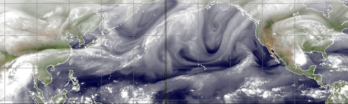
CIMSS
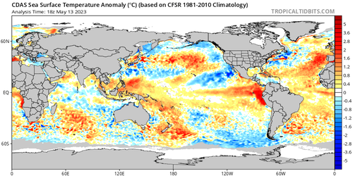
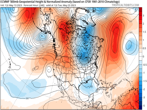
TropicalTidbits.Com (Dr. Levi Cowan) (3)
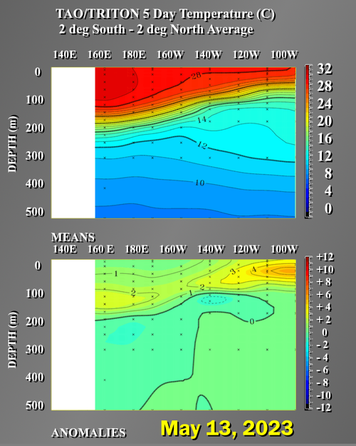
NOAA/PMEL
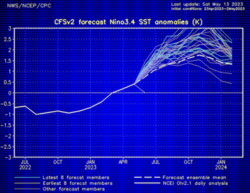
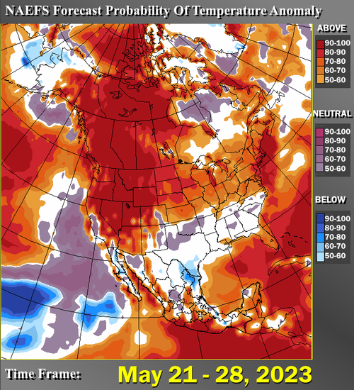
NOAA/CPC
HPRCC/University Of Nebraska (2)
Environment Canada
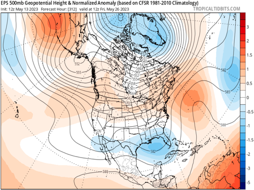
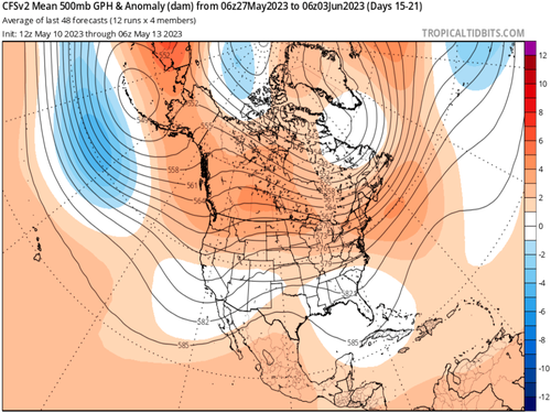
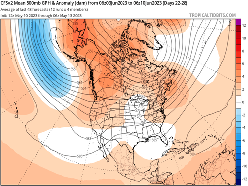
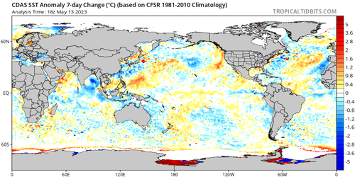
TropicalTidbits.Com (Dr. Levi Cowan) (5)
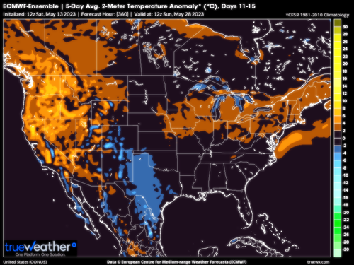
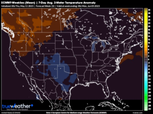
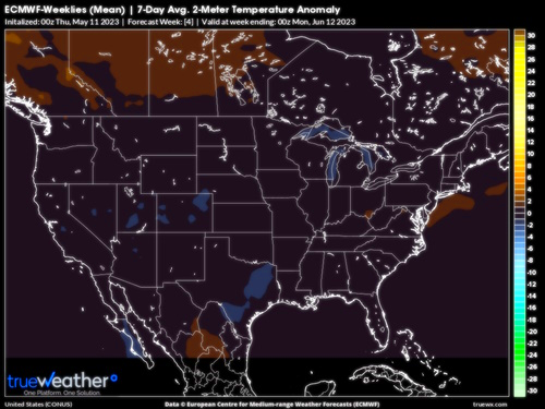
TrueWx.Com (3)
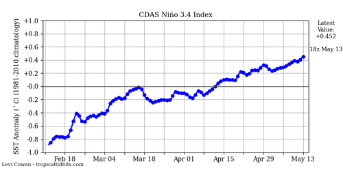
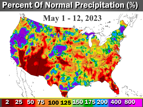
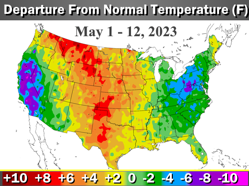
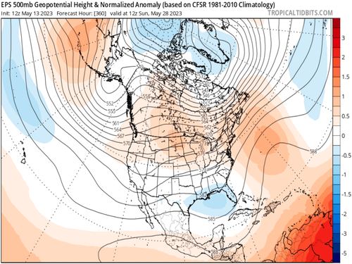
NOAA/CPC
In my many years of weather forecasting (now at 47....), I stress the importance of ridge type and position in prediction of temperature extremes. If an anticyclone is positioned at high latitudes, locations further south will have a colder trend. Should the ridge complex be stationed in the middle latitudes, and show core values at 500MB of 588dcm or more, hot air is a likely result. But if ridging is not present, and westerlies dominate, with any kind of jet stream, the milder spectrum will dominate over heat or cold.
Well guess what. All of the model guidance in the longer term shows a subtropical jet stream passing through the southern U.S. With disturbances, kind of an El Nino look except that it is not October, but May. Which immediately tells us that no one outside of South Texas or South Florida is likely to be hot this Memorial Day weekend. Mind you, this is not a very cool set-up; but rather a mild to occasionally warm scenario punctuated by showers and thunderstorms along the southern and eastern tiers of the lower 48 states.
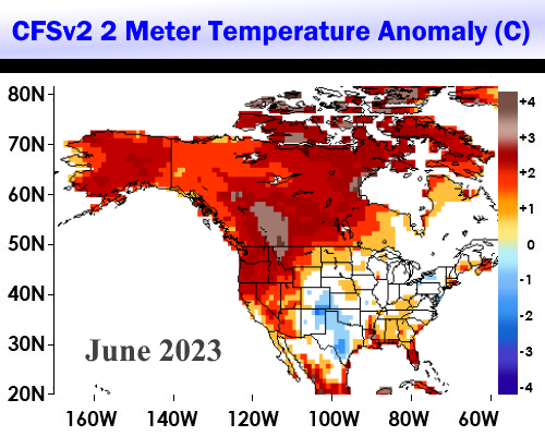
Interestingly, the upper air projections as we move into June are somewhat similar to that of 2009. This is not to say that we are headed for a cool summer nationally, but rather that at this point it would be unwise to push a bullish/hot forecast. There is one bubble ridge showing up in Weeks 3 and 4 over Texas, so that is the exception to a mild forecast expectation for next month.
The further complication is the negative height anomaly showing up in the Gulf of Mexico next week. Could it be a convective circulation that spins up on an old frontal structure? Since 2001 is one of the analogs I use in creating the summer (JJAS) outlook, it makes sense to look over a tropical system threat for the Texas and Louisiana shoreline of the Gulf of Mexico.
Prepared by Meteorologist LARRY COSGROVE on
Saturday, May 13, 2023 at 11:00 P.M. CT
Disclaimer:
The previous statements are my opinions only, and should not be construed as definitive fact. Links provided on this newsletter are not affiliated with WEATHERAmerica and the publisher is not responsible for content posted or associated with those sites.
Copyright 2023 by Larry Cosgrove
All rights reserved.
This publication may not be reproduced or redistributed in whole or in part without the expressed written consent of the author.
This publication may not be reproduced or redistributed in whole or in part without the expressed written consent of the author.
Reply all
Reply to author
Forward
0 new messages