WEATHERAmerica Newsletter, Saturday, March 26, 2022 at 8:25 P.M. CT; Near Term Forecast
45 views
Skip to first unread message

Larry Cosgrove
Mar 26, 2022, 9:30:11 PM3/26/22
to weather...@googlegroups.com
SHORT RANGE OUTLOOK
(Through The Next 72 Hours)
Cold Regime Slowly Lifts Through Eastern Portion Of North America
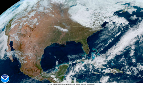
NOAA/NESDIS

PivotalWeather.Com (3)
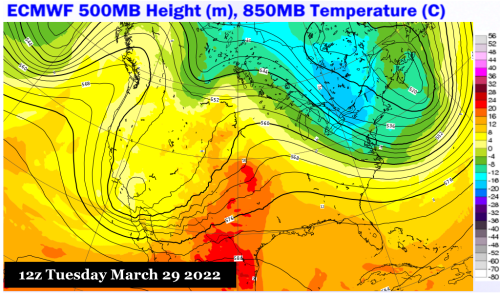
ECMWF
Many of the near term and medium range forecast models during the week previous showed extremely cold air across much of the eastern half of Canada and the U.S. While chilly values are seen in Ontario, Quebec, and the Northeast, overall influence of truly Arctic air is somewhat limited. The northwest flow of IcA values will not leave until Tuesday, and then only slowly. The strongest warming will be felt across the south central states and Dixie in early week, ahead of the next major storm. Keep in mind that the unstable character of the regime will lend itself to snow squall activity from locations near James Bay through the Great Lakes and into Appalachia on Sunday and Monday.
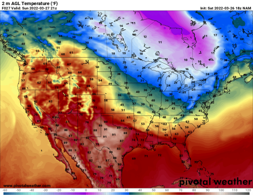
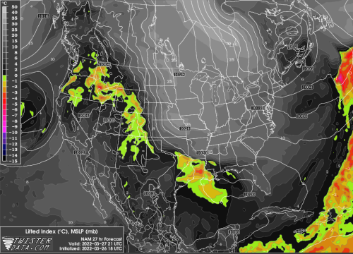
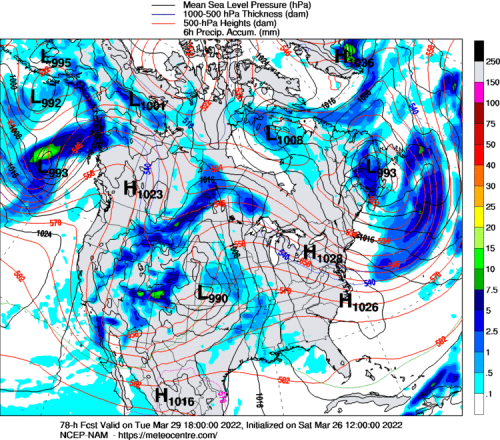
Developing Storm Along West Coast Will Have Major Impacts For Texas, Great Plains By Wednesday

NOAA/NESDIS
TwisterData.Com (3)
University Of Wisconsin Weather Server (3)
UQAM Meteocentre (3)
College Of DuPage Weather Laboratory (2)
Sit down. Buckle up. This is going to be a rough ride. On many levels.
Sit down. Buckle up. This is going to be a rough ride. On many levels.
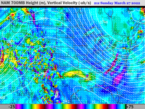
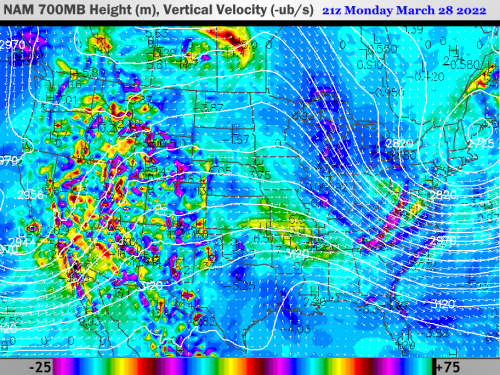
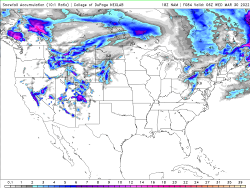
I am using an off-road metaphor to describe the slow, painful advance of a storm complex off of the West Coast. The southern branch core is stronger than its Gulf of Alaska counterpart, and will likely not reach California until Monday night. The impulse in the polar westerlies will follow the larger/colder storm in the subtropical branch, and then dig southward in a merger pattern over the High Plains. Scattered heavy mountain snows are likely across the western third of the U.S. during the next 72 hours. There is enough instability (steep lapse rate, some Pacific Ocean moisture) and energy (vorticity and difluence aloft) to mention severe weather potential across the southwestern states on Monday and Tuesday.
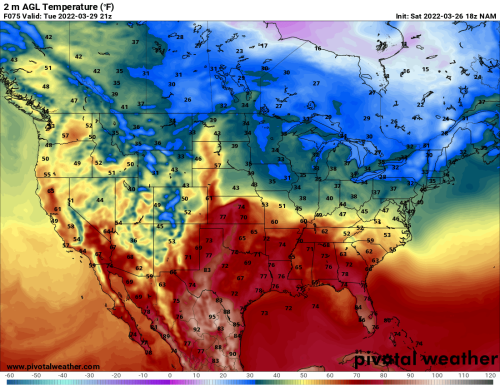
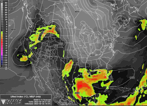
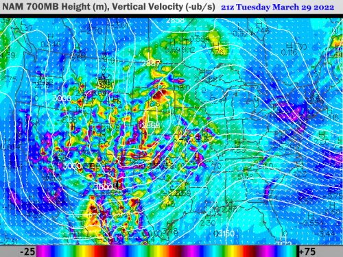
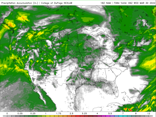
The phasing begins in earnest on Tuesday. Most of the schemes show a very deep surface low pressure center taking shape in the Texas/Oklahoma Panhandle Region, with the gusty southerly flow across texas and the Great Plains finally tapping into Gulf of Mexico moisture. Against a dryline from southwestern Kansas into northern Chihuahua state, and a pivot of the upper lwo and trough to a slightly negative tilt, intense thunderstorms should develop Tuesday night from the TX Hill Country into the NE Sand Hills. The area of intense convection will be capable of producing very large hail, tornadoes, and microbursts in the middle of the night before reaching the Interstate 35 corridor (Wichita KS to Austin TX) in the early morning hours of Wednesday.
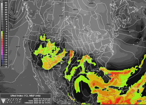
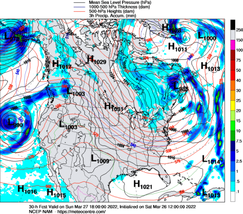
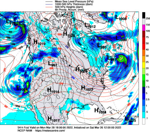
As we move into March 30, heavy snows in the cold sector will likely stretch from the E CO and W KS High Plains into the upper/middle Missouri Valley, with strong surface winds. Depending on timing, the arc of the strong and merged 500MB hybrid type storm will present risks for intense convection in a band from the eastern half of Texas into the Ozark Plateau, advancing by the end of Wednesday into the lower/middle Mississippi Valley. A vigorous wind shift and drop in temperatures, sort of a limited Blue Norther, will fall behind the severe weather threat. I emphasize again that many of the same locations hit by the tornado and hail event of Monday and Tuesday have the same, or greater, potential for severe thunderstorms during the March 29 - 31 period.
As we move into March 30, heavy snows in the cold sector will likely stretch from the E CO and W KS High Plains into the upper/middle Missouri Valley, with strong surface winds. Depending on timing, the arc of the strong and merged 500MB hybrid type storm will present risks for intense convection in a band from the eastern half of Texas into the Ozark Plateau, advancing by the end of Wednesday into the lower/middle Mississippi Valley. A vigorous wind shift and drop in temperatures, sort of a limited Blue Norther, will fall behind the severe weather threat. I emphasize again that many of the same locations hit by the tornado and hail event of Monday and Tuesday have the same, or greater, potential for severe thunderstorms during the March 29 - 31 period.
Reply all
Reply to author
Forward
0 new messages