WEATHERAmerica Newsletter, Saturday, April 16, 2022, 9:55 PM CT; Medium Range Forecast
51 views
Skip to first unread message

Larry Cosgrove
Apr 16, 2022, 11:00:33 PM4/16/22
to weather...@googlegroups.com
MEDIUM RANGE OUTLOOK
(Four To Ten Days From Now)
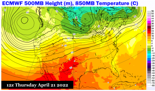
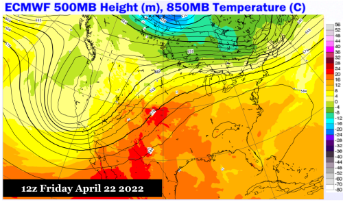
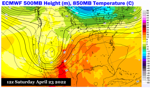
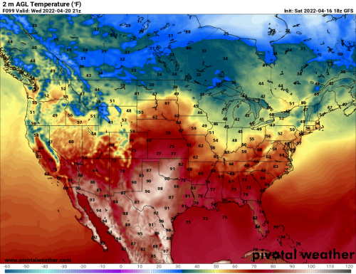
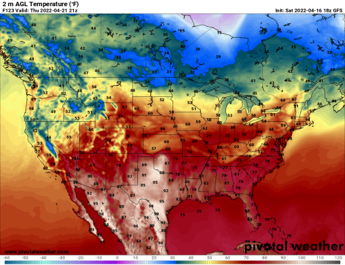
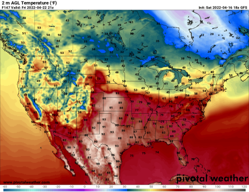
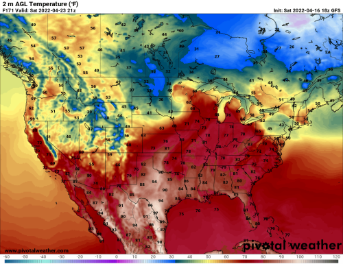
Return Of the Southeast Ridge Warms Locations To The Right Of The Rocky Mountains....

ECMWF (4)
Pivotal Weather (4)
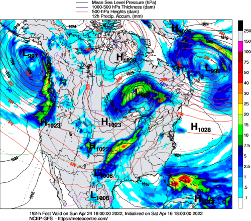
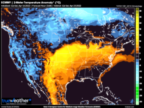
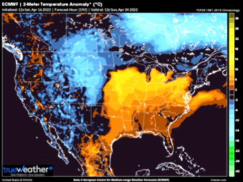
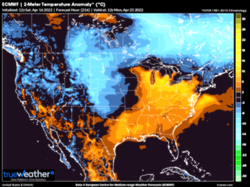
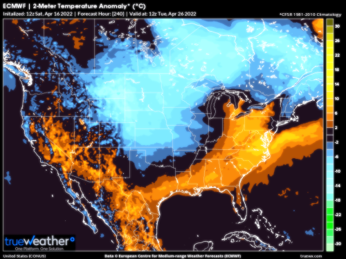
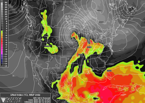
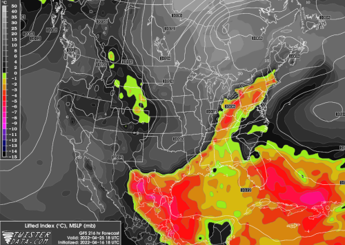
Sandwiched in between a major storm complex in the West and a moisture lagen upper level low in the Greater Antilles, our old friend the Southeast ridge will reappear during the medium range period. This is an important feature for spring, because the anticyclone creates opportunity for abundant sunshine, and with it, very warm temperatures. The ridge will not be easy to dislodge, so the area of positive thermal anomalies that takes shape from Texas through the Great Plains will likely not be weakened until April 26-27 or so. At some point, the disturbance centered over Hispaniola (which may bring extremely heavy rainfall from Cuba into Puerto Rico) could erode the right flank of the surface high pressure (risk to Florida for thunderstorms in the last week of April). But the system should provide a needed dose of summer-like weather for those under the impression that is or was going to be a cold spring.
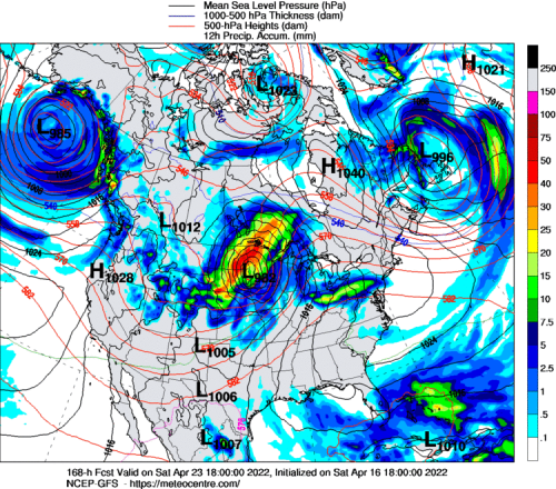
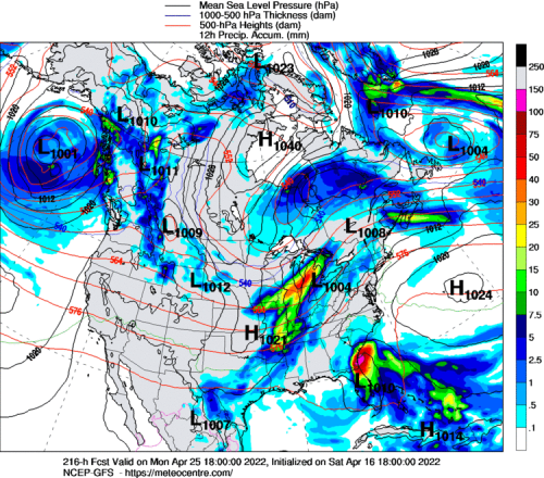
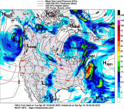
....While Huge Hybrid-Type Trough In The West Aims At The Corn Belt And Great Lakes Next Weekend
UQAM Meteocentre (4)
TrueWx.Com (4)

TwisterData.Com (4)
College Of DuPage Weather Laboratory (2)
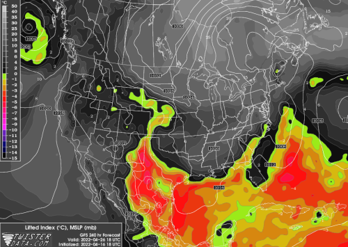
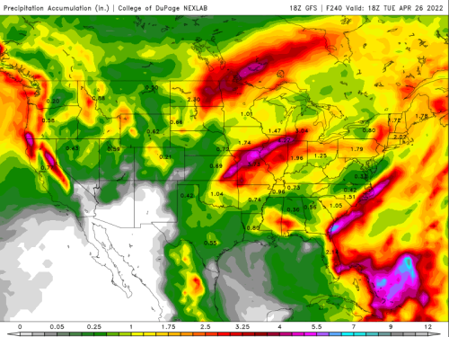
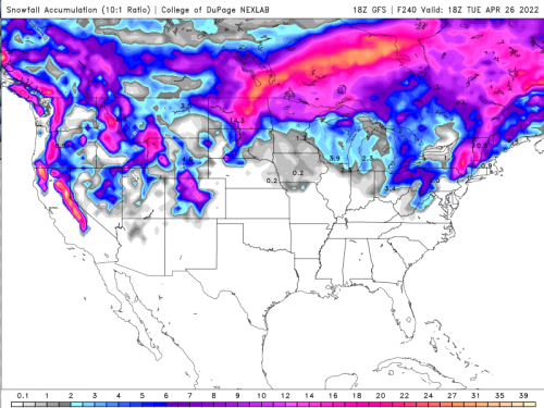
The huge bank of snow extant in Canada and over the northernmost Great Plains will afford opportunity for cold drainage, should storms move out of the northern Pacific Basin. There will likely be two such disturbances to follow a path from the Gulf of Alaska into the western third of the continent, which, in drawing colder values southward, will serve as a trigger for strong/severe thunderstorms across the Heartland, Corn Belt, and lower Great Lakes. But impacts east of the Appalachian Mountains should be limited, due in part to the tough-to-dislodge heat ridge over lower Appalachia. Convective threats may be finished for the season over the Gulf Coast region and much of Dixie, since you will see a pattern where low pressure moves higher in latitude upon entrance to the West Coast. The cold pool on April 26 stretching from the Front Range into the Great Lakes likely will be chilly, but like the current cold pool, will have little influence on Texas and the southern and eastern tier of states.
Reply all
Reply to author
Forward
0 new messages