WEATHERAmerica Newsletter, Saturday, May 27, 2023 at 11:10 PM CT; Medium Range Outlook
35 views
Skip to first unread message

Larry Cosgrove
May 28, 2023, 12:16:18 AM5/28/23
to weather...@googlegroups.com
MEDIUM RANGE OUTLOOK
(Four To Ten Days From Now)
No Joke! Amplified 500MB Blocking Configuration Sets Up Across the U.S. And Canada
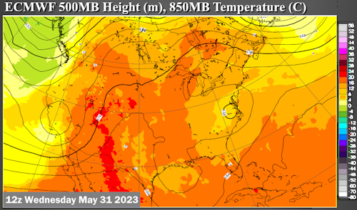
ECMWF (4)
PivotalWeather.Com (4)
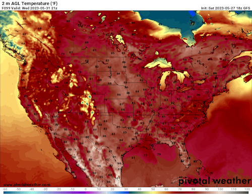
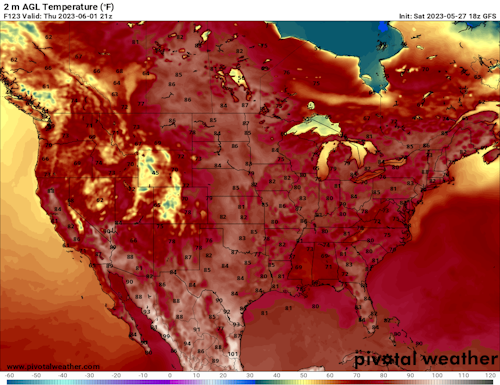
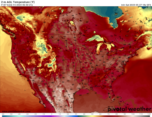
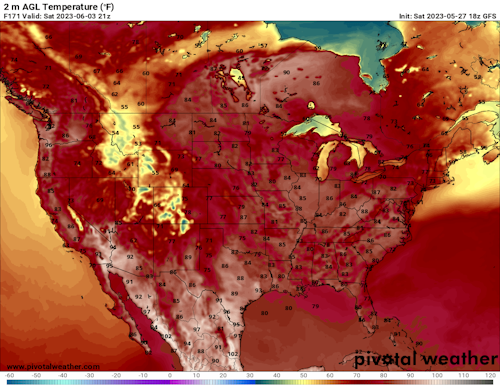
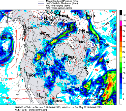
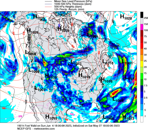
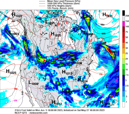
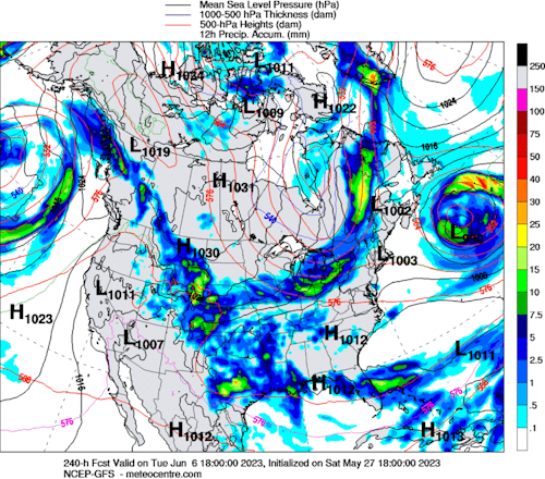
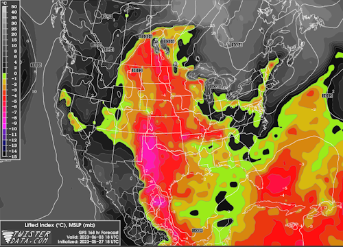
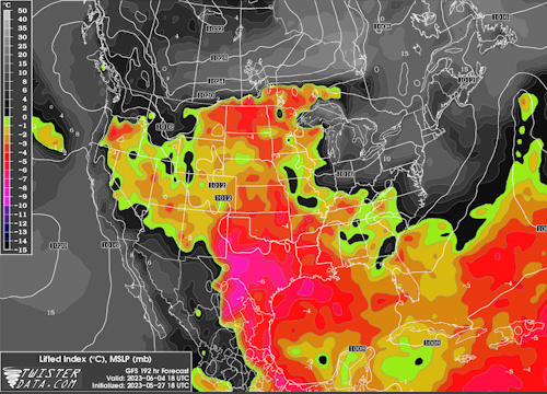
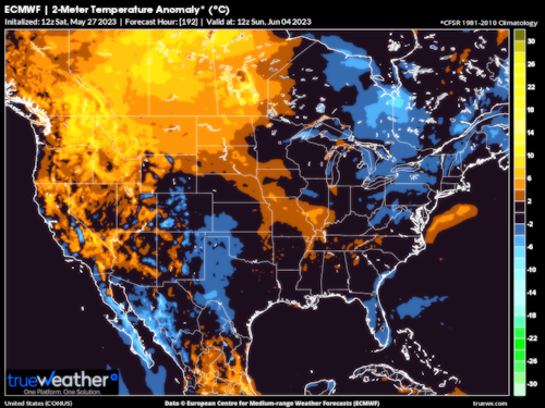
It is fair to call the ridge taking shape over the Prairie Provinces a block, as it sits above 45 N Latitude and takes on the familiar look of an El Nino inspired Rex signature at 500MB. This makes for a chaotic weather forecast, since the southern branch, which normally should be weakening and retreating north at this time of year, stays at lower latitudes and prevents truly hot weather from setting up in the U.S. Thunderstorms will be an issue over the Great Plains and Texas into the Mississippi Valley, and an upper impulse could lodge over the western Gulf of Mexico as a weakness closes off nearby in TX and LA. If you are looking for hot conditions, most will be along and south of the Rio Grande Valley.
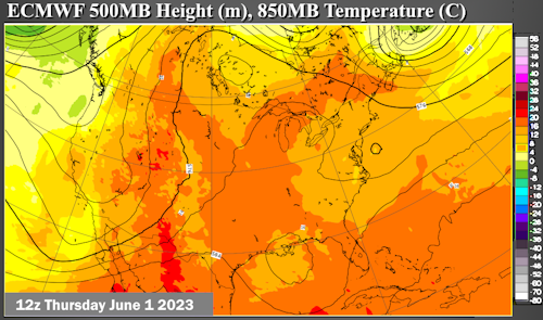
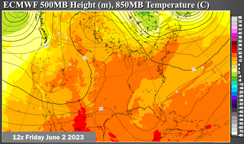
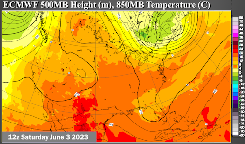
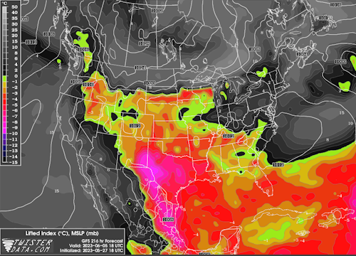
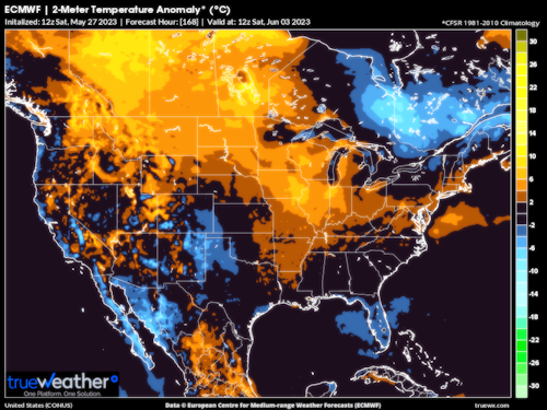
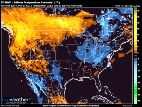
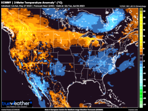
Active Southern Branch May Aid In Creating Deep, Cold Upper Low In Quebec
UQAM Meteocentre (4)

TwisterData.Com (4)
TrueWx.Com (4)

College Of DuPage Weather Laboratory
There is a fair chance in this crazy weather pattern that a cold 500MB low could close off over Quebec. Not as cold or deep as a Hudson bay vortex seen in the winter, but enough to depress temperatures across the eastern half of North America. A very feeble looking ridge over the Great Plains will continue to be perforated by cold pockets aloft, allowing for thunderstorm development and suppressing temperatures into the "mild or warm" category.
Reply all
Reply to author
Forward
0 new messages