WEATHERAmerica Newsletter, Saturday, April 16, 2022, 9:55 PM CT; Near Term Forecast
42 views
Skip to first unread message

Larry Cosgrove
Apr 16, 2022, 11:00:32 PM4/16/22
to weather...@googlegroups.com
SHORT RANGE OUTLOOK
(Through The Next 72 Hours)
Thunderstorm Threat In Dixie Turns Into A Nor'easter....
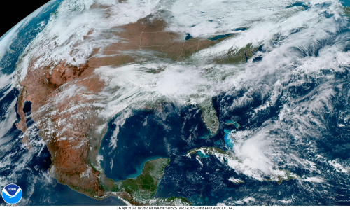
NOAA/NESDIS
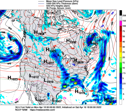
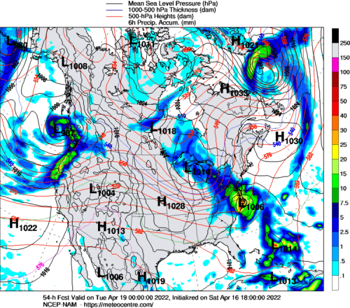
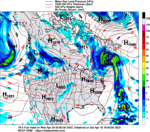
UQAM Meteocentre (3)
TwisterData.Com (3)
University Of Wisconsin Weather Server (3)
College Of DuPage Weather Laboratory (2)
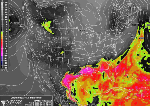
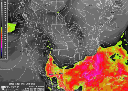
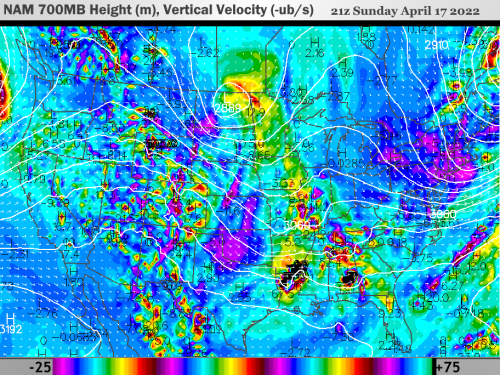
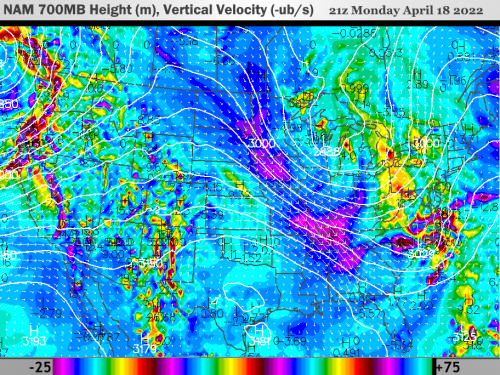
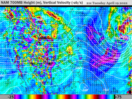
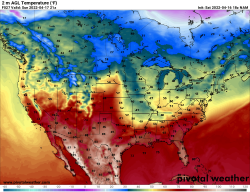
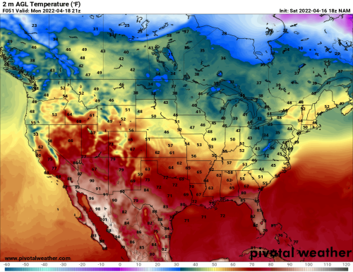
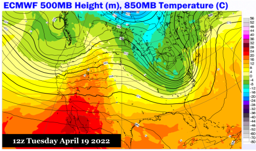
The numerical models of last week were correct in showing that despite the vast field of snow cover and Arctic air pouring out of Canada, the IcA regime would never really reach Texas and the Dixie states. A very warm and unstable regime from the Gulf of Mexico has reasserted itself along the Interstate 10 and 20 corridors, at a time when energy from a weak trough in the "Four Corners" vicinity is pressing eastward. Surface cyclogenesis will get underway near Austin TX in the wee hours of Sunday, and the frontal wave will strengthen as it moves eastward along the trailing stationary front. Vertical velocity forecasts are quite impressive, and suggest that supercell development will take shape in the Lone Star State, and track parallel and just north of the Gulf Coast into Monday morning. The narrow arc of jail, tornado and microburst formation in the Deep South will give rise to a surface low in South Carolina on April 18.
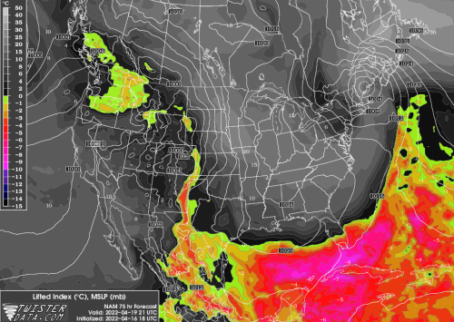
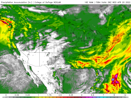
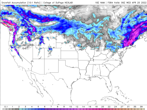
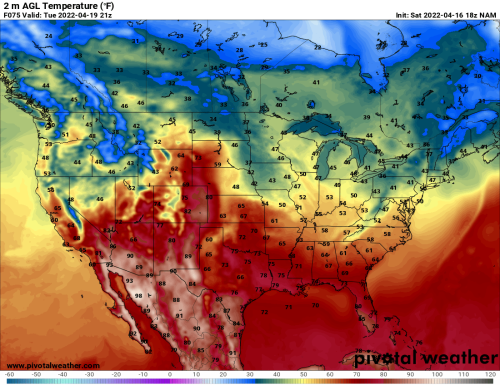
While many may clamor for a late-season "snow surprise" at the mention of a Nor'easter, the position of an upper low well inland with a rising sun angle argues against any freak accumulation events outside of the higher elevations of Pennsylvania and New York. This is, for the Interstate 95 cities anyway, purely a heavy cold stratiform rain event, with some thunder thrown in. Winds may pick, especially as the low pressure intensifies over Downeast Maine on Tuesday morning. Another brief cold advection will settle into the Great Lakes and Northeast before the inevitable warm-up later in the new week.
.....While New Storm On The West Coast Spreads Warmth Into The High Plains And Texas
NOAA/NESDIS
PivotalWeather.Com (3)
ECMWF
The broad, multi-layered storm complex off of the West Coast will take its time reaching the Pacific shoreline and Intermountain Region, so it is probable that the warm, dry temperature pattern in much of the western U.S. will be left undisturbed through the near term. But what is now a "Gulf Of Alaska Low" is likely to be centered over Vancouver Island BC on Tuesday. The associated trough, with a three-tier jet stream structure, will slowly consolidate. Precipitation chances will include snow in higher elevations (as well as parts of the Prairie Provinces). But this system will tap into a dry and very warm air mass from Mexico, which I see expanding from the Desert Regions into the Great Plains and Texas by midweek.
Reply all
Reply to author
Forward
0 new messages