WEATHERAmerica Newsletter, Saturday, April 9, 2022 at 9:55 P.M. CT; Longer Term Outlook
92 views
Skip to first unread message

Larry Cosgrove
Apr 9, 2022, 11:00:24 PM4/9/22
to weather...@googlegroups.com
EXTENDED PERIOD FORECAST
(Between Day 11 And Day 15)
Ongoing Trends Favor Neutral/Cool, Stormy North Vs. Hot And Dry South, West
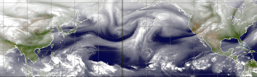
CIMSS
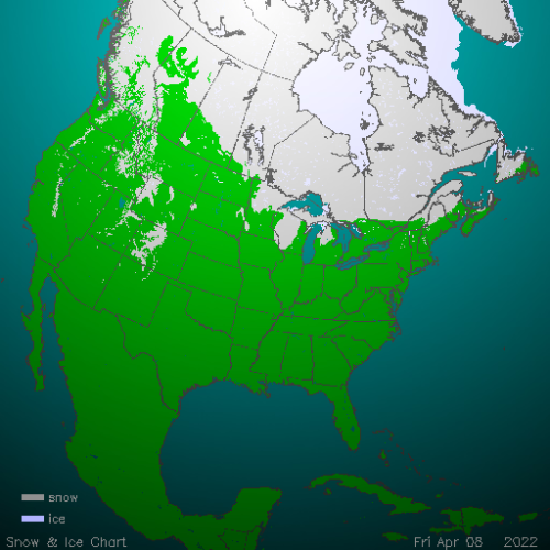
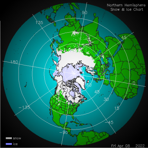
NOAA/IMS (2)
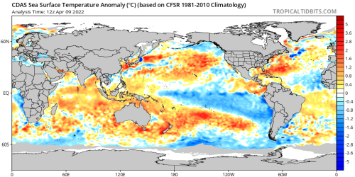

TropicalTidbits.Com (Dr. Levi Cowan) (3)
NOAA/PMEL
ECMWF
NOAA/CPC

HPRCC/University Of Nebraska (2)

Environment Canada


TropicalTidbits.Com (Dr. Levi Cowan) (5)

ECMWF (3)
NOAA/CPC
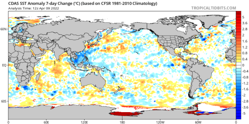
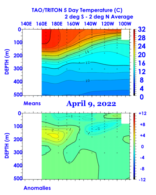
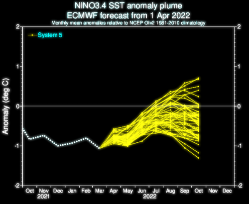
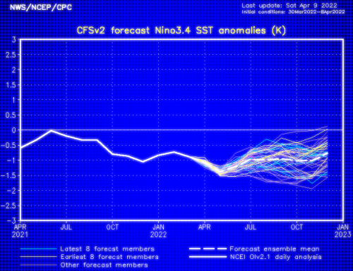
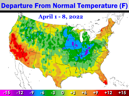
Now that I am formulating the summer season (JJAS) forecast, I have started to look at trends which will tell me the outlay of precipitation, temperature, and the tropics. To be honest, it is not giving away much that I think the high sun period will turn out differently from recent seasons, perhaps much so. I come to this conclusion because extreme dryness has gotten a foothold over much of the western half of the U.S., and ITCZ impulses have been very minor over equatorial Africa. And of course, most of the colder waters in the Pacific Basin are below the Equator. That ENSO signal could be very significant.
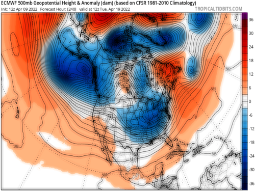
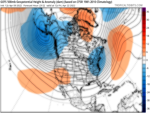
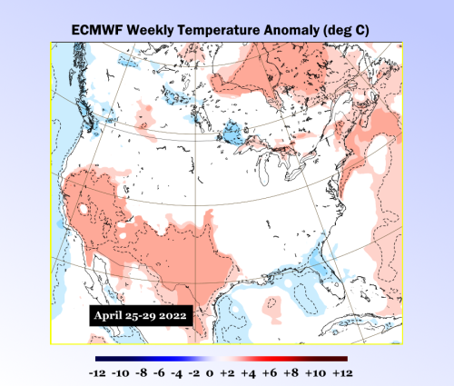
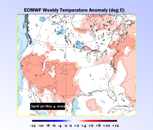
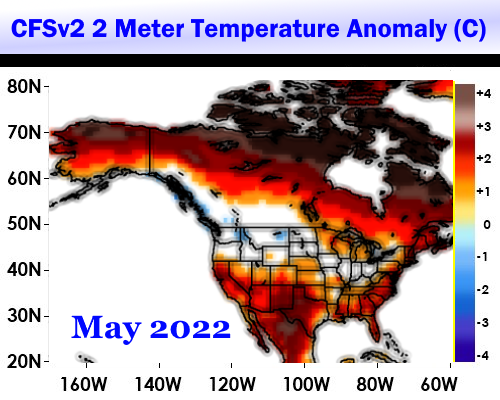
But a critical issue now is the ongoing ruse or rumor that this is a cold spring, especially over the eastern half of the U.S. There probably will be two more doses of polar air across the Midwest and Appalachia through the medium range. But when you examine CFS and ECMWF model weekly outlooks through the first week or so of May, it is easy to see that warmth and dryness will be expanding out of the Southwest and Texas, with some expansion into Dixie. The polar westerlies, though still laden with strong impulses, will be shifting gradually northward. It is entirely possible that the spring convective season will be above Interstate 70 next month. More ridging off of the East Coast looks to keep the Interstate 81 and 95 corridors generally warm, though there will be rainfall and convective potential due to nearness of the shortwaves moving along the International Border. The semizonal character of the 500MB flow forecast suggests that the coldest temperatures will stay across the far northern tier of the lower 48 states. On the flip side, the best chances for a hot surge in spring will be in California, Texas, and Florida.
But a critical issue now is the ongoing ruse or rumor that this is a cold spring, especially over the eastern half of the U.S. There probably will be two more doses of polar air across the Midwest and Appalachia through the medium range. But when you examine CFS and ECMWF model weekly outlooks through the first week or so of May, it is easy to see that warmth and dryness will be expanding out of the Southwest and Texas, with some expansion into Dixie. The polar westerlies, though still laden with strong impulses, will be shifting gradually northward. It is entirely possible that the spring convective season will be above Interstate 70 next month. More ridging off of the East Coast looks to keep the Interstate 81 and 95 corridors generally warm, though there will be rainfall and convective potential due to nearness of the shortwaves moving along the International Border. The semizonal character of the 500MB flow forecast suggests that the coldest temperatures will stay across the far northern tier of the lower 48 states. On the flip side, the best chances for a hot surge in spring will be in California, Texas, and Florida.
Prepared by Meteorologist LARRY COSGROVE on
Saturday, April 9, 2022 at 9:55 P.M. CT
Disclaimer:
The previous statements are my opinions only, and should not be construed as definitive fact. Links provided on this newsletter are not affiliated with WEATHERAmerica and the publisher is not responsible for content posted or associated with those sites.
Copyright 2022 by Larry Cosgrove
All rights reserved.
This publication may not be reproduced or redistributed in whole or in part without the expressed written consent of the author.
This publication may not be reproduced or redistributed in whole or in part without the expressed written consent of the author.
Reply all
Reply to author
Forward
0 new messages