WEATHERAmerica Newsetter, Saturday, May 6, 2023 at 9:40 PM CT; Longer Term Prediction
60 views
Skip to first unread message

Larry Cosgrove
May 6, 2023, 10:47:02 PM5/6/23
to weather...@googlegroups.com
EXTENDED PERIOD FORECAST
(Between Day 11 And Day 15)
Bordering On A Typical May Pattern (With Severe Weather And Heavy Rain Concerns Between The Continental Divide)
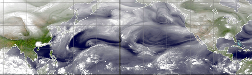
CIMSS

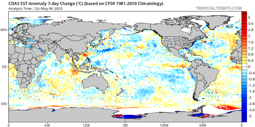
TropicalTidbits.Com (Dr. Levi Cowan) (3)

NOAA/PMEL
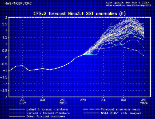
NOAA/CPC
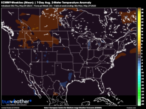
ECMWF

HPRCC/University Of Nebraska (2)
Environment Canada
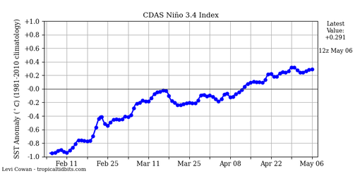
TropicalTidbits.Com (Dr. Levi Cowan) (5)

TrueWx.Com (3)
In some respects, the pattern is set for this month in that there are a) widespread cases of showers and thunderstorms, b) a lack of strong cool intrusions, and c) a slow build-up of rather warm and dry weather across the Desert Southwest into the High Plains. The biggest problems facing synopticians are familiar: where severe weather chances will be highest, and what are wedge or backdoor cold front probabilities for the Atlantic Coastal Plain? Another issue lurking in the background" could we see a western Gulf of Mexico subtropical/tropical depression or storm?
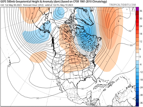
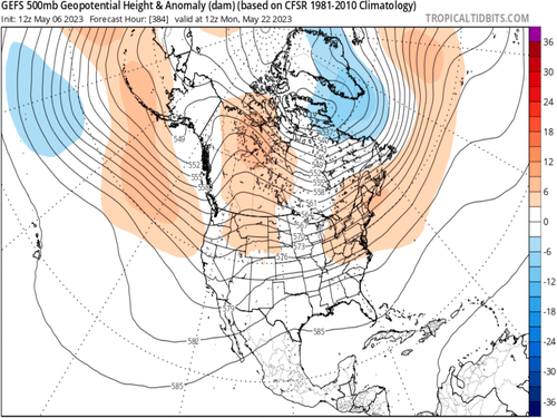
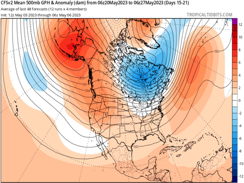
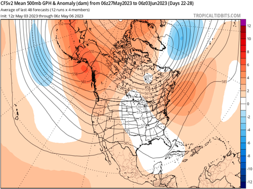
There is little variation among the numerical models and analogs for the national outcome in temperature. With a Gulf of Alaska Low, strong subtropical jet stream and lack of any true blocking ridge in the higher latitudes around North America, normal to above average temperatures are likely to cover all but the Intermountain Region/Pacific shoreline and New England. But look across data and you will see the lack of a heat ridge (subtropical high). There may be the familiar rise in 500MB heights to 588dcm or higher in Mexico or the Caribbean Sea. But without such a positive height or pressure anomaly reaching into the U.S. (Sonoran, Great Smokies or Bermuda position), it would be unrealistic to predict any sort of heat wave over the next two or three weeks. Only southwest flow in downslope fashion in the lower/middle High Plains or the Desert Regions may bring two or three days of comparative heat.
On the topic of thunderstorms, May is the biggest month for convection, and with it severe weather threats. Temperatures aloft are routinely cold, the tropical moisture sources are opening up (Gulf of Mexico most obviously). You have seen in the earlier forecast periods how much rain may fall, and I suspect that same pattern will continue through Memorial Day weekend. The gap in the Southwest is typical, since mountainous areas disrupt transport of higher dewpoints and flat shortwave rodging is likely to take shape. A tougher call may be the potential for a convective complex or vortex to spin off from energy in the subtropical; jet stream. Some of the forecast guidance hints at such an event below the Lower Rio Grande Valley after May 20. Since 2001 is a viable analog, risks to Texas must be monitored, since such a system would move slowly and have the familiar fetch off of the Gulf of Tehuantepec that might be an incentive for excessive rainfall. At the very least, the Lone Star State will have a fair amount of diurnal and nocturnal convective events into the first week of June.
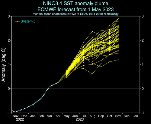
With so much mild or warm weather around, could a backdoor cold front or damming/wedge event cool down the Eastern Seaboard into Lower Appalachia? We see the possibility in the near term and again in mid-May, but the prevalence of west/southwest flow aloft and weaker presentation of the cold upper low in Quebec should minimize those cases where western Pennsylvania gets warm and Georgia turns raw and cool. One possibility to mention: with the subtropical jet stream likely to lift to higher latitudes, and El Nino in slow build, June and the first half of July may be the best chance for genuine hot summer weather east of the Rocky Mountains. I would not be surprised to see the latter two-thirds of the incoming season turn cooler with more thunderstorms in the Midwest into the East Coast.
Prepared by Meteorologist LARRY COSGROVE on
Saturday, May 6, 2023 at 9:40 P.M. CT
Disclaimer:
The previous statements are my opinions only, and should not be construed as definitive fact. Links provided on this newsletter are not affiliated with WEATHERAmerica and the publisher is not responsible for content posted or associated with those sites.
Copyright 2023 by Larry Cosgrove
All rights reserved.
This publication may not be reproduced or redistributed in whole or in part without the expressed written consent of the author.
This publication may not be reproduced or redistributed in whole or in part without the expressed written consent of the author.
Reply all
Reply to author
Forward
0 new messages