WEATHERAmerica Newsletter, Saturday, April 9, 2022 at 9:55 P.M. CT; Medium Range Outlook
49 views
Skip to first unread message

Larry Cosgrove
Apr 9, 2022, 11:01:35 PM4/9/22
to weather...@googlegroups.com
MEDIUM RANGE OUTLOOK
(Four To Ten Days From Now)
First Storm Likely To Trigger Blizzard Northern High Plains, Severe Weather Outbreak Mississippi River Watershed April 12 - 14

UQAM Meteocentre (4)
TrueWx.Com (4)
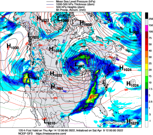
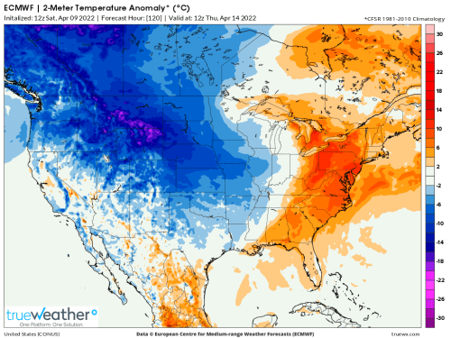
The first circulation involved with the storm event for middle and late week will take a path into southern Wyoming, then recurve northeastward into Minnesota and Ontario. Again, I must mention that severe weather potential will likely occur further east (along and to the right of an Interstates 35 and 29 arc), because of the broad, warm/dry slot that will cover the western half of Texas and the Great Plains. A blizzard is likely from the northern Front Range into the vicinity of James Bay. Snow will be heavy and wet, accompanied by winds up to 40 mph and accumulating (with the first impulse) up to 12 inches. As the associated cold front comes into deep-layered moisture and instability, much of the Mississippi River watershed and lower Great lakes will experience a severe thunderstorm outbreak, with highest tornado potential from LA and AR through the Ohio and Tennessee Valley from Tuesday night into Thursday.
Second Storm Targets Great Plains, Dixie And Eastern Seaboard April 16 - 19

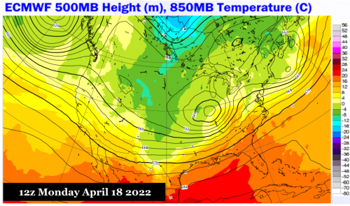
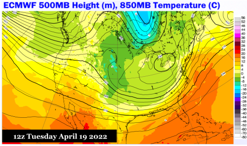
ECMWF (4)
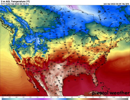
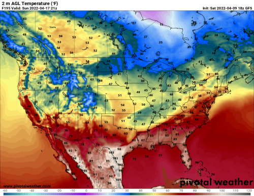
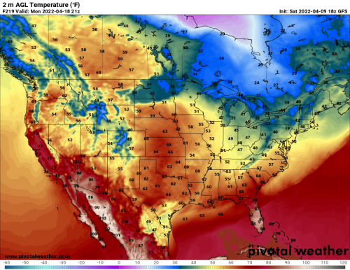
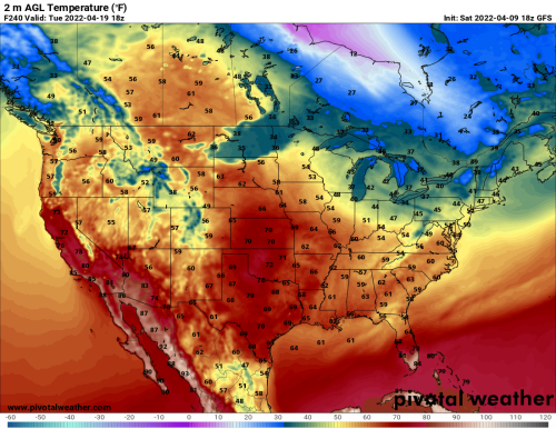
PivotalWeather.Com (4)


College Of DuPage Weather Laboratory (2)
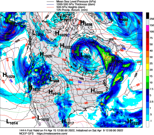
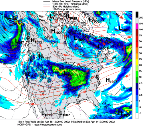
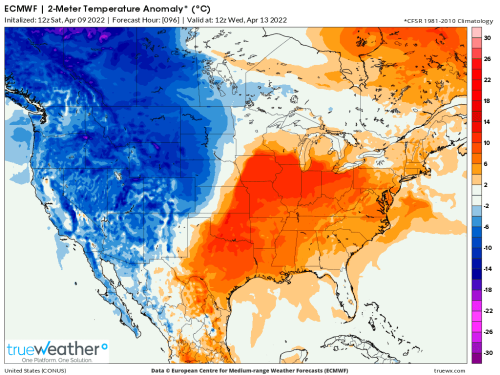
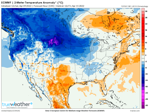
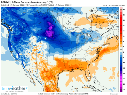
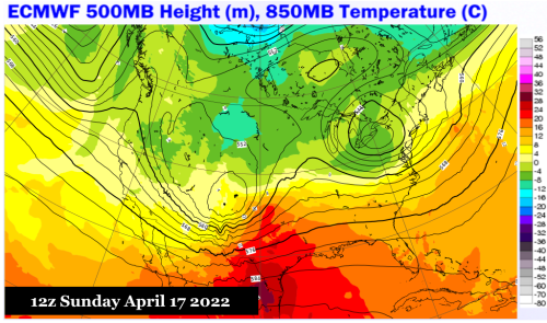
The ECMWF series has steadily maintained an argument that there will be two periods of extreme weather associated with the trough complex now over the eastern Pacific Ocean. The second storm in this sequence will likely take a track a bit further south than the primary circulation, but perhaps be deeper in terms of surface pressure, and generate a wider area of precipitation. If the ECMWF model suite is correct, a devastating snow storm could impact an area from WY and MT through the north central states and much of western Ontario and northern Quebec. The thunderstorm, heavy rain and severe weather area looks to be from Texas and Oklahoma through the Dixie and Mid-Atlantic states. Note that the most recent forecast guidance has a stronger and wider cold pool following the trough, and implies that the nocturnal freeze line may drop as far south as the Interstate 20 corridor from near El Paso TX to Jackson MS around April 19-20. But I doubt that the colder values will have much success in reaching the Eastern Seaboard, since the upper low will recurve into the Laurentian Shield.
Reply all
Reply to author
Forward
0 new messages