WEATHERAmerica Newsletter, Saturday, May 27, 2023 at 11:10 PM CT; Longer Term Forecast
79 views
Skip to first unread message

Larry Cosgrove
May 28, 2023, 12:15:54 AM5/28/23
to weather...@googlegroups.com
EXTENDED PERIOD FORECAST
(Between Day 11 And Day 15)
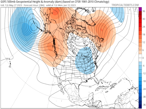
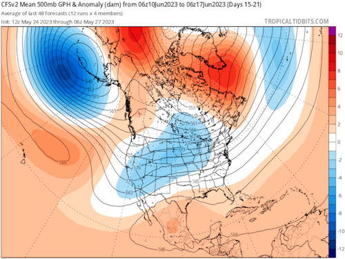
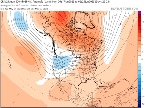
Are We Ever Going To Escape The Split Flow Pattern Over North America?
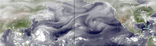
CIMSS (2)
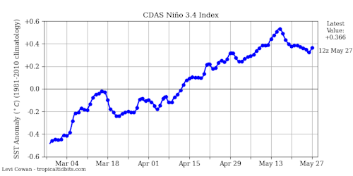
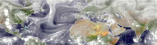
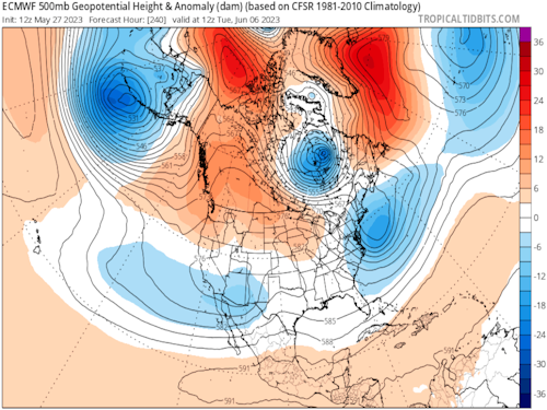
TropicalTidbits.Com (Dr. Levi Cowan) (3)
TropicalTidbits.Com (Dr. Levi Cowan) (3)
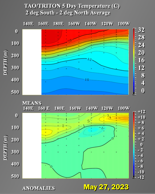
NOAA/PMEL
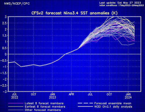
NOAA/CPC
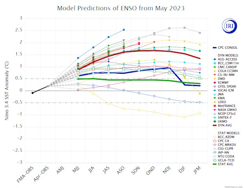
IRI/Columbia University
HPRCC/University Of Nebraska (2)
Environment Canada
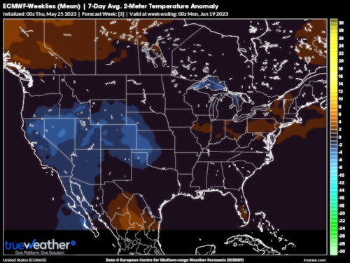
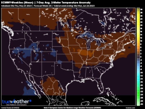
TrueWx.Com (3)
TropicalTidbits.Com (Dr. Levi Cowan) (5)
NOAA/CPC
NOAA/PSL
The short answer to the posted question is yes. As for how long said end to a distinctly un-summerlike pattern will last, I cannot be sure.
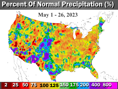
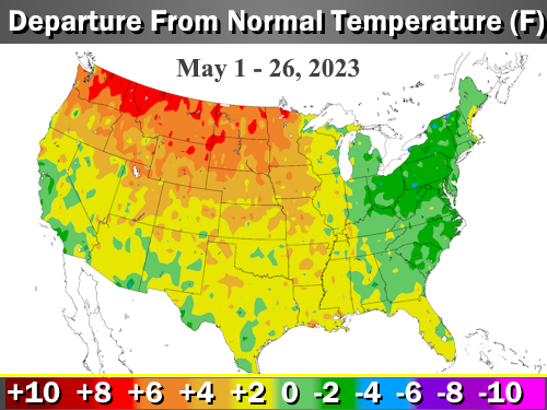
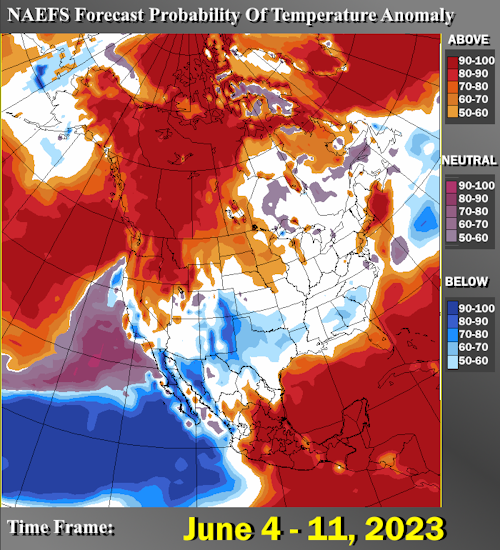
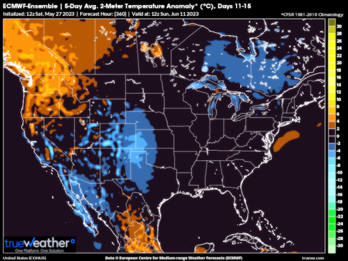
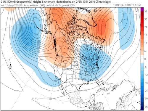
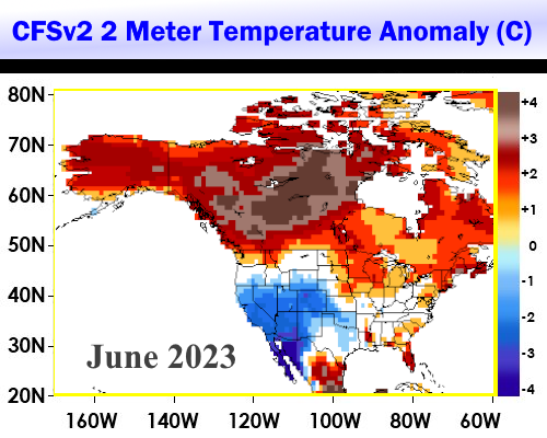
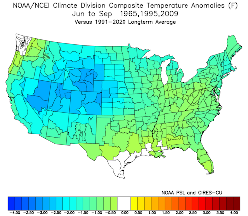
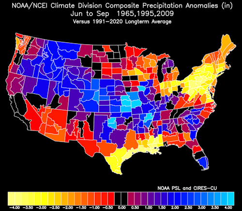
If you do comparison tests with 500MB longwave patterns of the past, 1965 and 1995 probably are closest. And if we see the Mexican/Greater Antilles heat ridge complex bump north a bit (ths exposing Texas to searing heat and dryness), then 2009 would be in the mix. July 1995 was infamous for its killer heat wave in the Midwest and (briefly) into the Mid-Atlantic. 2009 became notable for its "bubble heat ridge" in Texas while the rest of the nation was routinely cool. Looking back to 1965, a JJAS period that I remember well, cold intrusions were present all summer long with thunderstorm threats that arose in the Corn Belt and routinely reached the Northeast. When you blend these three seasons together (and I emphasize that these are a small sample of the general analog list), you arrive at something close to the 2009 solution. Time will tell if this line of thinking is correct. But be aware that we have not seen an extant subtropical high over the lower 48 states yet. My suspicion is that there will be an ejection of hot weather from the south central states through the Mississippi Valley into the Eastern Seaboard in late June, and probably the first half of July. However, with the El Nino episode gathering steam, the prevailing westerlies aloft argue against major heat waves lasting a long time. The dryness in the Ohio Valley, Appalachia and the Interstate 95 corridor presents a case for a heat breakthrough, despite a May so far that has often been quite cool.
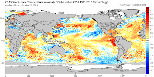
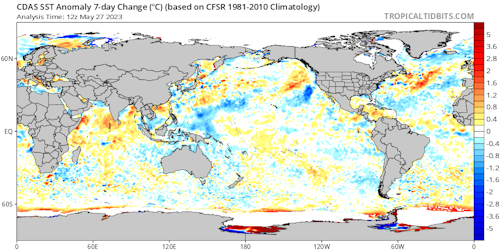
I am also watching the recent talk in social and broadcast media, both from professional meteorologists and enthusiasts about potential for tropical cyclones in the Atlantic Basin. Needless to say, I am not impressed by the chances of seeing many hurricanes, or for that matter, any particularly intense storms. While the sea surface temperature profiles had started out quite warm, from the Gulf of Mexico to the Maximum Development Region, some cooling has been evident in the past week. Most importantly, the prevailing upper level winds in the tropics continue from the west (easily discernible on water vapor imagery). No matter how strong ITCZ impulses are, or how warm the equatorial waters might be, shearing of thunderstorm tops will occur. That defeats the formation of circulations and clustering of convection. I think that we see a break in hostile flow in late June until mid-August, but a shutdown of warm core cyclogenesis in the last third of summer and through November 30. My call for the 2023 Tropical Cyclone Season is unchanged: 13 named storms, 5 hurricanes (one of which will be major).
Prepared by Meteorologist LARRY COSGROVE on
Saturday, May 27, 2023 at 11:10 P.M. CT
Disclaimer:
The previous statements are my opinions only, and should not be construed as definitive fact. Links provided on this newsletter are not affiliated with WEATHERAmerica and the publisher is not responsible for content posted or associated with those sites.
Copyright 2023 by Larry Cosgrove
All rights reserved.
This publication may not be reproduced or redistributed in whole or in part without the expressed written consent of the author.
This publication may not be reproduced or redistributed in whole or in part without the expressed written consent of the author.
Reply all
Reply to author
Forward
0 new messages