WEATHERAmerica Newsetter, Saturday, May 6, 2023 at 9:40 PM CT; Medium Range Outlook
36 views
Skip to first unread message

Larry Cosgrove
May 6, 2023, 10:47:24 PM5/6/23
to weather...@googlegroups.com
MEDIUM RANGE OUTLOOK
(Four To Ten Days From Now)
Severe Weather Outbreak Probable For Much Of Great Plains By Next Weekend
UQAM Meteocentre (4)
TwisterData.Com (4)
TrueWx.Com (4)
College Of DuPage Weather Laboratory
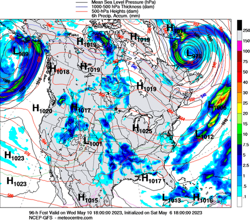
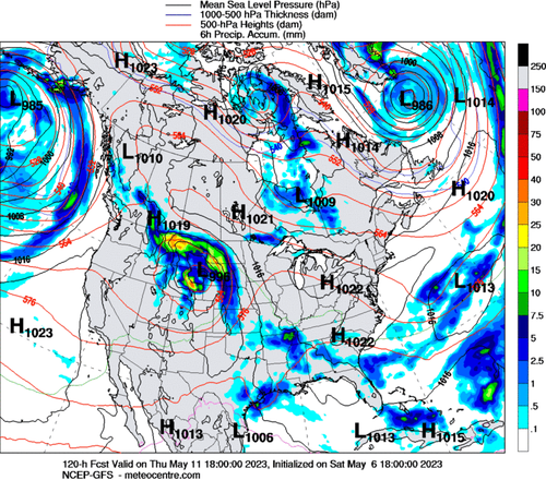
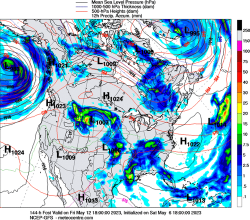
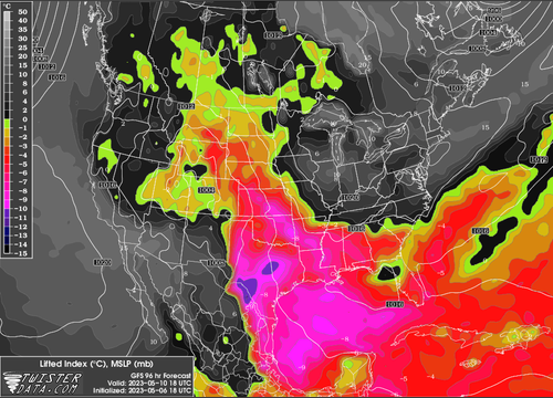
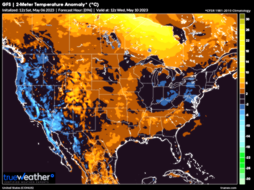
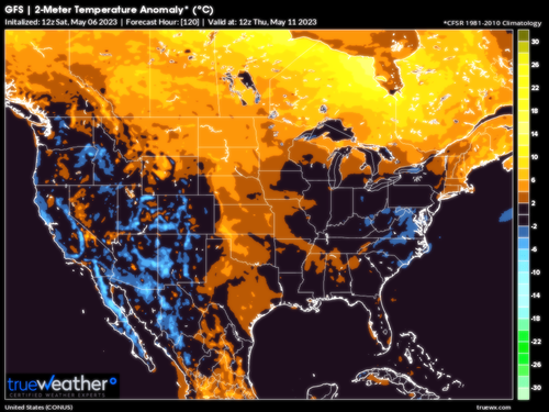
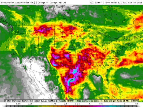
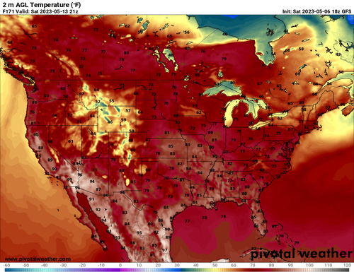
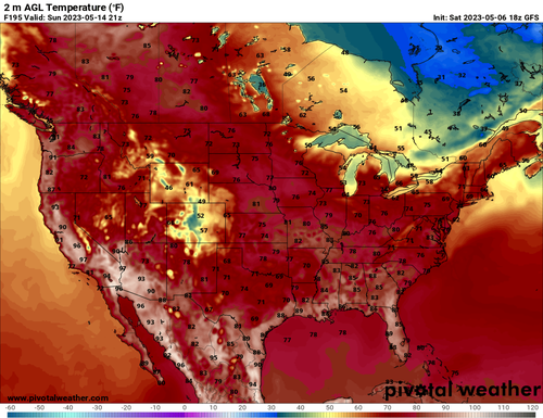
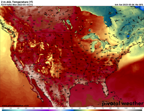
When you take a broad, cold trough across the Intermountain Region and move it into the Great Plains, with a dry insert from Mexico, severe weather threats are a given. This is the situation to watch between Wednesday and Saturday. The extended nature of this event is because the parent trough complex and upper low will slow as it crosses the Rocky Mountains, blocked by a 500MB ridge across the Prairie Provinces and Upper Midwest. Moisture from the Gulf of Mexico will lock into convergence against the Mexican air mass and polar values in the West, with repeated convection firing both in the afternoon and in the middle of the night. I have concerns about flooding rainfall in Texas into the Heartland and middle Mississippi Valley. Even Montana into the Black Hills could see a period of large hail and microbursts from the semi-stationary upper low that gets stuck there. It is possible that a branch of the convective activity may race eastward into the Mid-Atlantic and Virginias ahead of a cold front dropping out of Ontario and Quebec by May 14-16.
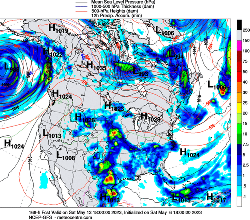
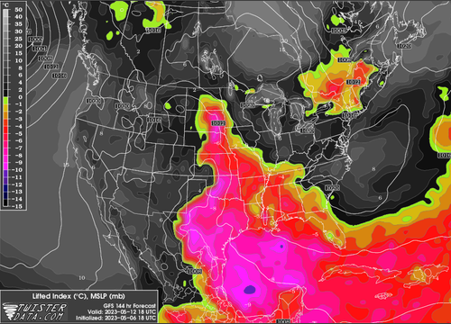
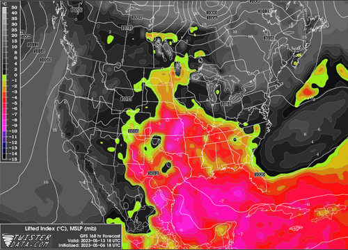
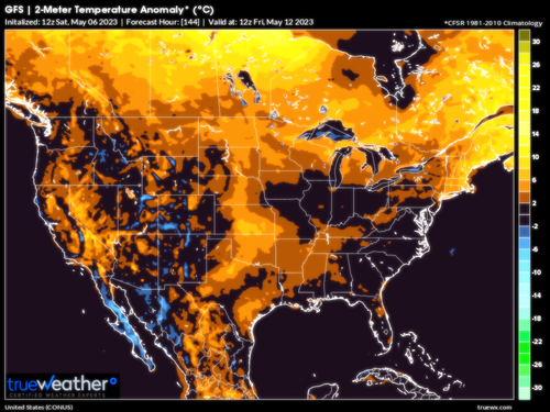
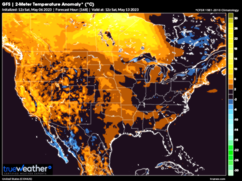
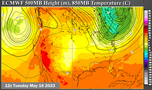
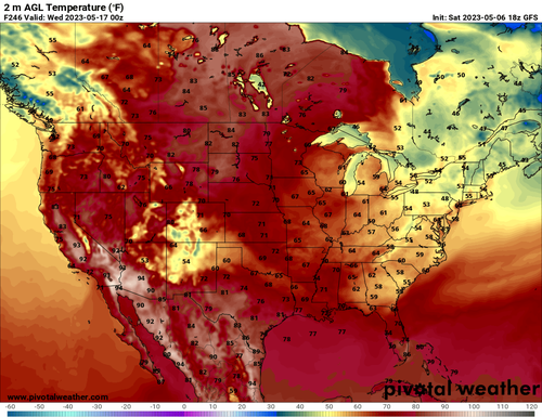
Ridge Expansion, With Drying And Warmth, Indicated Across Intermountain Region And Great Plains At Mid-Month
ECMWF (4)
PivotalWeather.Com (4)
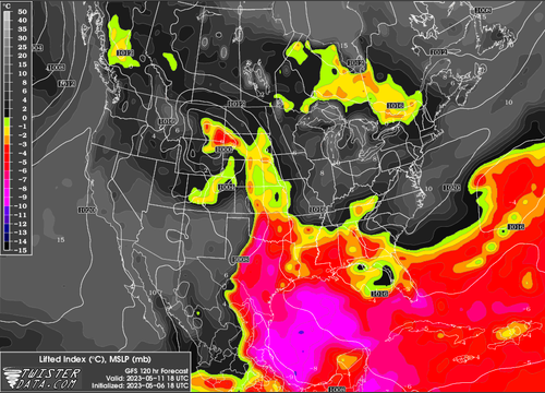
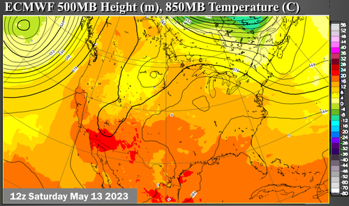
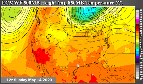
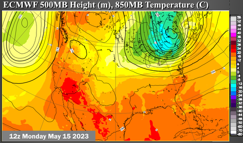
As a new cold low takes shape off of the West Coast, and a trough digs into the Eastern Seaboard from Canada, the 500MB pattern may shift to more ridging, temporarily, across the Great Plains. Temperatures may briefly come down, then rise, in an area from the Prairie Provinces into the lower Front Range. The worry here is that the thunderstorms may be pushed into Texas and northeastern Mexico. If winds aloft weaken, as may be the case, it is possible that a convective circulation could form over the shoreline of the western Gulf of Mexico after May 16. Chances for hot weather should be completely crushed in this scenario, except for some desert communities in Arizona and California.
Reply all
Reply to author
Forward
0 new messages