WEATHERAmerica Newsletter, Saturday, March 26, 2022 at 8:25 P.M. CT; Medium Range Forecast
55 views
Skip to first unread message

Larry Cosgrove
Mar 26, 2022, 9:30:13 PM3/26/22
to weather...@googlegroups.com
MEDIUM RANGE OUTLOOK
(Four To Ten Days From Now)
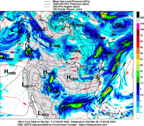
Following The Major Spring Storm, Cold Pool Expands Across Great Plains And Mississippi Valley
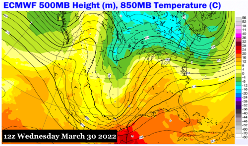
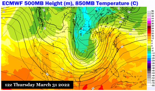
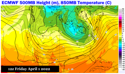
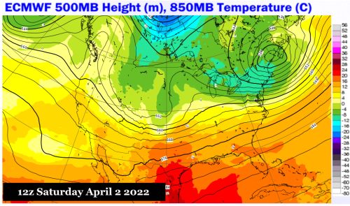
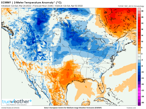
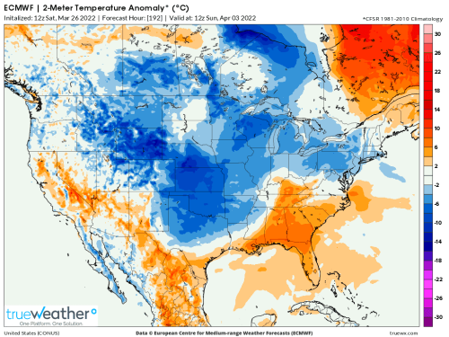
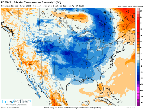
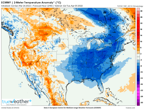
ECMWF (4)
PivotalWeather.Com (4)
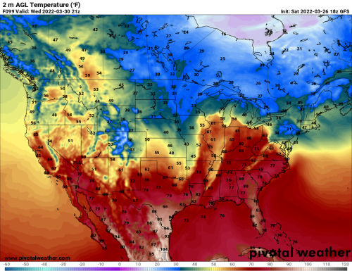
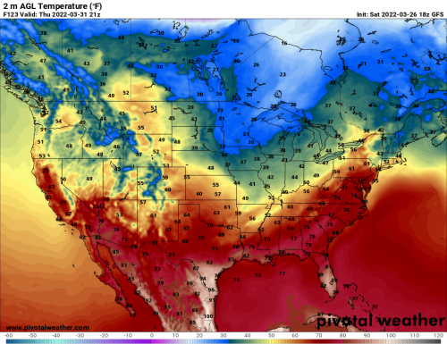
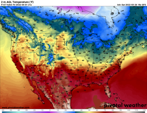
It is possible that the ECMWF version is overdoing cold air drainage during the middle and late portions of the new week. But I agree in general with its surface and upper air forecasts, which would imply a rather cool medium range outlook east of the Rocky Mountains and above the Interstate 20 corridor (Abilene TX to Columbia SC). The large 500MB storm and trough will move only slowly eastward, and likely not expand into the southern tier of the U.S. at all. Snowfall potential over the Upper Midwest and Ontario may continue until the morning of April 2, by which time a new cold pool will begin to organize over the northern High Plains.
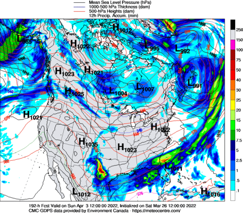
Second Disturbance Takes Shape With Possible Impacts For South Central, Dixie, And Eastern Seaboard
UQAM Meteocentre (4)
TrueWx.Com (4)
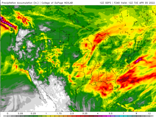
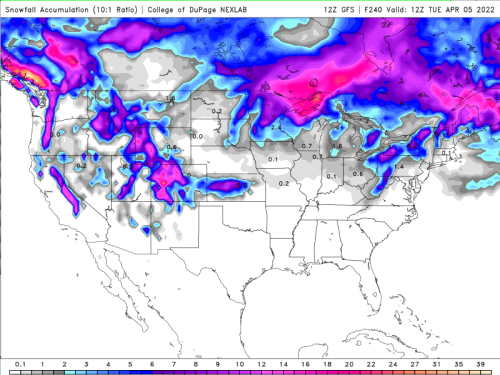
College Of DuPage Weather Laboratory (2)
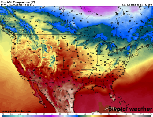
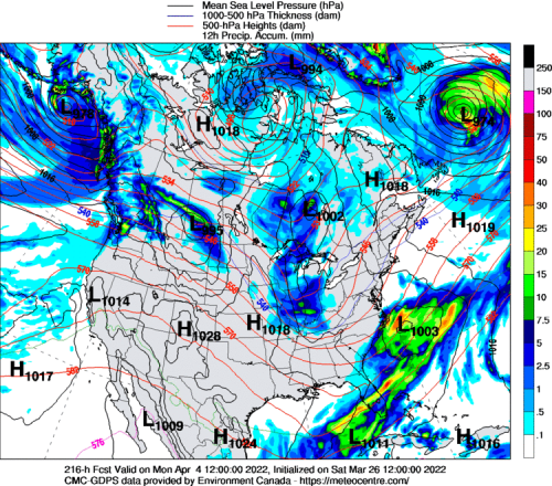
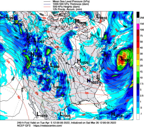
This being a rather active weather pattern in North America, we must be concerned with disturbances upstream which will advance into the lower 48 states from the Pacific Basin. Timing in an open/progressive flow will prove difficult, but many of the track scenarios suggest that a shortwave emerging in Montana and Wyoming behind the midweek system will drop south and eastward, and activate a surface low pressure system in the Texas Panhandle on or about April 2. Note that on the ECMWF and GFS forecast guidance, a parcel of cold polar air follows this energy as the system congeals and moves through the Dixie states, and along the Eastern Seaboard. The thermal and instability conflict seems enough to set off yet another round of severe weather and heavy rain, this time following the Interstate 10 and 20 corridors from Texas into the Southeast. I can see a scenario where the disturbance recurves northward into the Mid-Atlantic and New England states on April 3-4, with a cooler, more stable regime finally in place within ten days from now over the eastern half of the continent.
Reply all
Reply to author
Forward
0 new messages