WEATHERAmerica Newsletter, Saturday, April 15, 2023; Longer Term Prediction
62 views
Skip to first unread message

Larry Cosgrove
Apr 16, 2023, 12:33:36 AM4/16/23
to weather...@googlegroups.com
EXTENDED PERIOD FORECAST
(Between Day 11 And Day 15)
An Active Pattern Across Northern Half Of U.S., While Warmth Starts To Build Below 40 N Latitude
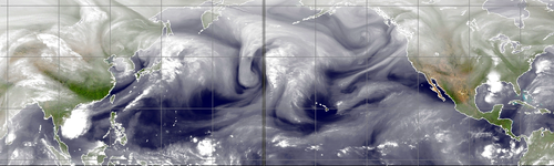
CIMSS
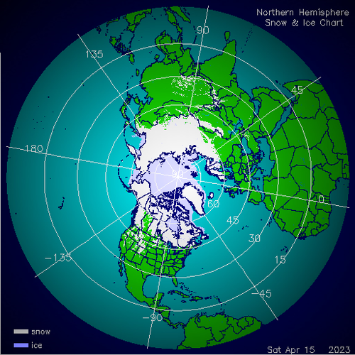
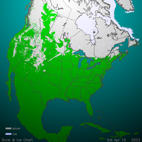
NOAA/IMS (2)
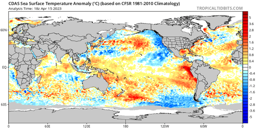
TropicalTidbits.Com (Dr. Levi Cowan) (3)
NOAA/PMEL
NOAA/CPC
HPRCC/University Of Nebraska (2)
Environment Canada
TrueWx.Com (3)

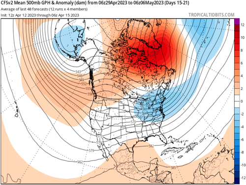
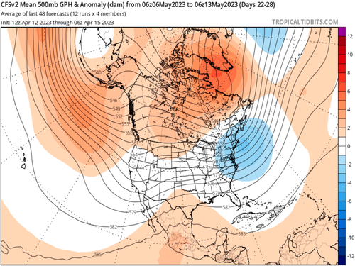
TropicalTidbits.Com (Dr. Levi Cowan) (5)
NOAA/CPC
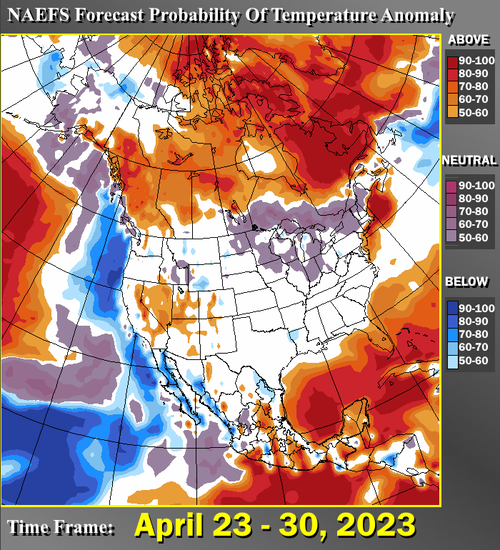
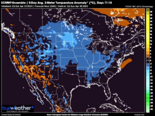
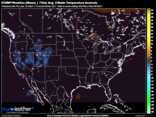
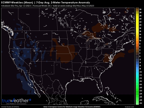
I suspect that the nation will have a stormy spring. The established pattern of severe weather events every 5 to 6 days has no reason to abate. And while the ensemble members of the various models are showing a cool 11-15 and 16-20 day period across the Northeast, the progressive nature of the pattern suggests a warm-up in the first ten days of May in those regions.
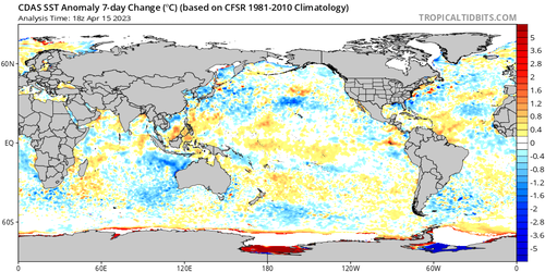
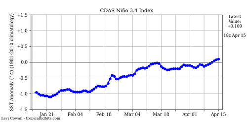
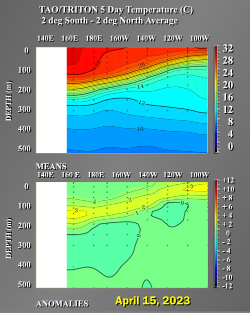
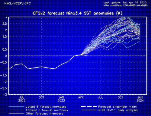
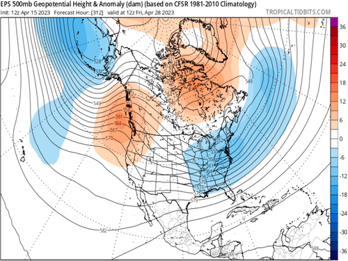
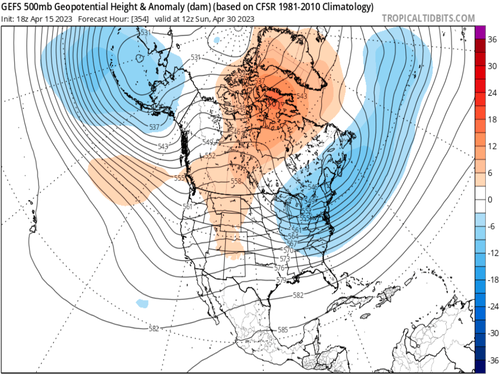
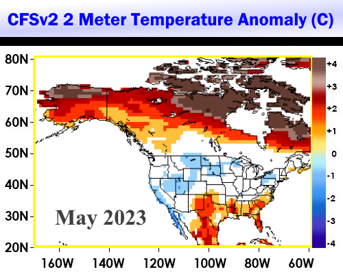
Although the numerical model data does not seem to have a good grasp on the temperature outlay across the U.S. (both the CFS and ECMWF series are fairly vague), a look at conditions across the Pacific Basin suggest that the lower 48 states are in for a rough ride in terms of apparent weather (thunderstorms and flooding). The ENSO 3.4 sea surface temperatures are now in the neutral positive range (just above 0 deg C difference from normal), headed toward what I feel will be a weak/moderate El Nino by this coming fall. Since the general storm track will be slowly retreating northward out of its current "Panhandle Hooker" path, some of the recent very warm weather should make northward gains in the last week of April.
The Gulf of Alaska Low will probably last into June. That means a generally warm pattern for the second half of calendar Spring in much of the nation outside of the Pacific Northwest. But effects from an El Nino will exert an influence. Analogs strongly suggest a small tropical cyclone threat to Texas from Late May to mid-June (2001 is an analog). The hotter air should shift to a bracket over the West and south central states in July. Thunderstorms should populate the Midwest and Northeast, leading to cooler temperatures in the JAS time frame.
Prepared by Meteorologist LARRY COSGROVE on
Saturday, April 15, 2023 at 11:25 P.M. CT
Disclaimer:
The previous statements are my opinions only, and should not be construed as definitive fact. Links provided on this newsletter are not affiliated with WEATHERAmerica and the publisher is not responsible for content posted or associated with those sites.
Copyright 2023 by Larry Cosgrove
All rights reserved.
This publication may not be reproduced or redistributed in whole or in part without the expressed written consent of the author.
This publication may not be reproduced or redistributed in whole or in part without the expressed written consent of the author.
Reply all
Reply to author
Forward
0 new messages