how to manage not spatially uniform points distribution in ALS dataset?
40 views
Skip to first unread message

Mauro Boreggio
Jul 18, 2022, 2:15:36 PM7/18/22
to LAStools - efficient tools for LiDAR processing
Dear all,
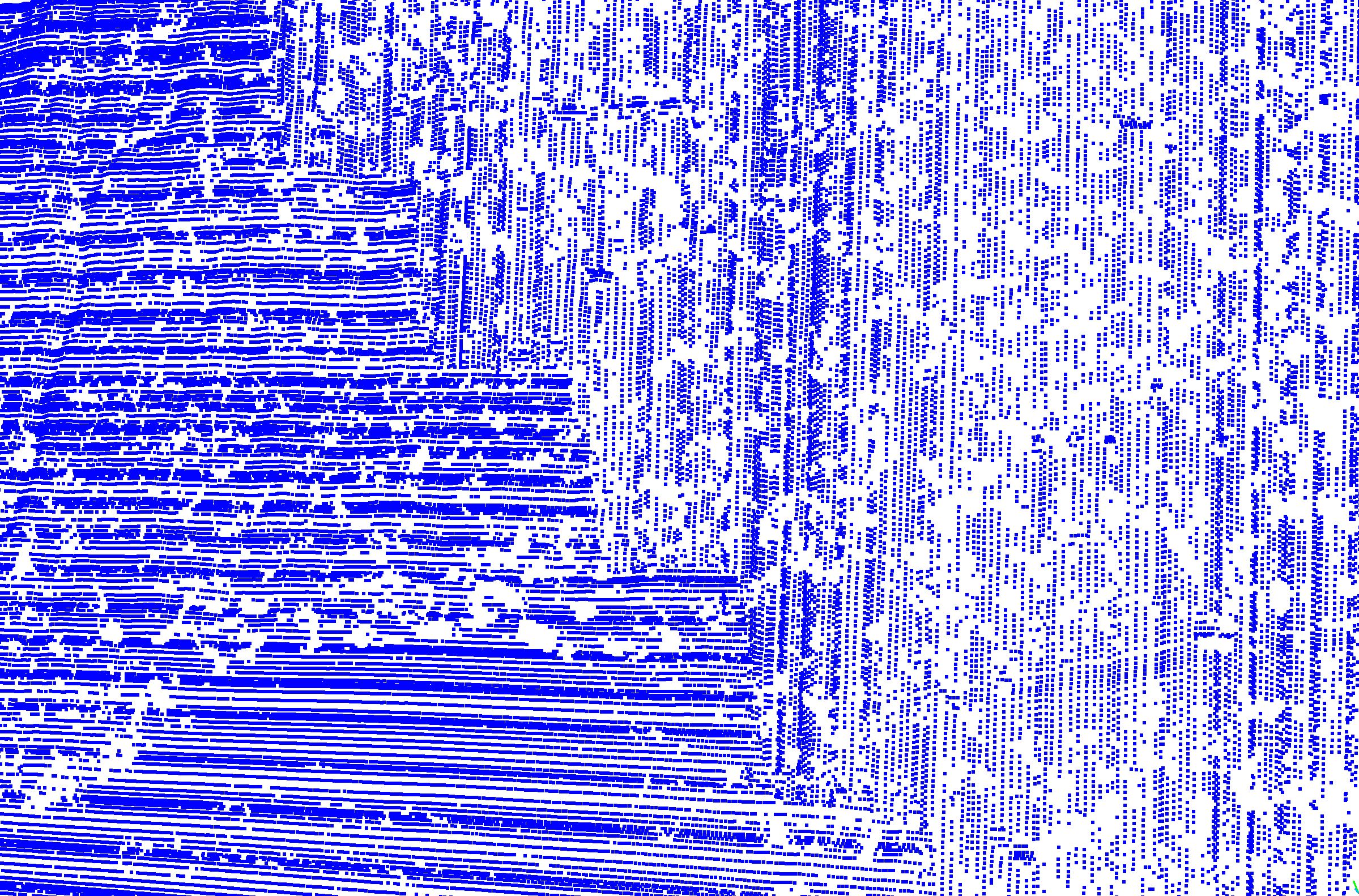
Working with ALS data within the lastool package I always found some problems in ensuring a homogeneous spatial points distribution in the final ground dataset.
As you can see in the attached picture (as an example), near the edge of each swath there is a natural increase of the points density. However, I noticed that this points patter generally introduces some artefacts in the derived elevation models (i.e., striping in the direction orthogonal to the flightline) and DEM of differences.
Therefore, I was wondering if there is somebody which faced the same problem, or if there is a workaround or any tips to reduce the impact of such a point pattern.
Attached you can also find a general workflow which I tuned during this year of working with ALS datasets in lastools. Any advice is welcome.
Regards,
Mauro
Mauro

Mark Levitski
Jul 18, 2022, 4:56:02 PM7/18/22
to last...@googlegroups.com
I'm not a heavy LAStools user but here are some more universal tips/principles that have helped me.
1) Uniformity with points is a nice concept but somewhat artificial. Example is with model keypoint algorithms which thin points where slope or elevation changes are minimal (according to user settings) but retain density where otherwise necessary to more accurately reflect terrain changes. You want elegant accuracy not strict uniformity.
2) I always look to utilize parallel flightlines and avoid perpendicular unless absolutely required to fill data gaps. Calibrated flightines/aligning strips that are parallel is a much more straightforward process because it mostly involves correcting roll in the platform. Perpendicular complicates unless it's strictly for providing some data for the correction algorithm. I include a single crossing flightline for the Terramatch routine just for that reason.
3) Matching/calibrating/aligning flightlines is absolutely necessary for accurate data. Bayes strip alignment,Terramatch, or some proprietary software can do that whereas as far as I know LAStools doesn't have tools for that yet.
4) I always cut any overlap AFTER calibrating flightlines. Who needs the extra points and unnecessary file size? With correct settings any shadows or gaps are filled with data from adjacent lines. And lines should match by then at the seams. Otherwise as you noticed the DEM will reveal it.
Hope this helps. Good luck!
Mark
--
Download LAStools at
https://rapidlasso.de
Manage your settings at
https://groups.google.com/g/lastools/membership
---
You received this message because you are subscribed to the Google Groups "LAStools - efficient tools for LiDAR processing" group.
To unsubscribe from this group and stop receiving emails from it, send an email to lastools+u...@googlegroups.com.
To view this discussion on the web visit https://groups.google.com/d/msgid/lastools/4027e037-b138-4564-8905-61984595b96bn%40googlegroups.com.

mauro boreggio
Jul 19, 2022, 9:46:56 AM7/19/22
to last...@googlegroups.com
Dear Martin,
1)
Uniformity with points is a nice concept but somewhat artificial.
Example is with model keypoint algorithms which thin points where slope
or elevation changes are minimal (according to user settings) but retain
density where otherwise necessary to more accurately reflect terrain
changes. You want elegant accuracy not strict uniformity.
Overall, I agree with your point of view. However, if the desired geospatial output is represetend by a surface model, during the gridding phase the spatial distribution of sampled points has a strong impact on the accuracy and shape reliability of the surface. In the same way, if you're using multi-temporal point clouds in the context of a change detection, the point pattern affects the performance of common cloud-to-cloud-distance algorithms.
2)
I always look to utilize parallel flightlines and avoid perpendicular
unless absolutely required to fill data gaps. Calibrated
flightines/aligning strips that are parallel is a much more
straightforward process because it mostly involves correcting roll in
the platform. Perpendicular complicates unless it's strictly for
providing some data for the correction algorithm. I include a single
crossing flightline for the Terramatch routine just for that reason.
Very useful tip.
3)
Matching/calibrating/aligning flightlines is absolutely necessary for
accurate data. Bayes strip alignment,Terramatch, or some proprietary
software can do that whereas as far as I know LAStools doesn't have
tools for that yet.
I hope that lastools will allow this task in the next future. By now, I simply use visual assements within CloudCompare and through the lasoveralp functionality.
4) I
always cut any overlap AFTER calibrating flightlines. Who needs the
extra points and unnecessary file size? With correct settings any
shadows or gaps are filled with data from adjacent lines. And lines
should match by then at the seams. Otherwise as you noticed the DEM will
reveal it.
Of couse. For this task I use the lasoverage tool, which based on ... (I think scan angle, scanning geometry? os somewhat else) ... automatically chooses which points to reteain in the "overlap" zone.
Many thanks for the knowledge sharing.
Regards,
Mauro
To view this discussion on the web visit https://groups.google.com/d/msgid/lastools/CALG8ac91hjbjfaVo0G1HYoKdgDcJEBOpbA7XygFiQBGFDXimWg%40mail.gmail.com.
Reply all
Reply to author
Forward
0 new messages