las2las rescale

Kristy48
LAStools command line
C:/LAStools\bin\lasinfo -i "C:\Users\uqkstev7\OneDrive - The University of Queensland\Desktop\lidar\practice dataNZ\NZ data\veganalysis1.laz"
LAStools console output
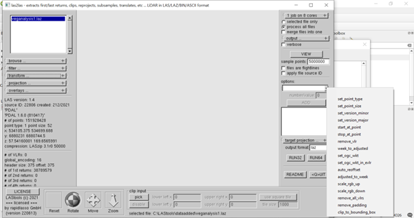
lasinfo (220613) report for 'C:\Users\uqkstev7\OneDrive - The University of Queensland\Desktop\lidar\practice dataNZ\NZ data\veganalysis1.laz'
reporting all LAS header entries:
file signature: 'LASF'
reporting all LAS header entries:
file signature: 'LASF'
file source ID: 22806
global_encoding: 16
project ID GUID data 1-4: 00000000-0000-0000-0000-000000000000
version major.minor: 1.4
system identifier: 'PDAL'
generating software: 'PDAL 1.6.0 (810417)'
file creation day/year: 212/2021
header size: 375
offset to point data: 1005
number var. length records: 1
point data format: 1
point data record length: 52
number of point records: 151928428
number of points by return: 38789579 0 0 0 0
scale factor x y z: 0.001 0.001 0.001
offset x y z: 534105 6880230 57.541600000000003
min x y z: 534105.375 6880231.000 57.542
max x y z: 534699.688 6880744.500 169.657
WARNING: stored resolution of max_x not compatible with x_offset and x_scale_factor: 534699.68798828125
start of waveform data packet record: 0
start of first extended variable length record: 0
number of extended_variable length records: 0
extended number of point records: 151928428
extended number of points by return: 38789579 0 0 0 0 0 0 0 0 0 0 0 0 0 0
variable length header record 1 of 1:
reserved 0
user ID 'LASF_Spec'
record ID 4
length after header 576
description 'Extra Bytes Record'
Extra Byte Descriptions
data type: 10 (double), name "Original cloud index", description: "", scale: 1 (not set), offset: 0 (not set)
data type: 10 (double), name "Ring", description: "", scale: 1 (not set), offset: 0 (not set)
data type: 10 (double), name "Range", description: "", scale: 1 (not set), offset: 0 (not set)
LASzip compression (version 3.1r0 c2 50000): POINT10 2 GPSTIME11 2 BYTE 2
reporting minimum and maximum for all LAS point record entries ...
X 375 594688
Y 1000 514500
Z 0 112115
intensity 0 244
return_number 0 1
number_of_returns 1 1
edge_of_flight_line 0 0
scan_direction_flag 0 0
classification 0 0
scan_angle_rank 0 0
user_data 0 0
point_source_ID 0 4
gps_time 1626319123.265864 1626329679.279658
WARNING: range violates GPS week time specified by global encoding bit 0
attribute0 0 2 ('Original cloud index')
attribute1 0 15 ('Ring')
attribute2 1.50015 89.9999 ('Range')
WARNING: there is coordinate resolution fluff (x10) in Y
WARNING: there is serious coordinate resolution fluff (x100) in Y
number of first returns: 151928428
number of intermediate returns: 0
number of last returns: 38789579
number of single returns: 151928428
WARNING: there are 113138849 points with return number 0
overview over extended number of returns of given pulse: 151928428 0 0 0 0 0 0 0 0 0 0 0 0 0 0
histogram of classification of points:
151928428 never classified (0)
Execution completed in 157.02 seconds (2 minutes 37 seconds)
Results:
{'': None}
Loading resulting layers
Algorithm 'lasinfo' finished

Jochen Rapidlasso

Jorge Delgado García
Everything seems to point that the LAS file you have generated with PDAL is too tight. One of the advantages that LAStools has is that it analyzes the headers of the LAS files to try to detect problems, etc. Not all warnings have to be equally dangerous, they actually appear as warnings and not as errors. However, it is a warning that the original file has certain problems, for example, from what I see problems in the GPS time reference, problems in the coordinate frames and perhaps most seriously a high number of points without data.
If you can access the original data before going through PDAL, in text format, etc. perhaps the most advisable would be to perform the transformation in a direct way within LAStools and thus ensure that the files will be fine. It is also recommended that you look at LASoptimize.
Greetings and if you need help, just tell me, if you send me the files I will do the conversion and send you the commands.
Jorge Delgado
--
Download LAStools at
https://rapidlasso.de
Manage your settings at
https://groups.google.com/g/lastools/membership
---
You received this message because you are subscribed to the Google Groups "LAStools - efficient tools for LiDAR processing" group.
To unsubscribe from this group and stop receiving emails from it, send an email to lastools+u...@googlegroups.com.
To view this discussion on the web visit https://groups.google.com/d/msgid/lastools/2ec7fc9f-b631-4eda-93bc-50744471b095n%40googlegroups.com.

Kristy48
LAStools command line
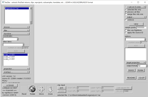
C:/LAStools\bin\lasinfo -i "C:\LAStools\dataadded\xyzscale.las"
LAStools console output
lasinfo (220613) report for 'C:\LAStools\dataadded\xyzscale.las'
reporting all LAS header entries:
file signature: 'LASF'
file source ID: 22806
global_encoding: 16
project ID GUID data 1-4: 00000000-0000-0000-0000-000000000000
version major.minor: 1.4
system identifier: 'LAStools (c) by rapidlasso GmbH'
generating software: 'las2las (version 220613)'
file creation day/year: 212/2021
header size: 375
offset to point data: 1005
number var. length records: 1
point data format: 1
point data record length: 52
number of point records: 151928428
number of points by return: 38789579 0 0 0 0
scale factor x y z: 0.001 0.001 0.001
offset x y z: 534105 6880230 57.541600000000003
min x y z: 534.105 8596814.823 0.058
max x y z: 534.700 8596815.336 0.170
start of waveform data packet record: 0
start of first extended variable length record: 0
number of extended_variable length records: 0
extended number of point records: 151928428
extended number of points by return: 38789579 0 0 0 0 0 0 0 0 0 0 0 0 0 0
variable length header record 1 of 1:
reserved 0
user ID 'LASF_Spec'
record ID 4
length after header 576
description 'Extra Bytes Record'
Extra Byte Descriptions
data type: 10 (double), name "Original cloud index", description: "", scale: 1 (not set), offset: 0 (not set)
data type: 10 (double), name "Ring", description: "", scale: 1 (not set), offset: 0 (not set)
data type: 10 (double), name "Range", description: "", scale: 1 (not set), offset: 0 (not set)
reporting minimum and maximum for all LAS point record entries ...
X -533570895 -533570300
Y 1716584823 1716585336
Z -57484 -57372
intensity 0 244
return_number 0 1
number_of_returns 1 1
edge_of_flight_line 0 0
scan_direction_flag 0 0
classification 0 0
scan_angle_rank 0 0
user_data 0 0
point_source_ID 0 4
gps_time 1626319123.265864 1626329679.279658
WARNING: range violates GPS week time specified by global encoding bit 0
attribute0 0 2 ('Original cloud index')
attribute1 0 15 ('Ring')
attribute2 1.50015 89.9999 ('Range')
number of first returns: 151928428
number of intermediate returns: 0
number of last returns: 38789579
number of single returns: 151928428
WARNING: there are 113138849 points with return number 0
overview over extended number of returns of given pulse: 151928428 0 0 0 0 0 0 0 0 0 0 0 0 0 0
histogram of classification of points:
151928428 never classified (0)