Steep Cliff Face

athum

Support at rapidlasso

Jochen Bind
Not to step outside of the LAStools realm here, but I think using multiple software packages to achieve a goal is often quite successful. This case, to me, represents a real 3D problem, rather than a 2.5D problem. LAStools’ approach to ground classification basically works in 2.5D.
We came across similar issues when trying to classify vegetation along near-vertical river banks. The approach we took was using the CloudCompare implementation Canupo (based on the paper available here: https://nicolas.brodu.net/common/recherche/publications/canupo.pdf) and got very good results.
Jo
--
Download LAStools at
https://rapidlasso.de
Manage your settings at
https://groups.google.com/g/lastools/membership
---
You received this message because you are subscribed to the Google Groups "LAStools - efficient tools for LiDAR processing" group.
To unsubscribe from this group and stop receiving emails from it, send an email to
lastools+u...@googlegroups.com.
To view this discussion on the web visit
https://groups.google.com/d/msgid/lastools/6bd0a083-4ef7-40c9-a18b-46451f57ba4cn%40googlegroups.com.

|
|

Jorge Delgado García
If in the end it is complicated to apply geometric elements, and as long as your point cloud has an associated RGB, or even with the reflectivity itself - let's not forget that most sensors work in IR - it is usually more or less simple to calculate a "vegetation index" (or an approximation to it) and discriminate what is "vegetation" from what is bare rock or soil. Do you consider it viable to apply this methodology?
Another possibility is not to try to perform the classification in one step, but to perform the classification in several steps, in order to be able to better adjust the parameters in each case. For that, LAStools is a great tool, you can use the -keep_classification and -drop_classification commands to select in which zones you want to reclassify, override the classifications and reclassify again.
To view this discussion on the web visit https://groups.google.com/d/msgid/lastools/SY4PR01MB7106E3E6D93159464291217FD96E9%40SY4PR01MB7106.ausprd01.prod.outlook.com.
--

Jochen Bind
Hi Jorge,
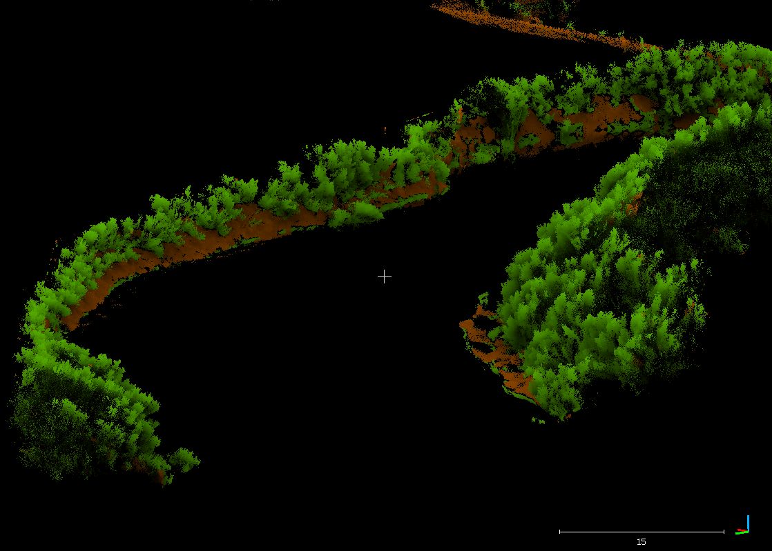
You raise some good points about making use of the IR information in the intensity of returns. In our case, we’re using a Velodyne scanner and have no RGB information. We did preliminary filtering out of water based on intensity.
You are correct in that Canupo requires some processing, but we’ve processed point clouds of about 150 Mio points on a 5-year old desktop without major issues. A small section of the vegetation classification results are shown in the attached image.
Cheers,
Jo
To view this discussion on the web visit https://groups.google.com/d/msgid/lastools/CADgtU__DXO-HsnQNf72ywud51Sib5MFWf3f3hf1FZ3RYbnkGSg%40mail.gmail.com.