Fwd: Strava Heat Map --showing workers on ships and rigs
3 views
Skip to first unread message

Scott Eustis
Jan 29, 2018, 1:46:08 AM1/29/18
to plots-g...@googlegroups.com, plots-or...@googlegroups.com
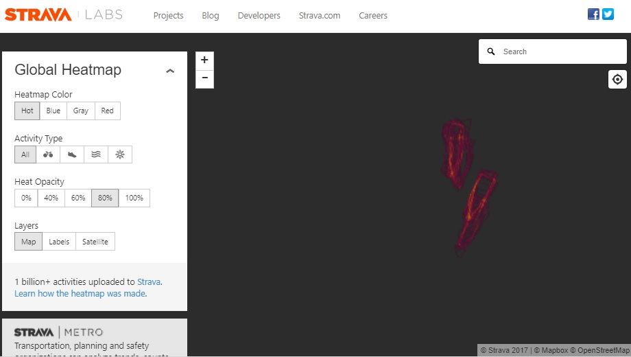
people are circling on the drilling rigs offshore
Or perhaps it's an effect of the dynamic positioning of the drilling units
But it's always refreshing to see the thousands of men who are marooned out there, drilling away, keeping the heat on in New York
you can see the guys that run their boats, you can see their boats, even
Scott EustisCommunity Science DirectorGulf Restoration Network330 Carondelet St.Suite 300New Orleans, LA 70130tel: 504-525-1528 x212mobile: 504 484 9599@HealthyGulf
Scott EustisCommunity Science DirectorGulf Restoration Network330 Carondelet St.Suite 300New Orleans, LA 70130tel: 504-525-1528 x212mobile: 504 484 9599@HealthyGulf

Liz Barry
Jan 29, 2018, 10:03:45 AM1/29/18
to plots-or...@googlegroups.com, plots-g...@googlegroups.com
WOW
--
-- Post to this group at plots-organizers@googlegroups.com. To unsubscribe, email plots-organizers+unsubscribe@googlegroups.com. Options at https://groups.google.com/d/forum/plots-organizers
---
You received this message because you are subscribed to the Google Groups "plots-organizers" group.
To unsubscribe from this group and stop receiving emails from it, send an email to plots-organizers+unsubscribe@googlegroups.com.
For more options, visit https://groups.google.com/d/optout.
Liz Barry
Jan 29, 2018, 10:20:58 AM1/29/18
to plots-or...@googlegroups.com, plots-g...@googlegroups.com
I'm going to tweet these as screenshots and credit you --

Gretchen Gehrke
Jan 29, 2018, 10:25:22 AM1/29/18
to plots-or...@googlegroups.com, plots-g...@googlegroups.com
I only see a blank screen (other than the left menu and top navigation bar). Can you share a screenshot here?
Scott Eustis
Jan 29, 2018, 12:32:57 PM1/29/18
to plots-g...@googlegroups.com, plots-or...@googlegroups.com
it is slow to load, here s the second link
--
Public Lab mailing lists (http://publiclab.org/lists) are great for discussion, but to get attribution, open source your work, and make it easy for others to find and cite your contributions, please publish your work at http://publiclab.org
---
You received this message because you are subscribed to the Google Groups "plots-GulfCoast" group.
To unsubscribe from this group and stop receiving emails from it, send an email to plots-gulfcoast+unsubscribe@googlegroups.com.
Scott Eustis
Scott Eustis
Jan 30, 2018, 4:16:30 PM1/30/18
to plots-g...@googlegroups.com, Kevin McDunn, plots-or...@googlegroups.com
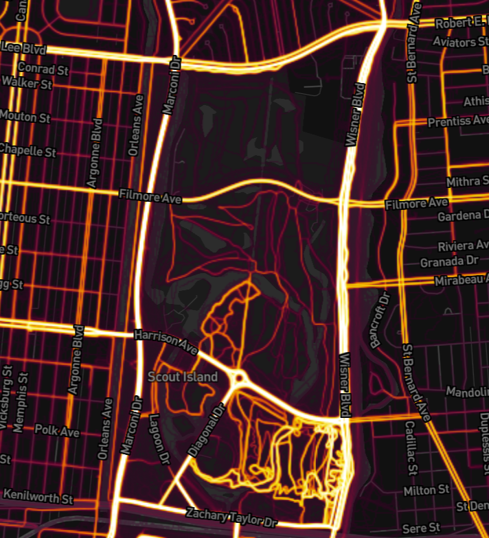
This Heat Map, attached, shows how much park activity has been displaced from City Park, in New Orleans.
The park in the middle of this pic. The top is the golf course--very low activity.
The bottom part is the "Wisner Tract", the soccer fields, and other parts of the park accessible to the public--highest activity. It's actually not that quiet, though, because it's close to an interstate bypass.
The middle is the Natural area and a fallow course that many people, including me and my dad, would go to exercise and get some quiet after Katrina.
Most of this area was converted and fenced off to make a golf course for a private developer in 2015.
Part of the justification was that "no one uses the old fallow golf course. Well,we knew it then, but now, some years later we have the data to prove it.
The fallow golf course was a great place to go, but the masters of City Park kicked us out.
On the other hand, we can argue that tilling the golf course, getting rid of it, will increase the use of the Park. So, it's nice to know you were right, even if we were kicked out of the Park.
S

pablo rey
Jan 31, 2018, 9:18:50 AM1/31/18
to plots-or...@googlegroups.com, plots-g...@googlegroups.com, Kevin McDunn
Deanonymization of data through Strava http://steveloughran.blogspot.com.es/2018/01/advanced-denanonymization-through-strava.html
Scott Eustis
Jan 31, 2018, 12:04:26 PM1/31/18
to plots-g...@googlegroups.com, plots-or...@googlegroups.com, Kevin McDunn
a how to guide. yikes.
Reply all
Reply to author
Forward
0 new messages