assest_Hazard_distance
32 views
Skip to first unread message

epeyg...@gmail.com
Jul 19, 2016, 10:11:25 AM7/19/16
to OpenQuake Users
Dear Virtor,
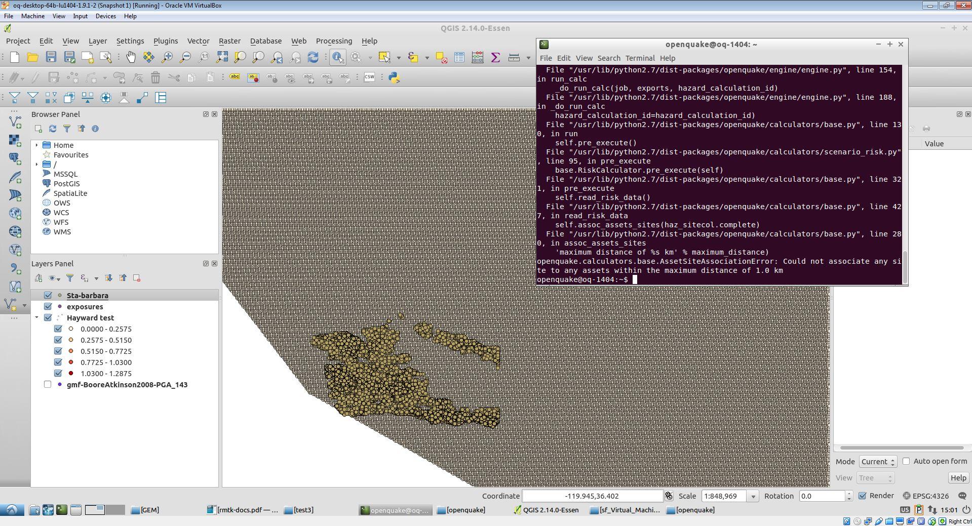
I am running the Scenario risk model for Santa Barbara. I performed the hazard analysis before and prepared the hazard gmfs file. Although hazard map as shown in the picture which are a grid with 1km resolution are located very near to the exposures, the OpenQuake can not find the hazard bins in vicinity of the exposures. I tried 5 , 10 and even 20 kilometer and get the same error. I have attached the figure for you to see the error. would you please let me know what is the problem?
Thanks
Elnaz

Vitor Silva
Jul 19, 2016, 6:19:12 PM7/19/16
to openqua...@googlegroups.com
Dear Elnaz,
It is probably a mismatch between the coordinates of the exposure and ground shaking. It is not possible to assess the actual issue with just this figure. Please share the input models with in...@openquake.org, and let us know which version of OQ you’re using.
Best regards,
Vitor
--
You received this message because you are subscribed to the Google Groups "OpenQuake Users" group.
To unsubscribe from this group and stop receiving emails from it, send an email to openquake-use...@googlegroups.com.
For more options, visit https://groups.google.com/d/optout.
You received this message because you are subscribed to the Google Groups "OpenQuake Users" group.
To unsubscribe from this group and stop receiving emails from it, send an email to openquake-use...@googlegroups.com.
For more options, visit https://groups.google.com/d/optout.
Reply all
Reply to author
Forward
0 new messages