maxent output elevation details
82 views
Skip to first unread message

Yagya Raj Paneru
Feb 20, 2017, 7:51:22 AM2/20/17
to Maxent
i created a distribution map using maxent. now i want to know the range of distribution in terms of elevation. how can i calculate elevation for each cell, i am using 30 arc-sec data,

Jamie M. Kass
Feb 20, 2017, 8:08:38 AM2/20/17
to Maxent
To get the values of a raster (e.g. elevation) for a set of points, you can use "Extract Values by Points" in ArcGIS, or extract() with the raster package in R. Make sure the raster and points are in the same projection (i.e. if raster is lat long and points are utm, project raster to utm before extracting). I'm sure there's a way in QGIS as well, so if you don't have ArcGIS and want a free GUI option, it should be easy enough to google the answer. Good luck!
Jamie Kass
PhD Candidate
City College of NYC
ndimhypervol
Feb 20, 2017, 4:55:47 PM2/20/17
to max...@googlegroups.com
You can assign all cells not equal to 1 (your "suitable area") to NA, then mask the elevation raster by this. The result is only elevation values for areas that were called "suitable". You can do this operation using the Raster Calculator (assign all cells not suitable to NA) and extract with Extract by Mask with ArcGIS.
What exactly is your goal with extracting the elevation values?
Jamie Kass
Jamie Kass
PhD Candidate, CCNY
cell: 917-602-5787
--
You received this message because you are subscribed to a topic in the Google Groups "Maxent" group.
To unsubscribe from this topic, visit https://groups.google.com/d/topic/maxent/6svkmqGGMHg/unsubscribe.
To unsubscribe from this group and all its topics, send an email to maxent+un...@googlegroups.com.
To post to this group, send email to max...@googlegroups.com.
Visit this group at https://groups.google.com/group/maxent.
For more options, visit https://groups.google.com/d/optout.
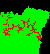
<present_alt_reclass.bmp>
Yagya Raj Paneru
Feb 22, 2017, 1:14:18 AM2/22/17
to Maxent
i want to know the elevation range of present possible distribution and for future predicted areas.
On Monday, February 20, 2017 at 6:36:22 PM UTC+5:45, Yagya Raj Paneru wrote:
Jamie M. Kass
Mar 5, 2017, 1:27:29 PM3/5/17
to Maxent
Oh okay, well then you can use the technique I just described. Have you tried it yet?
Jamie
Jamie
Yagya Raj Paneru
Mar 6, 2017, 1:15:06 AM3/6/17
to Maxent
That worked for me. Thanks Jamie.
On Monday, February 20, 2017 at 6:36:22 PM UTC+5:45, Yagya Raj Paneru wrote:
Reply all
Reply to author
Forward
0 new messages