lasheight

Karin...@ldbv.bayern.de
Hello Martin,
with lasheight there is the option to save the height above ground as extra bytes (-store_as_extra_bytes)
Is there a way to access the computed heights?
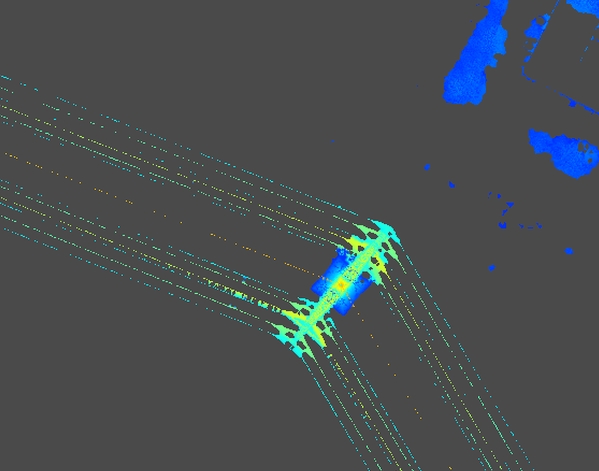
I want to use this for the detection of power lines and power poles.
Thanks
Karin

Martin Isenburg
--
Download LAStools at
http://lastools.org
http://rapidlasso.com
Be social with LAStools at
http://facebook.com/LAStools
http://twitter.com/LAStools
http://linkedin.com/groups/LAStools-4408378
Manage your settings at
http://groups.google.com/group/lastools/subscribe
Martin Isenburg
--
Karin...@ldbv.bayern.de
Hello Martin,
thank you for the detailed information.
Gridding the points with the height above ground visualizes the power lines and the power poles nicely if the point density is high enough. We then digitize the exact position of the poles.
The result is a point shape.
Now I am interested in the height of the pole. Up to now I clip all the positions (point shape with a buffer of 3m),
subsequently do a thinning with a grid spacing of 15m ( keeping only the highest or alternatively the lowest point in the cell).
This gives reasonable results but I would prefer to directly use the (buffered) point position to get more reliable heights.
Is there any workflow to achieve this with LAStools?
Regards,
Karin