Error with lastile

Dave....@mffp.gouv.qc.ca
Hello !
Why do I get so many error messages during a lastile?
Wearing the input data was classified with lasground and cleaned with lasnoise.
What should I understand?
Thank you !
WARNING: on-the-fly merged LAS 1.2 files contain too many points (24982103351) f
or single LAS 1.2 file.
WARNING: written 9792461 points but expected 0 points
WARNING: written 10573968 points but expected 0 points
ERROR: reading header.file_signature
ERROR: could not open lasreaderlas for file 'E:\UG23\2016\LAS\Donneesbrutes\filt
re\hauteur\16_2645424f07_02301_db_denoise_class_haut.laz'
WARNING: written 1299431 points but expected 0 points
WARNING: on-the-fly merged LAS 1.2 files contain too many points (24982103351) f
or single LAS 1.2 file.
WARNING: on-the-fly merged LAS 1.2 files contain too many points (24982103351) f
or single LAS 1.2 file.
ERROR: reading header.file_signature
ERROR: could not open lasreaderlas for file 'E:\UG23\2016\LAS\Donneesbrutes\filt
re\hauteur\16_2645424f07_02301_db_denoise_class_haut.laz'
removing E:\UG23\2016\LAS\Donneesbrutes\filtre\hauteur\tuiles\tuile_263200_54250
00.laz
WARNING: written 0 points but expected 0 points
WARNING: on-the-fly merged LAS 1.2 files contain too many points (24982103351) f
or single LAS 1.2 file.
ERROR: reading header.file_signature
ERROR: could not open lasreaderlas for file 'E:\UG23\2016\LAS\Donneesbrutes\filt
re\hauteur\16_2645424f07_02301_db_denoise_class_haut.laz'
WARNING: written 731692 points but expected 0 points
Dave Munger
Analyste en géomatique et LiDAR
Unité de gestion Rivière-Péribonka
Direction de la gestion des forêts du Saguenay-Lac-St-Jean
Ministère des Forêts, de la Faune et des Parcs
801, chemin du Pont-Taché Nord, bureau RC-03
Alma (Québec) G8B 5B7
Téléphone : 418 668-8319, poste 370
dave....@mffp.gouv.qc.ca
mffp.gouv.qc.ca

Tobias K Kohoutek

Dave Munge
Here is my command line :
Lastile –i *.laz –o tuile –tile _size 1400 –buffer 10 –cores 4 –olaz
And a lasinfo report :
reporting all LAS header entries:
file signature: 'LASF'
file source ID: 0
global_encoding: 1
project ID GUID data 1-4: 00000000-0000-0000-0000-000000000000
version major.minor: 1.2
system identifier: 'LAStools (c) by rapidlasso GmbH'
generating software: 'lasheight (160329) commercial'
file creation day/year: 306/2016
header size: 227
offset to point data: 569
number var. length records: 2
point data format: 1
point data record length: 30
number of point records: 4359879
number of points by return: 2720274 1498864 138691 2046 4
scale factor x y z: 0.01 0.01 0.01
offset x y z: 0 0 0
min x y z: 250000.00 5393000.00 181.58
max x y z: 250999.99 5393999.99 244.71
variable length header record 1 of 2:
reserved 0
user ID 'LASF_Projection'
record ID 34735
length after header 40
description 'by LAStools of rapidlasso GmbH'
GeoKeyDirectoryTag version 1.1.0 number of keys 4
key 1024 tiff_tag_location 0 count 1 value_offset 1 - GTModelTypeGeoKey: ModelTypeProjected
key 3072 tiff_tag_location 0 count 1 value_offset 2949 - ProjectedCSTypeGeoKey: NAD83(CSRS) / MTM zone 7
key 3076 tiff_tag_location 0 count 1 value_offset 9001 - ProjLinearUnitsGeoKey: Linear_Meter
key 4099 tiff_tag_location 0 count 1 value_offset 9001 - VerticalUnitsGeoKey: Linear_Meter
variable length header record 2 of 2:
reserved 43707
user ID 'LASF_Spec'
record ID 4
length after header 192
description 'by LAStools of rapidlasso GmbH'
Extra Byte Descriptions
data type: 4 (short), name "height above ground", description: "vertical point to TIN distance", scale: 0.01, offset: 250
the header is followed by 2 user-defined bytes
LASzip compression (version 2.4r1 c2 50000): POINT10 2 GPSTIME11 2 BYTE 2
reporting minimum and maximum for all LAS point record entries ...
X 25000000 25099999
Y 539300000 539399999
Z 18158 24471
intensity 0 1202
return_number 1 5
number_of_returns 1 5
edge_of_flight_line 0 1
scan_direction_flag 0 1
classification 1 2
scan_angle_rank -25 27
user_data 7 7
point_source_ID 21609 21611
gps_time 154266614.388402 154268351.559040
number of first returns: 2720274
number of intermediate returns: 140695
number of last returns: 2720971
number of single returns: 1222061
overview over number of returns of given pulse: 1222061 2719846 409791 8161 20 0 0
histogram of classification of points:
3423266 unclassified (1)
936613 ground (2)
The project includes 6400 tiles.
Regards
Dave Munge
What does this type of message mean:
Thank you !
Le mercredi 11 janvier 2017 10:55:34 UTC-5, Tobias K Kohoutek a écrit :

Martin Isenburg
--
Download LAStools at
http://lastools.org
http://rapidlasso.com
Be social with LAStools at
http://facebook.com/LAStools
http://twitter.com/LAStools
http://linkedin.com/groups/LAStools-4408378
Manage your settings at
http://groups.google.com/group/lastools/subscribe
Martin Isenburg
lastile -i *.laz ^
--
Dave Munge
Moreover, when I execute "laszip -i * .laz -check" on another PC, it runs perfectly and all the files are good.
-tile_size 1400 ^
-buffer 10 ^
-extra_pass ^
-o tiles / tile.laz
A very big thank you for your answers always just !!
Martin Isenburg
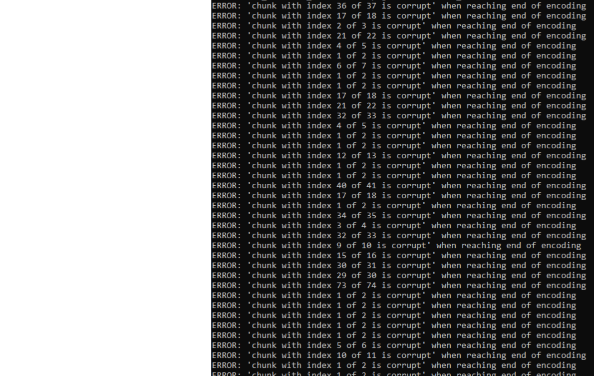
My memory problem seems to apply here too, because when I do on the problematic PC:Laszip -i * .laz -checkLastools freezes after displaying an error of type:ERROR: 'end-of-file during chunk with index 13' after 684923 of 3688701 points

Ruben Wauters

Jochen Rapidlasso
without testdata it is hard to analyze.
I think you have to try to get closer to the problem with changing parameters to see,
where the problem occurs.
Problems with large files may are also operating system, network or filesystem problems...
May see this post:
https://groups.google.com/g/lastools/c/zBxXBixGB_I/m/rb383WY8AwAJ
Did you check the files using lasvalidate and lasinfo?
- can you e.g. just copy them 1:1 using a command like
las2las -i *.laz -odir c:\temp\test
How big are the files?
Can you reproduce the problem on
- other/all files?
- other storage?
- other hardware with (more/less) memory?
...
So this are my first ideas.
After you have checked this I may have some more :)
Best,