Extracting Building footprint polygon using Las Tools
807 views
Skip to first unread message

Florina Dutt
Oct 5, 2017, 9:20:07 PM10/5/17
to LAStools - efficient tools for LiDAR processing
Hi ,
I would like to know how I would extract just building footprint polygon from Lidar point cloud data?
I do not need the entire building shape polygon that might be possible using las Boundary tool but just footprint polygons. If anyone could explain me the possible steps it would be really helpful.

Martin Isenburg
Oct 15, 2017, 12:16:21 AM10/15/17
to LAStools - efficient command line tools for LIDAR processing
Hello,
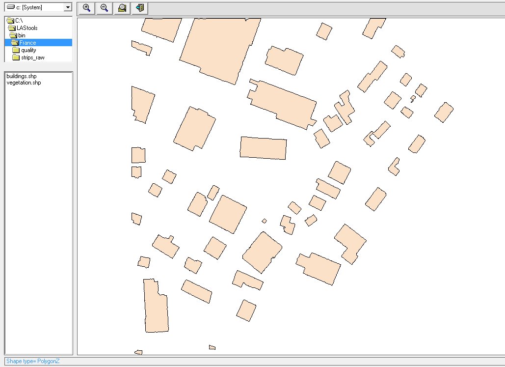
with lasboundary you can extract polygons of where buildings are when you have a the points corresponding to buildings (or their roofs) classified in the point cloud. You will not get simple, rectified polygons but - depending on the density and the quality of your input you can get reasonable results as shown in the attached images. I also attach the two (well documented) scripts that were used to do the classification and the derivative extraction. A similar workflow for larger inputs is described here:
https://rapidlasso.com/2013/10/13/tutorial-lidar-preparation/
https://rapidlasso.com/2013/10/20/tutorial-derivative-production/
https://rapidlasso.com/2013/10/20/tutorial-derivative-production/
Regards,
Martin @rapidlasso
PS: Want to meet rapidlasso GmbH in person and talk LiDAR, photogrammetry points and LAStools? See our upcoming event schedule here: http://rapidlasso.com/events
--
Download LAStools at
http://lastools.org
http://rapidlasso.com
Be social with LAStools at
http://facebook.com/LAStools
http://twitter.com/LAStools
http://linkedin.com/groups/LAStools-4408378
Manage your settings at
http://groups.google.com/group/lastools/subscribe
Reply all
Reply to author
Forward
0 new messages