openstreetmap.in!
54 views
Skip to first unread message

Sajjad Anwar
May 14, 2015, 9:23:09 AM5/14/15
to data...@googlegroups.com
Hey everyone,
Really happy to announce that openstreetmap.in is back and running.
This time with a great style and legal international borders. -
http://openstreetmap.in/
Earlier today, Satyaakam, Arun, Sanjay and I put it together. It's
hosted on a server that Sanjay and I maintain along with several other
open data projects. The tiles are hosted on mapbox.com under the
openstreetmap account, updated regularly - changes to OpenStreetMap
will reflect in under 10 minutes. The style is prepared using Mapbox
Studio and is here - https://github.com/osmlab/india.tm2 If you have
feature requests or find bugs in the style, just open a ticket. Pull
requests welcome!
You can use this map in your project, the instructions are here -
https://github.com/geohacker/openstreetmap.in#using-this-map
We have also setup a tasking manager instance -
http://tasks.openstreetmap.in/ - to coordinate mapping events and
workshops across the country. Please reach out to the list if you need
help organising a task.
Cheers,
Sajjad.

Nikhil VJ
May 24, 2015, 10:22:54 PM5/24/15
to datameet
Hi Sajjad, this is great.
1. Is this tile layer free to use in printed maps?
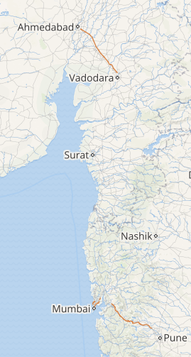
2. There are some red-colour roads standing out which I suspect are expressways. Screenshot attached. It seems a bit too standing-out, as if we're marking some crisis location or something. Once we zoom in, all the roads go yellow and it becomes OK again. But at 5,6,7 zoom level it looks odd.
3. I noticed while reading through OSM data that many places have their Hindi, Tamil and/or other Indian language titles too. I'd like to be able to browse the map with these Indian language names (ie, Map Localization); can't find any way to do that in OSM presently. Whereas I notice that happening for Thailand, China etc. I'm guessing customized map styling like what you're doing, is needed, to choose the other language label over English, if it is available. More vernacular place names may get contributed if there is a visible vernacular map browser. Do you think this could be made possible? We could then maybe have a hi.openstreetmap.in , etc for browsing the map in that language?
--
Cheers,
Nikhil
+91-966-583-1250
Pune, India
Self-designed learner at Swaraj University <http://www.swarajuniversity.org>
http://nikhilsheth.blogspot.in
Cheers,
Nikhil
+91-966-583-1250
Pune, India
Self-designed learner at Swaraj University <http://www.swarajuniversity.org>
http://nikhilsheth.blogspot.in
--
Datameet is a community of Data Science enthusiasts in India. Know more about us by visiting http://datameet.org
---
You received this message because you are subscribed to the Google Groups "datameet" group.
To unsubscribe from this group and stop receiving emails from it, send an email to datameet+u...@googlegroups.com.
For more options, visit https://groups.google.com/d/optout.
Sajjad Anwar
May 25, 2015, 1:40:16 AM5/25/15
to data...@googlegroups.com
Hey Nikhil -
On Mon, May 25, 2015 at 7:52 AM, Nikhil VJ <nikh...@gmail.com> wrote:
Hi Sajjad, this is great.1. Is this tile layer free to use in printed maps?
Yes. OpenStreetMap requires attribution though - http://www.openstreetmap.org/copyright
2. There are some red-colour roads standing out which I suspect are expressways. Screenshot attached. It seems a bit too standing-out, as if we're marking some crisis location or something. Once we zoom in, all the roads go yellow and it becomes OK again. But at 5,6,7 zoom level it looks odd.
Hmm, I don't really see this being a problem, but thanks for flagging.
3. I noticed while reading through OSM data that many places have their Hindi, Tamil and/or other Indian language titles too. I'd like to be able to browse the map with these Indian language names (ie, Map Localization); can't find any way to do that in OSM presently. Whereas I notice that happening for Thailand, China etc. I'm guessing customized map styling like what you're doing, is needed, to choose the other language label over English, if it is available. More vernacular place names may get contributed if there is a visible vernacular map browser. Do you think this could be made possible? We could then maybe have a hi.openstreetmap.in , etc for browsing the map in that language?
This is something that's definitely on the list, just that it's a bit more work than what it sounds. The reason why some places have names in local language is because the default name tag is in that local language - http://wiki.openstreetmap.org/wiki/Multilingual_names. We are working on this and there are some stuff already happening like https://www.mapbox.com/blog/maps-in-your-language/
Also, this means that we need names to be translated.
Cheers,
Sajjad.
Nikhil VJ
Jun 26, 2015, 8:01:01 AM6/26/15
to datameet
Hi Sajjad,
(Replying after a month..)Thanks for the pointers about the language.
It's a chicken or egg thing I guess: Make it easy to see a map with different languages, and then people will contribute the translations. Create the mechanism; demand as well as supply will automatically manifest :D
I've been using the Openstreetmap.IN tileset in the maps I'm making.. it's awesome. Great work!
--
Cheers,
Nikhil
+91-966-583-1250
Pune, India
Self-designed learner at Swaraj University <http://www.swarajuniversity.org>
http://nikhilsheth.blogspot.in
Cheers,
Nikhil
+91-966-583-1250
Pune, India
Self-designed learner at Swaraj University <http://www.swarajuniversity.org>
http://nikhilsheth.blogspot.in
--

Arun Ganesh
Jun 26, 2015, 9:48:27 AM6/26/15
to datameet
Reply all
Reply to author
Forward
0 new messages