Create terrain server

s.se...@gmail.com
http://cesium.agi.com/forum.html?place=msg%2Fcesium-dev%2F74a5XriE-eM%2Fjns0RsaWetYJ
May be already exists tools for generation tiles CesiumTerrainProvider format ?
s.se...@gmail.com

Kevin Ring
s.se...@gmail.com
May be You can help me with algorithm?
I modify gdal2tiles to generate GTiff in Int16 data type.
Now its generate 256x256 tiles. Them i need scale their to 65x65 ? or already gdal2tiles must generate 65x65 tiles ?
Thanks
PS. Sorry for my english
s.se...@gmail.com
Thanks for help.
PS. Cool project. Im very happy what find it =)
Kevin Ring
s.se...@gmail.com
Whats not realized:
1. Whater mask
2. Aprox height on tile borders
3. Split two and more SRTM files( example: srtm_15_08 and srtm_16_08 result at now looks as http://sergeserver.dyndns.org/images/cesium/heightfield3.png
Who knows russian may look this on my site: http://sergeserver.dyndns.org/index.php/programming/python/2-generator-landshafta-dlya-cesium
Script will be update on this site, changes will be posted in this topic.
Download script: http://sergeserver.dyndns.org/index.php/downloads/category/1-scripts?download=2:generator-landshafta-dlya-cesium
Kevin Ring

pim.res...@gmail.com
the script link is unavailable now. Could you send me(pim.researcher#gmail.com) the script or post it online.
Thanks a lot
Shawn
s.se...@gmail.com
> http://cesium.agi.com/forum.html?place=msg%2Fcesium-dev%2F74a5XriE-eM%2Fjns0RsaWetYJ
> May be already exists tools for generation tiles CesiumTerrainProvider format ?
In near feature will be done new version of this file.
pim.res...@gmail.com
Could you provide an example of the command line?
Thanks,
Shawn
s.se...@gmail.com
Sorry for english, its translate by google )
Original in my native language(russian) and screens may be read on http://sergeserver.dyndns.org/index.php/programming/python/4-generator-landshafta-dlya-cesium-versiya-ii
Whats new:
1. Posted tiles overlap the edges to fit the specification Cesium Terrain Server.
2. Added flag to glue tiles (- join)
3. Laid basic support for water mask
On the second point in more detail. I work with treated SRTM data taken from the server GisLab, this data is based on CGIAR, the only difference is that the mosaic is 5x5 degrees, and the value of NODATA c 255 is replaced by -32678.
So, the flag - join means that the script will first check for the existence of the generated files, and if there are, they will simply supplemented. It used the same script gdal2tiles just overwrite the existing or missing tiles. By the way, this flag can be used to generate raster tiles.
Example, consider two files DEM - srtm_45_04(http://gis-lab.info/data/srtm-tif/srtm_45_04.zip) and srtm_45_05(http://gis-lab.info/data/srtm-tif/srtm_45_05.zip). This two adjacent tile vertically.
For first tile we do gdal2srtmtiles.py --cesium -p geodetic srtm_45_04.tif terrain -z 0-9
We have screen - http://sergeserver.dyndns.org/images/cesium/srtm_45_04.png
For second gdal2srtmtiles.py --cesium -p geodetic srtm_45_05.tif terrain -z 0-9 --join
We have screen - http://sergeserver.dyndns.org/images/cesium/srtm_45_05.png
If you look at what was successful bonding.
With regard to the third point. Now I test your script to process the water mask. For water mask I use lannye SRTM Water Body Data Files (SWBD) that are online HB http://dds.cr.usgs.gov/srtm/version2_1/SWBD/. The algorithm works as follows script as an input parameter the tile DEM (georeferenced), then calculates what the script tiles 1x1 degrees to download http://dds.cr.usgs.gov/srtm/version2_1/SWBD/. The script unpacks the downloaded zip file, rastrizuet them GTiff (input, these tiles have a 1x1 degree shape format), then there is cross-linking of these tiles in a tile 5x5 degrees. When we have the original tile SRTM and ready to grow aquatic mask I do the following I to the basic raster SRTM add another layer (Band) from raster SWBD and generating tiles Cesium Terrain Server when setting a flag - water-mask layer that I will consider the aqueous mask. Has turned out to generate the tile surface with a water mask only for the ground level of tiles, for thumbnail not yet obtained. By the way, SWBD is not only the seas and oceans, but also rivers and lakes.
http://sergeserver.dyndns.org/images/cesium/stm_45_04-sea.png
http://sergeserver.dyndns.org/images/cesium/sertm_45_04-lake.png
pim.res...@gmail.com
I am going to use ASTER data. refer to, http://gdem.ersdac.jspacesystems.or.jp/search.jsp . Resolution is 30 meters. Is that data compatible to your script?
DEM output format for this data is, GeoTIFF, signed 16 bits, 1m/DN, Referenced to the WSG84/EGM96 geoid, -9999 for void pixels, 0 for sea water body.
Thanks,
Shawn
pim.res...@gmail.com
s.se...@gmail.com
researcher pim
pim.res...@gmail.com
Thanks,
Shawn
s.se...@gmail.com
gdal2srtmtiles.py --cesium -z 0-9 -p geodetic srtm_45_04.tif terrain
gdal2srtmtiles.py --cesium -z 0-9 -p geodetic srtm_13_06.tif terrain --join
And globe will be rendered full
GDAL 1.8.1, released 2011/07/09
Python 2.7.2
Terrain generated by me from this tiles : http://sergeserver.dyndns.org/phocadownload/terrain.tar.gz
And tile <-> name in globe for google-earth - http://sergeserver.dyndns.org/phocadownload/srtm41.kmz
pim.res...@gmail.com
And another tiny issue. I don't find "-32768" in script. I cannot replace it with my value, -9999. How to do this modification?
researcher pim

Ashley Mort

Ashley Mort
s.se...@gmail.com
> "dsquery.WriteRaster( tileposx, tileposy, self.tilesize, self.tilesize, dsquerytile.ReadRaster(0,0,self.tilesize,self.tilesize),band_list=list(range(1,tilebands+1)))".
>
>
> Of course this gives all the lower level tiles no value so I still need to find out why I'm getting bad values for the lower level/overview tiles.
>
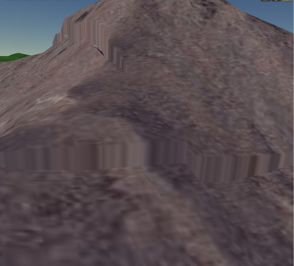
> On Wednesday, August 7, 2013 7:09:55 PM UTC-5, Ashley Mort wrote:This script almost works. When I run it, I keep getting spikes in my terrain which generally go away as I zoom/pan very close to them. Any ideas on what to do here?
> gdal2srtmtiles.py --cesium -z 0-9 -p geodetic srtm_53_07.tif terrain
>
>
>
> https://plus.google.com/photos/102422851817893481221/albums/5909532752528586129/5909532750633265218?banner=pwa&pid=5909532750633265218&oid=102422851817893481221
>
>
>
>
> http://cesium.agi.com/forum.html?place=msg%2Fcesium-dev%2F74a5XriE-eM%2Fjns0RsaWetYJ
> May be already exists tools for generation tiles CesiumTerrainProvider format ?

Martin Guttesen

deirdr...@magellium.co.uk
I'm just looking at getting this script up and running, and am getting some filename issues.
Looking at the code it seems we are creating a .terrain file, then creating .terrain.new file, (which we do stuff with), and then finally we try and rename the .terrain.new file back to the .terrain file, which, not surprisingly, fails for us ('Cannot create a file when that file already exists').
Any ideas? We're looking at the area between 1355 and 1385 (line numbers) in the code from the above script.
Also, there was mention of a new script, do you happen to have this?
Thanks
Deirdre.
Kevin Ring
--
You received this message because you are subscribed to the Google Groups "cesium-dev" group.
To unsubscribe from this group and stop receiving emails from it, send an email to cesium-dev+...@googlegroups.com.
For more options, visit https://groups.google.com/groups/opt_out.

Arne Schilling
Somewhere near the line numbers you mention I have this piece of code
# rename files
os.rename( tilefilename, tilefilename + '.old' )
os.rename( tilefilename + '.new', tilefilename )
It works at least if the directory has been emptied before.
There is also a os.remove operation in Python
Arne

Shengqi Song
Kevin Ring
Hi,Agree with Arne. The Script will work if you change line 1552 similar to "os.rename(tilefilename + '.new', tilefilename+'1')". From the screenshot I found the author use Mac, not Windows. Probably that's the reason of a Windows error ('Cannot create a file when that file already exists'). I am new to Cesium. My question is how to be used by Cesium after generated the tiles? Kevin, could you give me some instruction? Thanks.
--
s.se...@gmail.com
Ashley Mort
Here is a brain dump in case someone wants to run with this. I haven't touched it in months.
I will post what I did to get it to run in Windows and attach Serge's script which I modified to run in Windows. It will at least give you some usable output. It's been a while since I ran this so I don't know if the overview tiles below the highest level are generated to be blank or not. If they're not blank, you will just get big spikes in terrain which I have not figured out yet. If anyone can fix this it would be greatly appreciated. Our current use is just to write level 8 for the world for example (which works) then we have custom javascript code to ignore all terrain levels lower than that (to avoid problems, blackness, etc).
To run the script:
gdal2srtmtiles.py --cesium -z 0-8 -p geodetic SRTM_NE_250m.tif terrain
note1: this command needs to be run from the GDAL110 (MSVC 2010) command prompt
note2: some sample SRTM data is available here (http://srtm.csi.cgiar.org/). Use the hc.box.net link.
note3: The gdal2srtmtiles script will generate real
terrain files for the highest level of terrain(ex: 8) then try to calculate
the terrain tiles for all lower levels as "overviews". This
generate_overview_tiles part does not work properly (gives big spikes in
terrain in certain areas) so currently I write all lower levels (0-7)
to have zero elevation. This needs to be fixed at some point. A Windows
Python debugger is available here (https://code.google.com/p/winpdb/wiki/DebuggingTutorial).
ActivePython 2.7.2 32bit
GDAL 1.10 32bit MSVC2010
GDAL 1.10 Python 2.7.2 bindings
Numpy for Python

homme.z...@gmail.com
This may be of interest to folks in this thread: I've written a tool for generating heightmap terrain tiles from a gdal data source, very similar in concept to the modified gdal2tiles.py script discussed previously.
https://github.com/geo-data/cesium-terrain-builder
It has a number of known limitations (https://github.com/geo-data/cesium-terrain-builder#limitations-and-todo) and no doubt a lot of currently unknown issues: comments and contributions are very welcome!
Best regards,
Homme
On Wednesday, 8 January 2014 17:09:48 UTC, Ashley Mort wrote:
> Here is a brain dump in case someone wants to run with this. I haven't touched it in months.
> I will post what I did to get it to run in Windows and attach Serge's script which I modified to run in Windows. It will at least give you some usable output. It's been a while since I ran this so I don't know if the overview tiles below the highest level are generated to be blank or not. If they're not blank, you will just get big spikes in terrain which I have not figured out yet. If anyone can fix this it would be greatly appreciated. Our current use is just to write level 8 for the world for example (which works) then we have custom javascript code to ignore all terrain levels lower than that (to avoid problems, blackness, etc).
> To run the script:
> gdal2srtmtiles.py --cesium -z 0-8 -p geodetic SRTM_NE_250m.tif terrain
> note1: this command needs to be run from the GDAL110 (MSVC 2010) command prompt
> note2: some sample SRTM data is available here (http://srtm.csi.cgiar.org/). Use the hc.box.net link.
> note3: The gdal2srtmtiles script will generate real
> terrain files for the highest level of terrain(ex: 8) then try to calculate
> the terrain tiles for all lower levels as "overviews". This
> generate_overview_tiles part does not work properly (gives big spikes in
> terrain in certain areas) so currently I write all lower levels (0-7)
> to have zero elevation. This needs to be fixed at some point. A Windows

Guillaume Beraudo
Thanks for sharing your work.
I am also interested in terrain generation, and have been experimenting on
it on my free time. I barely scratched the surface of it.
A few questions:
- why using gdal2, which is not released and packaged yet?
- what about using standard c++11 shared_ptr for the podataset?
I will give you more feedback when it get compiled.
BR,
Guillaume
--
Guillaume Beraudo
Camptocamp Engineer
Homme Zwaagstra
On 20 June 2014 08:55, Guillaume Beraudo
It's a pleasure.
> I am also interested in terrain generation, and have been experimenting on
> it on my free time. I barely scratched the surface of it.
>
> A few questions:
> - why using gdal2, which is not released and packaged yet?
`Dataset.Reference()` and `Dataset.Dereference()` methods to GDAL
datasets. This comes in handy when copying dataset handles. Also,
GDAL 2 is the future and I wanted the terrain generation code to work
with it.
I imagine terrain generation is a fairly niche activity and folks will
be able to go to the trouble to custom install GDAL 2 between now and
when it is released. The docker container provided with the package
provides an easy way of getting off the ground for others.
> - what about using standard c++11 shared_ptr for the podataset?
dataset referencing functionality for this.
I'm sure, however, the code in general could benefit from migrating to
C++11. The reason I didn't use C++11 features is that g++ marks the
11 standard as experimental (https://gcc.gnu.org/projects/cxx0x.html)
and clang potentially requires patches on some systems
(http://clang.llvm.org/cxx_status.html#cxx11), so I decided sticking
to C++98/03 would be more portable, at least for the moment.
> I will give you more feedback when it get compiled.
Best regards,
Homme
> To unsubscribe from this topic, visit https://groups.google.com/d/topic/cesium-dev/rBieaEBJHiU/unsubscribe.
> To unsubscribe from this group and all its topics, send an email to cesium-dev+...@googlegroups.com.
Guillaume Beraudo
> > - what about using standard c++11 shared_ptr for the podataset?
>
> I did consider this but thought it better to use the underlying GDAL
> dataset referencing functionality for this.
taking care of releasing the resource automatically (including on
exception).
This is done using a deleter, which can call the unref method, for
example.
> I'm sure, however, the code in general could benefit from migrating to
> C++11. The reason I didn't use C++11 features is that g++ marks the
> 11 standard as experimental (https://gcc.gnu.org/projects/cxx0x.html)
> and clang potentially requires patches on some systems
> (http://clang.llvm.org/cxx_status.html#cxx11), so I decided sticking
> to C++98/03 would be more portable, at least for the moment.
We sticked with "basics" C++11 features like auto, shared_ptr, locks and threads.
It was working reliably on Debian squeeze and Redhat6 (g++4.4).
You may install an older g++ compiler and have cmake automatically
choose this one to avoid using advanced features by inattention.
Today, Debian, Redhat and Ubuntu all ships implementations with very
good C++11 support (g++ > 4.7). On Macos latest clang is also working great.
It would certainly be less work to use the robust subset of C++11 now
than to rewrite with C++11 later and change your library API.
Best Regards,
Guillaume
Homme Zwaagstra
Thanks for the insight: programming in C++ is generally peripheral to
my work :) It sounds like C++11 would work fine, although might need
some CMake finessing to get it working portably. Unfortunately at the
moment I haven't got too much more time to spend on the project.
Regarding the use of `shared_ptr`, as well as setting the deleter to
call Dataset.Dereference(), we'd still have to call
Dataset.Reference() before/during creating the shared pointer.
It would also be nice to standardise on using the C++ interface to
GDAL: at the moment it is a mix of the C and C++.
Best regards,
Homme
On 20 June 2014 10:30, Guillaume Beraudo

wenwu2...@gmail.com

First name Last name
I can't see any information about this in documentation.

Hannah Pinkos

nigamr...@gmail.com
s.se...@gmail.com
http://sergeserver.noip.me/phocadownload/gdal2srtmtiles.tar.gz (Not more supported)
Why you not use GeoserverTerrainProvider ?
nigamr...@gmail.com
nigamr...@gmail.com
layerName: "wcs:clip11(reproject)",
});
globe.terrainProvider = terrainProvider;
nigamr...@gmail.com

giszh...@gmail.com
Have you solved the water mask problem in cesium, can i get some sugestions about adding water mask data to generate the terrain tiles?
在 2017年5月18日星期四 UTC+8下午12:50:36,nigamr...@gmail.com写道:
