Consequences of creating cycle tracks on Comm. Ave.
88 views
Skip to first unread message

Eva Webster
Mar 26, 2015, 6:54:29 AM3/26/15
to cleveland-cir...@googlegroups.com, AllstonBrighton2006, AB...@googlegroups.com
Here is a perceptive point from a public comment letter written to BTD by a fair-minded bicycling instructor and consultant ( http://john-s-allen.com/pdfs/Allen_2014-10-11_comments.pdf ) on the subject of creating separated bikeways (cycle tracts) on Comm. Ave. from BU to Packard’s Corner:
But most likely, truckers will NOT be parking in bikeways because cars parked in the parking lane will make truckers’ access to bikeways impossible. Instead, delivery trucks will have no choice but to park in the right-side car lane (one of two that will remain) — effectively narrowing Comm. Ave. to only one car lane (in each direction). Traffic jams that this will be causing will be paralyzing!
Even now, it is often difficult to get from Comm. Ave. onto BU Bridge or inbound Storrow Drive. Anything that will cause traffic delays on outbound Comm. Ave. in the BU Bridge area will have a negative ripple effect on traffic as far as St. Mary’s, and also along inbound Comm. Ave.
Additionally, the whole project to install cycle tracks from BU Bridge to Packard’s corner will result in a major loss of parking spaces. Here is a quote from another Globe article
( http://www.bostonglobe.com/metro/2015/03/25/city-plans-install-new-parking-meters-citywide-eliminate-towing-for-street-sweeping/yBlpa1LGs23tbPyvsbf2KM/story.html ):
Once all those changes take place between BU Bridge and Packard’s Corner, it’s only a matter of time before efforts to do the same from Packard’s Corner all the way to BC will be underway.
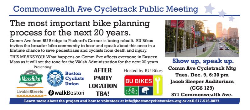
The Globe article I sent in the previous posting ( http://www.bostonglobe.com/metro/2015/03/24/victory-for-cyclists-commonwealth-avenue-install-protected-bike-lanes/Ew6SwQEhFxZB4XI3V5z80O/story.html ) says that there were about 30 public meetings to discuss the changes to Comm. Ave. between BU Bridge and Packard’s Corner.
None of those meetings were widely publicized to the Allston-Brighton community. They appear to have been just between BTD and the well-organized bicycle activists.
Who was speaking in those meetings for other users of Comm. Ave. -- pedestrians, drivers, business people?
Is this how the public process will be conducted for the rest of Comm. Ave. re-design process?
Much of this stretch of Commonwealth Avenue is a retail business district where truckers make pickups and deliveries. Double parking is a reality, whether we like it or not. Double parking in a [regular – E.W.] bike lane leaves two lanes open for travel. Bicyclists must merge out of the bike lane to overtake double-parked vehicles, but this is a normal maneuver which they must use in many other locations. Double parking with a separate bikeway [cycle track – E.W.], on the other hand, seriously reduces capacity of the street. Also, truckers must then carry goods across the bikeway. Often, as experience in other cities has shown, truckers park in the bikeway, and bicyclists then must divert onto the sidewalk or thread between parked cars into the street to continue their trips.
But most likely, truckers will NOT be parking in bikeways because cars parked in the parking lane will make truckers’ access to bikeways impossible. Instead, delivery trucks will have no choice but to park in the right-side car lane (one of two that will remain) — effectively narrowing Comm. Ave. to only one car lane (in each direction). Traffic jams that this will be causing will be paralyzing!
Even now, it is often difficult to get from Comm. Ave. onto BU Bridge or inbound Storrow Drive. Anything that will cause traffic delays on outbound Comm. Ave. in the BU Bridge area will have a negative ripple effect on traffic as far as St. Mary’s, and also along inbound Comm. Ave.
Additionally, the whole project to install cycle tracks from BU Bridge to Packard’s corner will result in a major loss of parking spaces. Here is a quote from another Globe article
( http://www.bostonglobe.com/metro/2015/03/25/city-plans-install-new-parking-meters-citywide-eliminate-towing-for-street-sweeping/yBlpa1LGs23tbPyvsbf2KM/story.html ):
Concerns about parking have also cropped up amid plans for the city to install protected bike lanes on a stretch of Commonwealth Avenue near Boston University from the Boston University Bridge to Packard’s Corner. The move is a victory for cyclists, who had been pushing for more bike protections along the corridor for years.
City officials say 73 of 177 parking spaces on the section of Commonwealth Avenue would be eliminated after the city installed the cycle track, repaved streets and sidewalks, and widened the platform for the Green Line.
Once all those changes take place between BU Bridge and Packard’s Corner, it’s only a matter of time before efforts to do the same from Packard’s Corner all the way to BC will be underway.
The Globe article I sent in the previous posting ( http://www.bostonglobe.com/metro/2015/03/24/victory-for-cyclists-commonwealth-avenue-install-protected-bike-lanes/Ew6SwQEhFxZB4XI3V5z80O/story.html ) says that there were about 30 public meetings to discuss the changes to Comm. Ave. between BU Bridge and Packard’s Corner.
None of those meetings were widely publicized to the Allston-Brighton community. They appear to have been just between BTD and the well-organized bicycle activists.
Who was speaking in those meetings for other users of Comm. Ave. -- pedestrians, drivers, business people?
Is this how the public process will be conducted for the rest of Comm. Ave. re-design process?

sarah correia
Mar 26, 2015, 7:33:37 AM3/26/15
to cleveland-cir...@googlegroups.com, AllstonBrighton2006, AB...@googlegroups.com
I went to a few of those meetings. So no they were not all conducted with the bicycle activists.
I am a pedestrian in Packards' Corner/Babcock (the next T stop headed east) as many are on the Brighton and the Brookline side across the street as people come and go to the T stop, supermarket, gym, EMS etc. It will be much safer for pedestrians with the cycle track than it is now.
In an area where there are many people on foot and on bikes everything can't be decided around automotive desires & businesses. Indeed many people going to the various businesses are walking, biking or arriving on the T in any case.
Sarah Perry-Correia
--
You received this message because you are subscribed to the Google Groups "Cleveland Circle Community" group.
To unsubscribe from this group and stop receiving emails from it, send an email to cleveland-circle-co...@googlegroups.com.
To post to this group, send email to cleveland-cir...@googlegroups.com.
Visit this group at http://groups.google.com/group/cleveland-circle-community.
For more options, visit https://groups.google.com/d/optout.

drh...@bu.edu
Mar 26, 2015, 8:59:38 AM3/26/15
to allstonbr...@googlegroups.com, cleveland-cir...@googlegroups.com, AllstonBr...@googlegroups.com, AB...@googlegroups.com
On Thursday, March 26, 2015 at 6:54:29 AM UTC-4, Eva Webster wrote:
But most likely, truckers will NOT be parking in bikeways because cars parked in the parking lane will make truckers’ access to bikeways impossible. Instead, delivery trucks will have no choice but to park in the right-side car lane (one of two that will remain) — effectively narrowing Comm. Ave. to only one car lane (in each direction). Traffic jams that this will be causing will be paralyzing!
Not sure what comm ave you travel down currently, but if a truck double parks, it narrows the road by one lane already. It doesn't matter if the truck parks in the bike lane, it still blocks the travel lane. Look at that truck, parked in the bike lane, but no car can use the right lane.

Motorcyclists and bicyclists squeeze into that half-a-right lane, but not cars; I've been in enough "merge to get around the truck" situations daily on Comm Ave to know that a double-parked truck always blocks the right lane, even if it uses the bike lane. The notion that there will be new traffic jams is laughable since the situation you describe is what already happens every day.
-David

Charles Denison
Mar 26, 2015, 12:25:51 PM3/26/15
to allstonbr...@googlegroups.com, cleveland-cir...@googlegroups.com, AllstonBr...@googlegroups.com, AB...@googlegroups.com
At the public meeting on Tuesday, the City mentioned that they are talking with all the business owners to see how they want the on-street parking regulated. This includes creating loading zones at certain times/days of the week. Double parking for unloading trucks is indeed a problem today, and designing loading zones is a good solution to that. I've also read about other cities encouraging businesses to do deliveries overnight as to lessen the impact on traffic during the day. That could be something worth discussing in Boston as well, since even if trucks end up double parking, traffic is very light during the overnight hours and wouldn't really be affected much.
Mr. Allen is right that delivery people will have to cross the protected bike lanes when making deliveries. On the other hand, cars and trucks will no longer have to cross the path of bicyclists when pulling into and out of on-street parking. Bicyclists and pedestrians crossing paths typically pose much less of a danger to each other than bicyclists and cars.
Charlie
On Thursday, March 26, 2015 at 6:54:29 AM UTC-4, Eva Webster wrote:
Eva Webster
Mar 26, 2015, 3:22:16 PM3/26/15
to cleveland-cir...@googlegroups.com, AllstonBrighton2006, AB...@googlegroups.com
Sarah - where/how were those Comm. Ave. redesign meetings advertised/publicized? How did you learn about them — please tell.
None of those meetings were posted on the main A-B neighborhood google groups, where many or most civically engaged folks get information from, or announced in the BAIA meetings.
Any changes to Comm. Ave. in the BU area, or farther in Allston, are the entire Allston-Brighton’s community business. We all use that road. Also, certain solutions may call for uniformity — so whatever happens near BU or farther in Allston has the potential of being continued/foisted on Comm. Ave. in Brighton (where many more people with cars live than in Allston due the difference in demographics).
As for the mildly chastising tone of your message, saying that planning for Comm. Ave. “can’t be decided around automotive desires & businesses” -- I think you missed the word “only”.
Comm. Ave. is a major arterial route, as well as commercial area east of Packard’s Corner -- and needless to say, drivers ARE principal users of Comm. Ave. and should not be marginalized. I’m not sure if pedestrians were well represented either, despite your random presence in this or that meeting -- with all due respect. Another constituency that may have been marginalized in that process, or at least not heard from, are people who care about street trees, and would like to see more of them., with proper room for growth.
The bottom line is that nobody is saying that pedestrians’ and bicyclists’ needs are not important — only that all stakeholders should have been well-represented in those meetings, and unless someone has evidence to the contrary, I think that has not been the case.
Eva
On 3/26/15 7:33 AM, "'sarah correia' via Cleveland Circle Community" <cleveland-cir...@googlegroups.com> wrote:
I went to a few of those meetings. So no they were not all conducted with the bicycle activists.
I am a pedestrian in Packards' Corner/Babcock (the next T stop headed east) as many are on the Brighton and the Brookline side across the street as people come and go to the T stop, supermarket, gym, EMS etc. It will be much safer for pedestrians with the cycle track than it is now.
In an area where there are many people on foot and on bikes everything can't be decided around automotive desires & businesses. Indeed many people going to the various businesses are walking, biking or arriving on the T in any case.
Sarah Perry-Correia
Consequences of creating cycle tracks on Comm. Ave.
Here is a perceptive point from a public comment letter written to BTD by a fair-minded bicycling instructor and consultant (
http://john-s-allen.com/pdfs/Allen_2014-10-11_comments.pdf ) on the subject of creating separated bikeways (cycle tracts) on Comm. Ave. from BU to Packard’s Corner:

Athena Laines
Mar 26, 2015, 5:00:06 PM3/26/15
to allstonbr...@googlegroups.com, cleveland-cir...@googlegroups.com, AB...@googlegroups.com
Eva - They have been advertised for weeks. They were included in John Laadt's weekly newsletter and it even included a flyer about the proposed cycle track seen here: Commonwealth Ave Phase 2A Improvement Project Update
Unfortunately I wasn't able to make it but I'm really excited for the cycle track. I rode a bike one summer from Allston to Kenmore Square where I had my job and gave up after that because I had a few near accidents that scared me away from it. I applaud this and any other efforts by the city to make bicycling safer for both bicyclists AND drivers. ----
To post to this group, send email to AllstonBr...@googlegroups.com
For more options, visit this group at http://groups.google.com/group/AllstonBrighton2006?hl=en
---
You received this message because you are subscribed to the Google Groups "AllstonBrighton2006" group.
To unsubscribe from this group and stop receiving emails from it, send an email to allstonbrighton...@googlegroups.com.
Eva Webster
Mar 26, 2015, 5:56:31 PM3/26/15
to cleveland-cir...@googlegroups.com, AllstonBrighton2006, AB...@googlegroups.com
On 3/26/15 8:59 AM, "drh...@bu.edu" <drh...@bu.edu> wrote:
Did you even read the cited Globe article before you responded to my message trying to prove me wrong?
The article says:
This means that Comm. Ave. will lose one full lane of traffic, and the remaining lanes will be made narrower. With the current three-lane outbound lane, delivery trucks CAN park in the right lane, and two full lanes are still available to traffic.
With only two car lanes remaining on the outbound side under the new plan, delivery trucks WILL be impacting traffic to a greater extent, because their presence will be leaving only one unobstructed car lane. This is just a fact — it can’t be changed by your perception.
Your derisive language “Not sure what comm ave you travel down currently” was totally uncalled for. Not to make it tit for tat, but I think you often make totally specious arguments, which I usually don’t bother to respond to because it’s too much time to explain the many things that you just omit in your thinking.
...double-parked truck always blocks the right lane, even if it uses the bike lane. The notion that there will be new traffic jams is laughable since the situation you describe is what already happens every day.
-David
Did you even read the cited Globe article before you responded to my message trying to prove me wrong?
The article says:
On the outbound side of the street, officials will remove one of the three lanes. On both sides of the street, two lanes will remain — one that is 10 feet wide, and another that is 11 feet wide.
This means that Comm. Ave. will lose one full lane of traffic, and the remaining lanes will be made narrower. With the current three-lane outbound lane, delivery trucks CAN park in the right lane, and two full lanes are still available to traffic.
With only two car lanes remaining on the outbound side under the new plan, delivery trucks WILL be impacting traffic to a greater extent, because their presence will be leaving only one unobstructed car lane. This is just a fact — it can’t be changed by your perception.
Your derisive language “Not sure what comm ave you travel down currently” was totally uncalled for. Not to make it tit for tat, but I think you often make totally specious arguments, which I usually don’t bother to respond to because it’s too much time to explain the many things that you just omit in your thinking.
On 3/26/15 8:59 AM, "drh...@bu.edu" <drh...@bu.edu> wrote:
On Thursday, March 26, 2015 at 6:54:29 AM UTC-4, Eva Webster wrote:
But most likely, truckers will NOT be parking in bikeways because cars parked in the parking lane will make truckers’ access to bikeways impossible. Instead, delivery trucks will have no choice but to park in the right-side car lane (one of two that will remain) — effectively narrowing Comm. Ave. to only one car lane (in each direction). Traffic jams that this will be causing will be paralyzing!
Not sure what comm ave you travel down currently, but if a truck double parks, it narrows the road by one lane already. It doesn't matter if the truck parks in the bike lane, it still blocks the travel lane. Look at that truck, parked in the bike lane, but no car can use the right lane.
Eva Webster
Mar 26, 2015, 6:09:16 PM3/26/15
to cleveland-cir...@googlegroups.com, AllstonBrighton2006, AB...@googlegroups.com
On 3/26/15 4:12 PM, "RonH" <stp...@hotmail.com> wrote:
Oh, but you make too much sense in this case, Ron ;-)
In a planning meeting for Comm. Ave. redesign for the stretch between Packard’s Corner and Warren Street that I attended in late November, there was a loud voice (maybe more than one) calling for eliminating those sensible, very useful and needed Comm. Ave. carriage lanes. The person who voiced that opinion tends to attend those meetings, and folks like you don’t — so take a guess who is more likely to be heard.
Posting on this issue is not something I enjoy — but I only do it to make folks in A-B realize that if they don’t make an effort to partake in the Comm. Ave. redesign planning process, they may find themselves surprised -- and if they are motorists, or in need of on-street parking — very likely dismayed by certain changes that could be affecting them deeply.
I’m not opposed to changes that can make things safer and better, but meetings cannot/should not be filled just with bicycling proponents -- that’s all. Different pairs of eyes and perspectives are needed to get a balanced plan that avoids hardship to any category of users of the road.
On 3/26/15 4:12 PM, "RonH" <stp...@hotmail.com> wrote:
Why would the same changes that will be made to the BU section of Comm Ave ever be considered in the are where there are already very protected quasi-bicycling lanes. Though they are not totally protected, these lanes are much, much safer than riding on Comm Ave near the BU bridge.
Oh, but you make too much sense in this case, Ron ;-)
In a planning meeting for Comm. Ave. redesign for the stretch between Packard’s Corner and Warren Street that I attended in late November, there was a loud voice (maybe more than one) calling for eliminating those sensible, very useful and needed Comm. Ave. carriage lanes. The person who voiced that opinion tends to attend those meetings, and folks like you don’t — so take a guess who is more likely to be heard.
Posting on this issue is not something I enjoy — but I only do it to make folks in A-B realize that if they don’t make an effort to partake in the Comm. Ave. redesign planning process, they may find themselves surprised -- and if they are motorists, or in need of on-street parking — very likely dismayed by certain changes that could be affecting them deeply.
I’m not opposed to changes that can make things safer and better, but meetings cannot/should not be filled just with bicycling proponents -- that’s all. Different pairs of eyes and perspectives are needed to get a balanced plan that avoids hardship to any category of users of the road.
On 3/26/15 4:12 PM, "RonH" <stp...@hotmail.com> wrote:
What is different about Comm Ave from Packard Corner to chestnut Hill Ave? Oh, yes. the carriage roads (if that is what the protected outer lanes are called). Why would the same changes that will be made to the BU section of Comm Ave ever be considered in the are where there are already very protected quasi-bicycling lanes. Though they are not totally protected, these lanes are much, much safer than riding on Comm Ave near the BU bridge. It is not through traffic, is much lighter traffic, and is generally much slower. Certainly that's where I rode when I lived on Comm Ave, and only the foolish ride on the main traffic lanesin that area.. Chestnut Hill Ave to BC is another story, however. But I bet it is vastly safer than the BU area.
RH
On Thursday, March 26, 2015 at 6:55:04 AM UTC-4, Eva wrote:

Laura Bethard
Mar 26, 2015, 6:46:34 PM3/26/15
to Charles Denison, allstonbr...@googlegroups.com, cleveland-cir...@googlegroups.com, AB...@googlegroups.com
As a sometimes driver, sometimes cyclist, I find the notion that protected bike lanes are objectionable because of illegal double-parking somewhat baffling, since the implication is that the cyclists are the unreasonable ones, instead of the illegal parkers. I'm glad to see the city is speaking with business owners to usefully resolve the issue at it's source.
Laura
From: Charles Denison <cden...@gmail.com>
To: allstonbr...@googlegroups.com
Cc: cleveland-cir...@googlegroups.com; AllstonBr...@googlegroups.com; AB...@googlegroups.com
Sent: Thursday, March 26, 2015 12:25 PM
Subject: [ABNNF] Re: Consequences of creating cycle tracks on Comm. Ave.
Laura
-Yf thou were a latyn tretise ich wolde putte thee in the vernacular.
From: Charles Denison <cden...@gmail.com>
To: allstonbr...@googlegroups.com
Cc: cleveland-cir...@googlegroups.com; AllstonBr...@googlegroups.com; AB...@googlegroups.com
Sent: Thursday, March 26, 2015 12:25 PM
Subject: [ABNNF] Re: Consequences of creating cycle tracks on Comm. Ave.
At the public meeting on Tuesday, the City mentioned that they are talking with all the business owners to see how they want the on-street parking regulated. This includes creating loading zones at certain times/days of the week. Double parking for unloading trucks is indeed a problem today, and designing loading zones is a good solution to that. I've also read about other cities encouraging businesses to do deliveries overnight as to lessen the impact on traffic during the day. That could be something worth discussing in Boston as well, since even if trucks end up double parking, traffic is very light during the overnight hours and wouldn't really be affected much.
Mr. Allen is right that delivery people will have to cross the protected bike lanes when making deliveries. On the other hand, cars and trucks will no longer have to cross the path of bicyclists when pulling into and out of on-street parking. Bicyclists and pedestrians crossing paths typically pose much less of a danger to each other than bicyclists and cars.
Charlie
On Thursday, March 26, 2015 at 6:54:29 AM UTC-4, Eva Webster wrote:
Here is a perceptive point from a public comment letter written to BTD by a fair-minded bicycling instructor and consultant ( http://john-s-allen.com/pdfs/ Allen_2014-10-11_comments.pdf ) on the subject of creating separated bikeways (cycle tracts) on Comm. Ave. from BU to Packard’s Corner:
Much of this stretch of Commonwealth Avenue is a retail business district where truckers make pickups and deliveries. Double parking is a reality, whether we like it or not. Double parking in a [regular – E.W.] bike lane leaves two lanes open for travel. Bicyclists must merge out of the bike lane to overtake double-parked vehicles, but this is a normal maneuver which they must use in many other locations. Double parking with a separate bikeway [cycle track – E.W.], on the other hand, seriously reduces capacity of the street. Also, truckers must then carry goods across the bikeway. Often, as experience in other cities has shown, truckers park in the bikeway, and bicyclists then must divert onto the sidewalk or thread between parked cars into the street to continue their trips.
But most likely, truckers will NOT be parking in bikeways because cars parked in the parking lane will make truckers’ access to bikeways impossible. Instead, delivery trucks will have no choice but to park in the right-side car lane (one of two that will remain) — effectively narrowing Comm. Ave. to only one car lane (in each direction). Traffic jams that this will be causing will be paralyzing!
Even now, it is often difficult to get from Comm. Ave. onto BU Bridge or inbound Storrow Drive. Anything that will cause traffic delays on outbound Comm. Ave. in the BU Bridge area will have a negative ripple effect on traffic as far as St. Mary’s, and also along inbound Comm. Ave.
Additionally, the whole project to install cycle tracks from BU Bridge to Packard’s corner will result in a major loss of parking spaces. Here is a quote from another Globe article
Concerns about parking have also cropped up amid plans for the city to install protected bike lanes on a stretch of Commonwealth Avenue near Boston University from the Boston University Bridge to Packard’s Corner. The move is a victory for cyclists, who had been pushing for more bike protections along the corridor for years.
City officials say 73 of 177 parking spaces on the section of Commonwealth Avenue would be eliminated after the city installed the cycle track, repaved streets and sidewalks, and widened the platform for the Green Line.
Once all those changes take place between BU Bridge and Packard’s Corner, it’s only a matter of time before efforts to do the same from Packard’s Corner all the way to BC will be underway.
The Globe article I sent in the previous posting ( http://www.bostonglobe.com/ metro/2015/03/24/victory-for- cyclists-commonwealth-avenue- install-protected-bike-lanes/ Ew6SwQEhFxZB4XI3V5z80O/story. html ) says that there were about 30 public meetings to discuss the changes to Comm. Ave. between BU Bridge and Packard’s Corner.
None of those meetings were widely publicized to the Allston-Brighton community. They appear to have been just between BTD and the well-organized bicycle activists.
Who was speaking in those meetings for other users of Comm. Ave. -- pedestrians, drivers, business people?
Is this how the public process will be conducted for the rest of Comm. Ave. re-design process?
--
You received this message because you are subscribed to the Google Groups "Allston/Brighton North Neighbors Forum" group.
To unsubscribe from this group and stop receiving emails from it, send an email to ABNNF+un...@googlegroups.com.
To post to this group, send email to AB...@googlegroups.com.
You received this message because you are subscribed to the Google Groups "Allston/Brighton North Neighbors Forum" group.
To unsubscribe from this group and stop receiving emails from it, send an email to ABNNF+un...@googlegroups.com.
To post to this group, send email to AB...@googlegroups.com.
drh...@bu.edu
Mar 26, 2015, 10:39:16 PM3/26/15
to allstonbr...@googlegroups.com, cleveland-cir...@googlegroups.com, AB...@googlegroups.com
Let’s clear up a misconception that seems to be present:
The reduction from 3 lanes to 2 lanes of traffic is unrelated to the creation of separated bike lanes (aka cycle tracks). Anyone who presents it otherwise is misled.
If one goes back to the plans the city presented in 2012, there were two outbound lanes and the bike lanes were positioned between the parking and traffic, just as they are today. For reference, I’ve attached these plans which clearly show two lanes on the outbound side, with a left turn lane showing up at intersections; this is the same number of lanes as the current proposed plan. The loss of a lane has nothing to do with the creation of separated bike lanes.
For the sake of people who don’t travel outbound side today, I’ll give a brief summary:
Current 3 lanes:
- Right Lane: through traffic, but there’s a lot of people trying to take right turns, dropping people off at StuVi or Agannis, taking right turns depending on the intersection
- Left Lane: sometimes through, but is a left turn lane at almost every intersection
- Center Lane: the lane you can stick in and generally get through traffic without issue. The only true through lane
The new situation with two lanes:
Right Lane: the same
Left Lane: equivalent to the current Center lane
Intersections: a third lane shows up that is a turn lane
For those of us going from the BU Bridge to A/B, who primarily go through, very little is changed. Hang out in your lane, people on your right will be making turns, dropping off passengers, unloading cargo, etc. On your left, a left turn lane will show up and people will take left turns.
The current design has two through lanes (right and center), the new design has two through lanes. Very little change
I repeat, separated bike lanes are completely unrelated to the reduction in travel lanes; the number of through lanes remains virtually unchanged; the removed lane primarily serves as a left turn lane and the proposed plan has left turn lanes at intersections.
Adding the cycle track moves the bicycles to the other side of the parking and, in my opinion, makes driving less stressful (lower chance of accidentally hitting a cyclist) and parking on Comm Ave simpler as one no longer has to worry about crossing/blocking a lane of moving cyclists while trying to parallel park.
To answer another question asked, many street trees are being added. As can be seen in the attached plan from 2012, all the dark green spots are proposed trees. Some of the proposed trees appear to be places where a tree would be removed and replaced, but overall, there is a significant increase in the number of street trees along this section of Comm Ave.
Re: considering pedestrians, a member of Walk Boston (celebrating 25 years of advocating for pedestrians in Boston) said at the meeting Tuesday night that he feels the changes made were major improvements to Comm Ave for pedestrians. The changes introduced include raised crosswalks and deflection islands, both of which make both the cyclists and pedestrians more visible to cars. There are also islands for pedestrians that fall in line with the parked cars; This shortens the distance for a pedestrian to cross Commonwealth by ~15 feet.
I’m not going to claim it is perfect. Many, many, many people would love to be able to legally cross Comm Ave at Alcorn Street/Naples Road. We all see pedestrians illegally crossing every day without a crosswalk, lugging large bags of groceries. The status quo is clearly not acceptable. You can find many people trying to push the city on getting a crosswalk in the 5-6 months before this project goes out for bids.
-David

Andrew Fischer
Mar 26, 2015, 11:39:35 PM3/26/15
to cleveland-cir...@googlegroups.com, Charles Denison, allstonbr...@googlegroups.com, AB...@googlegroups.com
Blaming the cyclist for the double parked cars in the bike lane is like blaming the woman who got raped because she dressed seductively.
You received this message because you are subscribed to the Google Groups "Cleveland Circle Community" group.
To unsubscribe from this group and stop receiving emails from it, send an email tocleveland-circle-co...@googlegroups.com.
To post to this group, send email to cleveland-cir...@googlegroups.com.
sarah correia
Mar 27, 2015, 6:40:44 AM3/27/15
to cleveland-cir...@googlegroups.com, AllstonBrighton2006, AB...@googlegroups.com
Hi Eva
As a later poster said the meetings were mentioned in John Laadt's newsletters. I myself heard about them at my gym and saw notices at various T stops.
Sarah Correia
Eva Webster
Mar 27, 2015, 7:52:33 AM3/27/15
to AllstonBrighton2006, AB...@googlegroups.com, Cleveland-Cir...@googlegroups.com
Thanks to Althea and Sarah for pointing out that announcements of Comm. Ave. redesign meetings were in John Laadt’s weekly newsletters. Those newsletters have a lot of content, and sometimes I’m just too pressed for time to read through the entire long list of announcements.
So I was aware of only two Comm. Ave. meetings – on Nov. 17 (preliminary discussion about the stretch from Packard’s Corner to Warren Street), which I attended -- and the second one just last Tuesday, March 24 (about the stretch from BU Bridge to Packard’s Corner) which I could not attend — but I understand it was basically just the city announcing its approval of cycling tracks along that stretch of Comm. Ave.
But that plan doesn’t seem to be 100% final yet, since the city is still in conversations with business owners affected by loss of parking. The business folks were probably not present in the meetings that led to the plan, and must be in shock now that the city wants to eliminate over 40% of parking spaces that their businesses rely on.
John Laadt has been diligently informing us about all kinds of public meetings, so there may have been perhaps another Comm. Ave. meeting announcement that I missed – I don’t know. But the Globe reported that there were 30 meetings! Some were internal, I’m sure — but many others were organized by the bicyclist lobby, and would not be necessarily well publicized by them for strategic reasons.
For example, AB2006 has Charlie D. and Matt D. as members -- and both are very active within the bicycle lobby — and yet neither thought of publicizing here any of those Comm. Ave. meetings that were organized by bicycling activists (like the one below).
Also, it turns out there is a private google group (comm...@googlegroups.com), to which Matt posted an interesting write-up yesterday (it’s pasted farther down), but he didn’t share it on A-B neighborhood google groups -- though I’m sure he knows it would be interesting to most of us. So much for inclusiveness and neighborly information-sharing. But I understand – I really do. He and Charlie don’t want other Comm. Ave. stakeholders to get engaged and start defending their interests too. Just bicycle politics!
But I’m very impressed with the level of organization that the bicycle lobby has been displaying. Vis-à-vis drivers, they’re like David against Goliath (Boston area motorist don’t seem to be organized at all).
And the cyclist movement is active nation-wide. Take a look at this amazing (real) message from a NYC cyclist activist to one in Cambridge, MA, that I found on the internet (but it’s not from the comm-ave google group that Matt uses):
Well, the guy doesn’t seem to understand that legally traffic accidents are not easy to prosecute because you can’t prove the offender’s intent to harm the victim (and often the victim may be at fault too). But still, as an activist myself, I do admire in others a strong commitment to a cause.
I’m also thinking — gee, if they only applied the same amount of passion and energy to toppling Citizens United, they could change the country and the world!
Eva
P.S. Below is Matt’s detailed description of BTD’s plan for Comm. Ave. from BU Bridge to Packard’s Corner, that he didn’t want us to see. Why, Matt, why? Isn’t it our Comm. Ave. too?
------ Forwarded Message
So I was aware of only two Comm. Ave. meetings – on Nov. 17 (preliminary discussion about the stretch from Packard’s Corner to Warren Street), which I attended -- and the second one just last Tuesday, March 24 (about the stretch from BU Bridge to Packard’s Corner) which I could not attend — but I understand it was basically just the city announcing its approval of cycling tracks along that stretch of Comm. Ave.
But that plan doesn’t seem to be 100% final yet, since the city is still in conversations with business owners affected by loss of parking. The business folks were probably not present in the meetings that led to the plan, and must be in shock now that the city wants to eliminate over 40% of parking spaces that their businesses rely on.
John Laadt has been diligently informing us about all kinds of public meetings, so there may have been perhaps another Comm. Ave. meeting announcement that I missed – I don’t know. But the Globe reported that there were 30 meetings! Some were internal, I’m sure — but many others were organized by the bicyclist lobby, and would not be necessarily well publicized by them for strategic reasons.
For example, AB2006 has Charlie D. and Matt D. as members -- and both are very active within the bicycle lobby — and yet neither thought of publicizing here any of those Comm. Ave. meetings that were organized by bicycling activists (like the one below).
Also, it turns out there is a private google group (comm...@googlegroups.com), to which Matt posted an interesting write-up yesterday (it’s pasted farther down), but he didn’t share it on A-B neighborhood google groups -- though I’m sure he knows it would be interesting to most of us. So much for inclusiveness and neighborly information-sharing. But I understand – I really do. He and Charlie don’t want other Comm. Ave. stakeholders to get engaged and start defending their interests too. Just bicycle politics!
But I’m very impressed with the level of organization that the bicycle lobby has been displaying. Vis-à-vis drivers, they’re like David against Goliath (Boston area motorist don’t seem to be organized at all).
And the cyclist movement is active nation-wide. Take a look at this amazing (real) message from a NYC cyclist activist to one in Cambridge, MA, that I found on the internet (but it’s not from the comm-ave google group that Matt uses):
From:
Date: November 19, 2014 at 8:00:23 PM EST
To:
Subject: Critical Mission for someone in Boston
Hey [-----]:
Wondering if you might have anyone in Cambridge good for this last minute, high-impact advocacy assignment:
Tomorrow at 4pm Manhattan District Attorney Cy Vance is going to be doing a talk at Harvard Law. When he first ran for office in 2009 Vance promised to aggressively prosecute drivers who kill pedestrians and cyclists on NYC streets. Sadly, he has not done that at all. In fact, his office has, for all intents and purposes, de facto legalized killing people on the streets of Manhattan when the weapon is a motor vehicle and the driver is sober and does not flee the scene.
A few of us are testing out a strategy of confronting Vance in public with (respectful) questions on this issue and, when possible, getting that Q&A on film. I got him at Fordham Law School on Friday and, I must say, it really seemed to have an impact on him.
I am wondering if you can think of anyone who might be available to show up to Harvard Law at 4pm and find a way to ask Vance a simple question along the lines of: "Why do you choose not to prosecute reckless motorists who kill pedestrians and cyclists on the streets of Manhattan?" We could also use a camera person to record this exchange. It does not have to be professional. I can coach the person asking the question on some more specifics. I can even offer a decent stipend for this.
Know anyone?
Well, the guy doesn’t seem to understand that legally traffic accidents are not easy to prosecute because you can’t prove the offender’s intent to harm the victim (and often the victim may be at fault too). But still, as an activist myself, I do admire in others a strong commitment to a cause.
I’m also thinking — gee, if they only applied the same amount of passion and energy to toppling Citizens United, they could change the country and the world!
Eva
P.S. Below is Matt’s detailed description of BTD’s plan for Comm. Ave. from BU Bridge to Packard’s Corner, that he didn’t want us to see. Why, Matt, why? Isn’t it our Comm. Ave. too?
------ Forwarded Message
From: Matthew Danish <matthew....@gmail.com>
Date: March 26, 2015 6:30:43 PM EDT
To: comm...@googlegroups.com
Subject: [comm-ave] Comm Ave update
Reply-To: matthew....@gmail.com
Hi,
As many of you know, some exciting stuff happened this week:
http://www.wbur.org/2015/03/25/walsh-transportation-initiatives
Thank you to everyone who showed up, and to everyone who has helped along the way. It's not over yet, however.
I thought it might be useful to summarize things:
- BTD presented a revised design for the reconstruction of Comm Ave between Packard's Corner and the BU Bridge, including
- rationalization of travel lanes into a configuration with 2 lanes outbound and 2 lanes inbound
- improved Green Line platforms for ADA accessibility
- separated bike lanes with (mostly) protected intersections at the cross-streets
- pedestrian crosswalk curb extensions that complement the protected intersections
- protected bus stops on floating, accessible islands
- raised crosswalks along Pleasant, Agganis, and Amory
- an announcement about a working group for transit signal priority
- a claim that the 57 bus receives transit signal priority at Babcock Street, under a currently running experiment
- replacement of about half the trees in the corridor with new trees, and also additional trees to be planted
- conversion of the fifth lane of travel into a dedicated left-turn lane on the outbound side
- the expansion of the roadway to create a dedicated left-turn lane on the inbound side for Agganis Way
- improvement of many, many sight-lines, creating visibility between drivers, walkers and riders of bikes.
The two new Green Line stations will replace the four existing ones
- One station will be built between Babcock and Pleasant Street
- Another station will be built between St Paul and Amory Street
- All major intersections in the scope of the project will have access to a station, one way or another.
The separated bike lane will replace the existing bike lane and will shift to the correct side of the parked cars
- There will be a curb separating cars from bikes, in a buffer zone that is about 3' wide
- Bikes will be separated from bus traffic entirely, as well
- The bike lane itself will be about 6.5' wide except when it goes behind a bus stop, minimum of 5' wide
- The bike lane will mostly be at street level except where it needs to go around a bus stop, where it will rise up to the sidewalk level
- The intersections will use protective islands that force turning motorists to slow down and look carefully before crossing the bike lane
The crosswalks will extend across the bike lane and there will be expansive safe areas for people waiting to cross the street
- The curb extensions shorten the distance that people need to walk in order to cross the street
- The raised crosswalks will cause the street to rise up to the sidewalk level instead of requiring ramps for pedestrians. That slows down the turning cars as well.
The new configuration of the motorway will be a standard 2 lanes by 2 lanes, with modern left-turn lanes at St Paul, Babcock, and Agganis Way.
- The lane sizes will be: 8' parking, 11' travel, 10' travel, (10' left turn lane), 10' travel, 11' travel, 8' parking.
In order to widen the MBTA reservation, create the left-turn lane at Agganis Way, and improve sight-lines, the city reported that it had to cut 73 parking spaces.
bike-lane-diagram.png <https://docs.google.com/file/d/0BwkU70l9krTldVBSSWJjRTdNcm8/edit?usp=drive_web>
The revised design is a great step forward, and along with the Vision Zero announcement, represents a major change in philosophy coming from the very top, which I am grateful to hear.
There are some outstanding matters to try and advocate around:
I will try and obtain an electronic copy of the design as soon as I can.
- The city has not included a crosswalk at Alcorn Street (or Naples Rd).
- This was brought up many times at the meeting.
- The newly installed left-turn lane at Agganis Way will cut deeply into the sidewalk, narrowing the sidewalk in front of Sullivan Tire to about the minimum that will be seen in the project.
- I believe that they said it would be about 9' wide, but I will try to check that out.
- The inbound side of the Babcock Street intersection will not have a protected intersection design because they felt it would not be compatible with sidewalk cafes.
- Several of us asked them to look into it again.
- The connection with the Phase 2B project on the BU Bridge was shown as that awful, tiny bike lane sandwiched between four lanes of cars, the one that we saw at the meeting last month.
- They claim, now, however, that this design is in flux and they will seek to extend the protection as far as they can.
A lot of rumors and bad reporting has been flying around about the project over the past couple of days, I've been thinking that a little myth-busting might be helpful, in case you need a talking point:
- Myth: It's a $17 million bike lane!!
- Fact: It's a $17 million street reconstruction project that has been in the works for decades. Rearranging the bike lanes to be separated is a relatively small and recent part of that.
- Myth: The bike lane is removing 73 parking spaces!!
- Fact: A large proportion of the parking spaces must be removed because of
- The MBTA platform ADA accessibility fixes
- The creation of a brand new left-turn lane at Agganis Way
- The improvement of safety by clearing many sight-lines for clear visibility between users of the street
- Vastly improved crosswalks at intersections
- Myth: A car lane is being converted into a bike lane!!
- Fact: Not at all. There are currently 5 unspecified general purpose travel lanes. One of them is being converted into a dedicated left-turn lane. The bike lane space is largely coming about by shifting the existing bike lanes outward, and then careful threading between the parked cars and the sidewalk. Some sidewalk space is being lost, but they have attempted to maintain 10-15 feet clear at most points.
- Extra fact: Not only are all car lanes being preserved, the city is actually expanding the motorway space by creating a brand new left-turn lane at Agganis Way. For better or for worse.
- Myth: Bike riders will be forced to use the separated facility!!
- Fact: No, by law, bike riders may use any non-limited-access public way. However, I believe that the separated bike lane will be so attractive that only a rare few riders will not want to use it.
- Myth: Cars are the most dominant mode on Comm Ave!!
- Fact: No, public transit is the most dominant mode of travel on Comm Ave, accounting for at least 40,000 to 45,000 trips a day. The combined city & MBTA projects should vastly improve the Green Line and 57 bus travel experience on this segment of Comm Ave.
Alright, I hope that helps. Let me know if you have any other questions,
Matthew

Becky Ward
Mar 27, 2015, 9:09:22 AM3/27/15
to AB...@googlegroups.com, cleveland-cir...@googlegroups.com, AllstonBr...@googlegroups.com
Eva, I have watched your activity on this forum for several months and I do not think you should be chastising other posters for "derisive" tone, "chastising" tone, or responding to a comment without reading it carefully. Please be more polite, or many of us will find it difficult to listen to your points.
Charles Denison
Mar 27, 2015, 9:35:22 AM3/27/15
to allstonbr...@googlegroups.com, AllstonBr...@googlegroups.com, AB...@googlegroups.com, Cleveland-Cir...@googlegroups.com
I actually was a bit confused by the "30 meetings" quote in the newspaper. When I heard the 30 meetings mentioned at the public meeting Tuesday, it sounded like they were between the City and their consultants and between the various constituents (BU, businesses, advocates, etc). There have only been 3 public meetings to my knowledge, one in 2012 and then two within the last year or so.
Regarding the businesses, there were two folks who spoke at the public meeting Tuesday who had been walking up and down Comm Ave and talking to the businesses about the proposed plan. They said all of them were excited about the protected bike lane, and some of them did have minor concerns about parking loss, but overall were very supportive of the plan.
I don't appreciate the claim that I am part of some bicycle lobby intent on making live difficult for drivers. That couldn't be further from the truth. The whole point of LivableStreets Alliance is to promote and strive towards streets that work better for everyone, and that includes drivers. Comm Ave is not a zero sum game, and I don't see any particular group as being on the losing end of this plan. Everyone should see their lives improved with this plan.
Charlie
Message has been deleted
Message has been deleted
Message has been deleted

Marina Rodriguez
Apr 14, 2015, 6:25:26 PM4/14/15
to allstonbr...@googlegroups.com, AB...@googlegroups.com, cleveland-cir...@googlegroups.com
Hello everyone,
I would like to switch it up a bit and ask anyone here if they can point me in the direction of the person or people i can contact regarding street sweeping in my area, we have it done every Wed. up until Nov. 1st. Its so useless and annoying, It's so hard to find parking on my street when i get out of work late at night, there are people from comm ave and surrounding areas that park on my street during the day and leave they're cars there until the next day, meanwhile, i stuck trying to find a parking spot, how can i try and either stop the street cleaning or have it just done once a month on each side. I can beleive in this day and age, we still "need" the sweepers?
I would appreciate any feed back or suggestions on who to contact.
Thank you
On Friday, March 27, 2015 8:45 PM, Bat_cave <Bat_...@comcast.net> wrote:
On 3/27/15 7:22 PM, "mrs_clifford" <mrs_cl...@hotmail.com> wrote:
Very funny that Mrs Clifford thinks hers is a classy post. Why do people need to get this in their mailboxes?
I learn new things from other posters but have never seen anything informative or interesting from either Mrs Clifford or Ms. Ward. Not a big loss, I daresay.
> I've actually set a filter so that mail Eva sends goes to my junk folder.
> Sadly it doesn't quite work too well so im giving up. I've been on this
> newsgroup list for some time, but I think its time to give up! Be well all!
Very funny that Mrs Clifford thinks hers is a classy post. Why do people need to get this in their mailboxes?
I learn new things from other posters but have never seen anything informative or interesting from either Mrs Clifford or Ms. Ward. Not a big loss, I daresay.
--
--
To post to this group, send email to AllstonBr...@googlegroups.com
For more options, visit this group at http://groups.google.com/group/AllstonBrighton2006?hl=en
---
--
To post to this group, send email to AllstonBr...@googlegroups.com
For more options, visit this group at http://groups.google.com/group/AllstonBrighton2006?hl=en
---
You received this message because you are subscribed to the Google Groups "AllstonBrighton2006" group.
To unsubscribe from this group and stop receiving emails from it, send an email to allstonbrighton...@googlegroups.com.
To unsubscribe from this group and stop receiving emails from it, send an email to allstonbrighton...@googlegroups.com.

Mike D
Apr 14, 2015, 7:08:26 PM4/14/15
to allstonbr...@googlegroups.com
Marina, John Laadt is our local contact with the mayor's office. Is your street resident parking?
I respectfully disagree that street cleaning is useless. Not sure which street you are on, but streets in A/B are cleaner after street sweeping and cars that are parked for weeks at a time and accumulate debris are towed. Those of us who are street parkers (myself included), have the option of paying for an off street spot if we want more convenience.
I respectfully disagree that street cleaning is useless. Not sure which street you are on, but streets in A/B are cleaner after street sweeping and cars that are parked for weeks at a time and accumulate debris are towed. Those of us who are street parkers (myself included), have the option of paying for an off street spot if we want more convenience.
Marina Rodriguez
Apr 15, 2015, 4:07:34 PM4/15/15
to allstonbr...@googlegroups.com
Yes Mike my street is resident parking, and it's a hassle, i'm just thinking if street cleaning was scheduled twice a month, it would ease the parking situation, especially when you have other residents having difficulty parking on they're street, they end up parking on my street leaving us with no where to park, i see people coming on a Tuesday leaving their cars on my street knowing they will not find parking.
Thank you Mike for the contact, hopefully we can maybe ease the stress on people
Thanks again!
Marina
Marina, John Laadt is our local contact with the mayor's office. Is your street resident parking?
I respectfully disagree that street cleaning is useless. Not sure which street you are on, but streets in A/B are cleaner after street sweeping and cars that are parked for weeks at a time and accumulate debris are towed. Those of us who are street parkers (myself included), have the option of paying for an off street spot if we want more convenience.
I respectfully disagree that street cleaning is useless. Not sure which street you are on, but streets in A/B are cleaner after street sweeping and cars that are parked for weeks at a time and accumulate debris are towed. Those of us who are street parkers (myself included), have the option of paying for an off street spot if we want more convenience.
--
To post to this group, send email to AllstonBr...@googlegroups.com
For more options, visit this group at http://groups.google.com/group/AllstonBrighton2006?hl=en
---
You received this message because you are subscribed to the Google Groups "AllstonBrighton2006" group.
To unsubscribe from this group and stop receiving emails from it, send an email to allstonbrighton2006+unsub...@googlegroups.com.
Reply all
Reply to author
Forward
0 new messages