Tools not working correctly.

Darell Arocho

whiteboxgeo
Hi Darell,
I'm sorry, while I'm the developer of WhiteboxTools, I actually don't ever really use ArcGIS. I tend to interact with WBT through either the WhiteboxTools Runner (see user manual), QGIS, or Python. Perhaps someone else on the list serve who uses ArcGIS more regularly, or Dr. Wu, who maintains the ArcGIS front-end, may be able to chime in here.
Regards,
John Lindsay
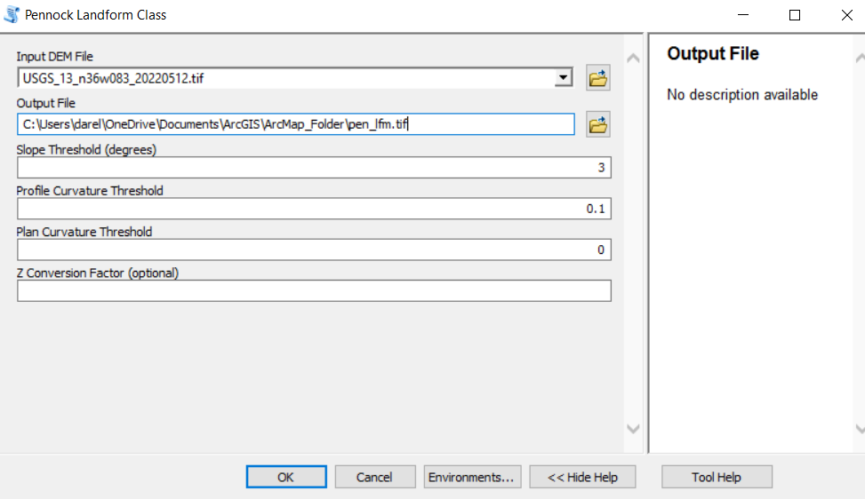
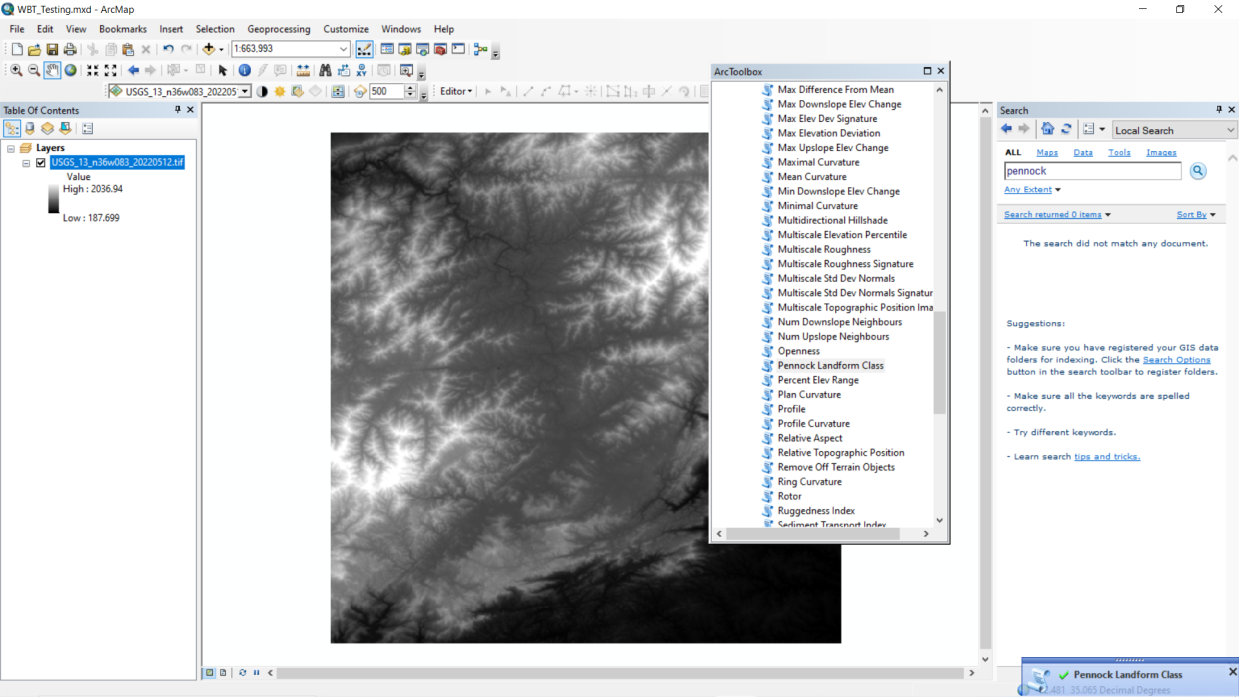
Hi! I'm using ArcMap 10.8 and I just installed the WhiteBox Tools following this tutorial: https://www.youtube.com/watch?v=3pFZ6u9cYoQ&t=379s&ab_channel=WiseGIS and the tools appear in ArcMap and I can open them, but when I try to use them it "performs" the action that it needs to do but no output is given. For example, I'm trying to run the Pennock Landform Class tool on a DEM and I pass the DEM as the Input value and for the Output Value I put the location (C:\Users\darel\OneDrive\Documents\ArcGIS\ArcMap_Folder\pen_lfm.tif) but when I run it no file named "pen_lfm.tif" appears in the folder. --
You received this message because you are subscribed to the Google Groups "WhiteboxTools" group.
To unsubscribe from this group and stop receiving emails from it, send an email to whiteboxtool...@googlegroups.com.
To view this discussion on the web visit https://groups.google.com/d/msgid/whiteboxtools/d4df4ba9-074c-46b3-820d-368b31bc1183n%40googlegroups.com.
For more options, visit https://groups.google.com/d/optout.

Qiusheng Wu
To view this discussion on the web visit https://groups.google.com/d/msgid/whiteboxtools/e6115397-f270-f8aa-ed59-79fe9df6d601%40gmail.com.
whiteboxgeo
No, Qiusheng, the PennockLandformClassification tool is in the Whitebox Open-Core. You don't need a license.
Regards,
John
whiteboxgeo
I think this must be an issue with the ArcGIS front-end because I
can confirm that running the tool directly from WBT results in an
output image being created.
Qiusheng Wu
Darell Arocho
whiteboxgeo
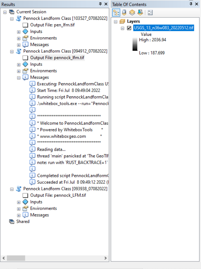
But are there any outputs while the tool runs? There should be, for example, notices about progress and elapsed time, etc. Everyone of the tools does this. I would suggest that you try running the tool in the WhiteboxTools Runner and see if it produces your output. If it does, then we can confirm that the issue lies in the ArcGIS frontend instead. The Runner is simply a Python script that is distributed with WhiteboxTools and lives inside your WBT folder. Simply cd to your WBT folder in your terminal and type: python3 wb_runner.py. You should then see a simple Python GUI open up and there will be a listing of all of the available tool in WBT on the lefthand side. You can find the Pennock tool and run it from there.
Regards,
John Lindsay
To view this discussion on the web visit https://groups.google.com/d/msgid/whiteboxtools/ea26cbdb-2d24-4e6a-9cb1-e2a3c2203821n%40googlegroups.com.
Qiusheng Wu
To view this discussion on the web visit https://groups.google.com/d/msgid/whiteboxtools/c255f8e1-d8c6-6324-bb79-361a72279733%40gmail.com.
Darell Arocho
Qiusheng Wu
To view this discussion on the web visit https://groups.google.com/d/msgid/whiteboxtools/963755ee-074d-4ada-bed3-a90a1bfdcd14n%40googlegroups.com.
Darell Arocho
Darell Arocho
whiteboxgeo
Well there's your problem. You're using a GeoTIFF that uses floating-point predictors. You simply need to convert your input DEM GeoTIFF, perhaps using GDAL, so that it uses an alternative compression scheme, or not compression at all.
John
To view this discussion on the web visit https://groups.google.com/d/msgid/whiteboxtools/402f962c-219e-4636-8bb2-6900d97584edn%40googlegroups.com.
Darell Arocho

Whitebox Geospatial Inc
So, there's no need to upload your file any longer. We've figured out that you simply need to modify your input DEM. If I can give you a bit of advice about running the Pennock classification tool as well, it's highly sensitive to DEM noise because it uses slope and surface curvatures (profile and plan). And so it is often the case that the output classification will greatly benefit from a bit of smoothing first, particularly if you are dealing with a fine resolution lidar DEM, or an ifSAR DEM. For this, I would recommend using the FeaturePreservingSmoothing tool in WBT: https://www.whiteboxgeo.com/manual/wbt_book/available_tools/geomorphometric_analysis.html#FeaturePreservingSmoothing
Regards,
John
To view this discussion on the web visit https://groups.google.com/d/msgid/whiteboxtools/2eecbf4a-1acb-49a1-afd8-7bd0a13f1febn%40googlegroups.com.
Whitebox Geospatial Inc
I shouldn't think it's the only way you can modify a GeoTIFF's compression format. It's the way that I use, and I think a good chuck of the geospatial community use GDAL for this type of thing. But I'm sure that ArcGIS has something in place, some setting, for doing a similar thing. Again, I don't use Arc regularly.
Regards,
John
To view this discussion on the web visit https://groups.google.com/d/msgid/whiteboxtools/fe9b283f-12b7-437b-801c-cbbed8716efcn%40googlegroups.com.
Darell Arocho
Qiusheng Wu
To view this discussion on the web visit https://groups.google.com/d/msgid/whiteboxtools/cc29fa83-d802-425a-917c-4fbde9d62e57n%40googlegroups.com.