new render style (and routing) for enduro bike

cricri du lauragais
Hello
I created a render style for a utilization in the tracks and paths with a motorcycle (or a car).
the tracks are classified by "carrossability" in 2 categories:
- brown tracks = easy
- green tracks = unknown or difficult with a big bike
they are subdivided into continuous line and dotted line in each color according to tag tracktype, surface, smoothness, mtb:scale.
the paths are in thin dotted black with 4 levels of difficulty for light motorcycles like enduro:
- green dot = easy
- orange dot = technique
- red dot = difficult (push the bike)
- black dot = impossible with a motorcycle
these levels are extrapolated from mtb tags and sac_scale
all hiking routes are displayed according to the French usage (red/white for iwn and nwn networks, red/orange for rwn, yellow for lwn),
mtb routes are in blue.
Roads use French color like IGN maps
minimum text for better visibility
The style menu is simplified, you can hide all the hiking/mtb_route in one go.
I also added options in the style menus for use with a large screen emulator
another to use with a background map like Microsoft Earth.
comments in the xml file are in French (sorry)
I created this style to use in enduro motorcycle and also with my other bikes.
I use it with 3 routings in 3 profiles :
- one for big bike that only takes the easy brown tracks (and roads of course J )
- one for midrange motorcycle that takes the brown and green tracks
- the latest for light enduro bikes that also take single-track paths
the 3 routings comply with motorized, private and other prohibitions.
each of the routings has its preferences and penalties depending on the difficulty of the paths.


Werner
Thanks
cricri
--
You received this message because you are subscribed to the Google Groups "OsmAnd" group.
To unsubscribe from this group and stop receiving emails from it, send an email to osmand+un...@googlegroups.com.
To view this discussion on the web visit https://groups.google.com/d/msgid/osmand/d1c3618d-5e25-4880-970a-b7dd0281f243o%40googlegroups.com.
cricri du lauragais
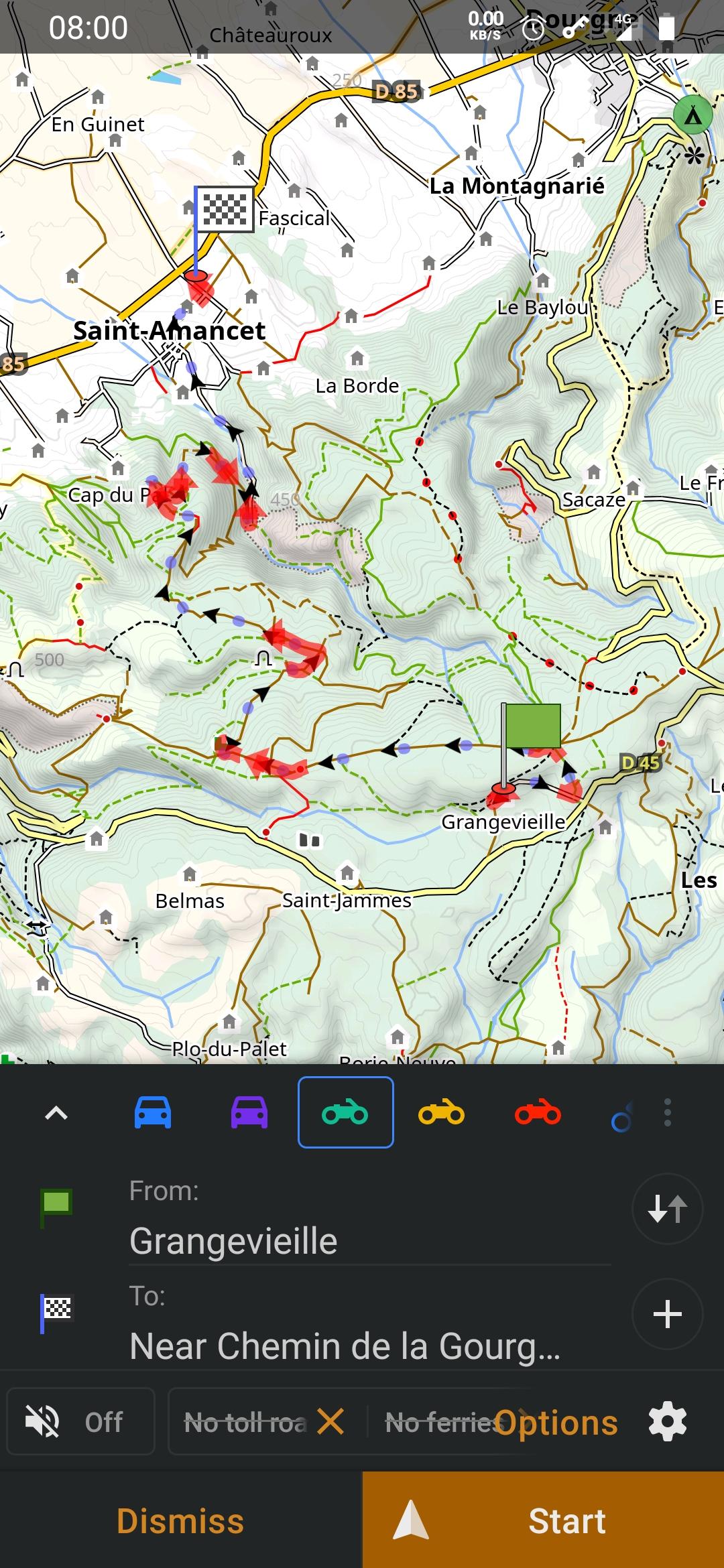
after putting the files in their folders"enduro" style is available in"configure map""map rendering"Press 'map style'and choose "enduro" from the listthen do "apply"and go back to the displayIn the menu "Details" of style there are 3 choices:
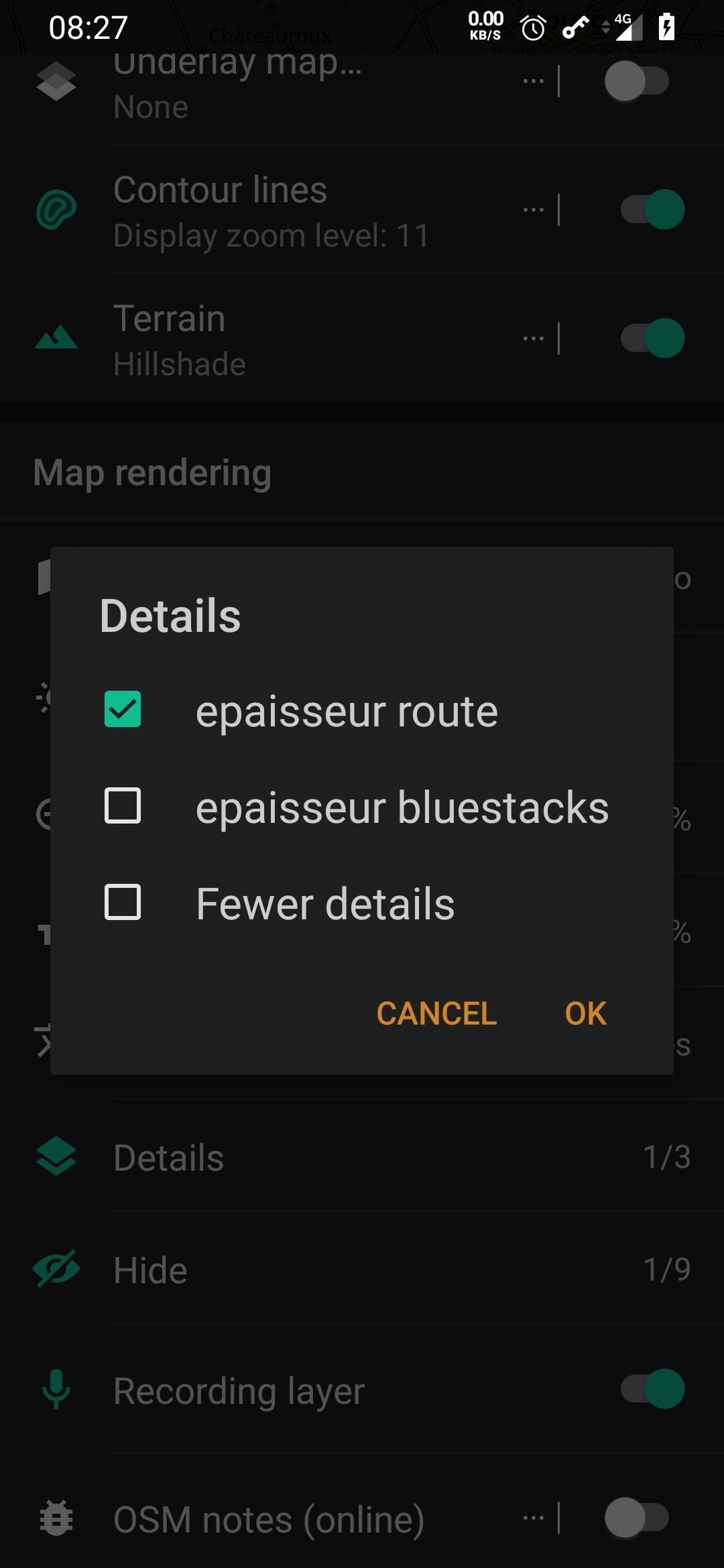
- "epaisseur route" = contour of thinner roads at distant zoom levels, try it- "epaisseur bluestacks" = all lines are thinner in uns than the level 15 zoom, the display is better on the big screen of the computer.- "Fewer details" = only displays brown paths and roads.in the "hide" style menu there are 3 new choices at the top of the list, the others are usual:
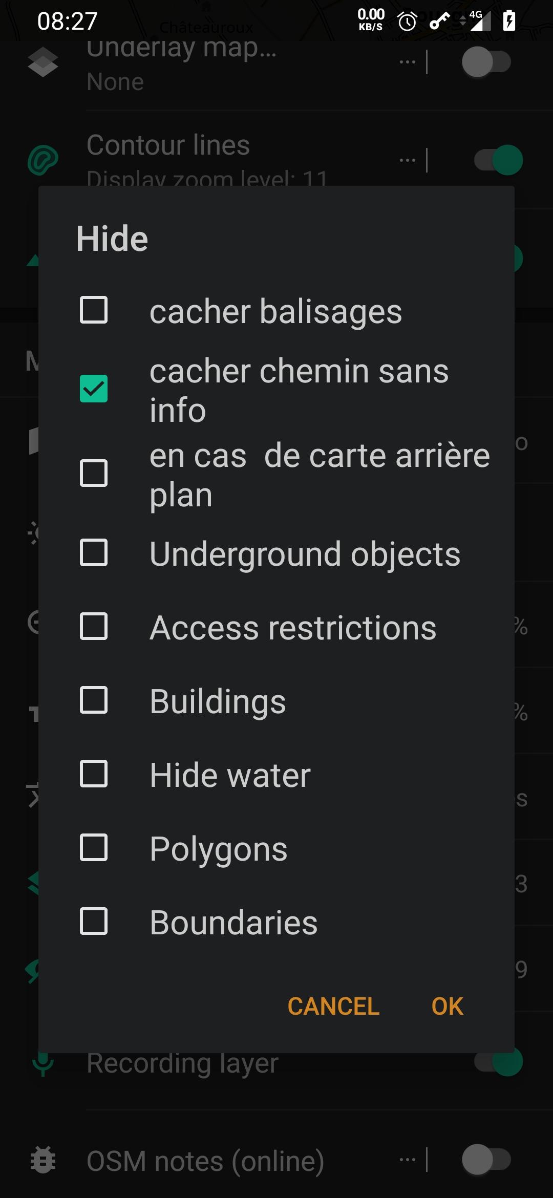
- "cacher balisages" = hide hiking and mountain biking routes- "cacher chemins sans info" = hide the clear green dotted lines that are on the paths without information in OSM (good to check the way but a little flashy)- "en cas de carte arrière plan" = check it if you use Microsoft earth in the background, the paths and the texts read better, try it :)To choose a particular routing, you need to:"configure profile""Navigation settings""Type navigation"and thread the list to the end

and choose one of the 3 "trail"- enduro.xml for enduro motorcycle- gros_trail.xml for large heavy motorcycle or SUV- petit_trail.xml for dual sport motorcycle (trail bike)then my profiles are set like this:- avoid motorways and toll
- prefer unpaved roads

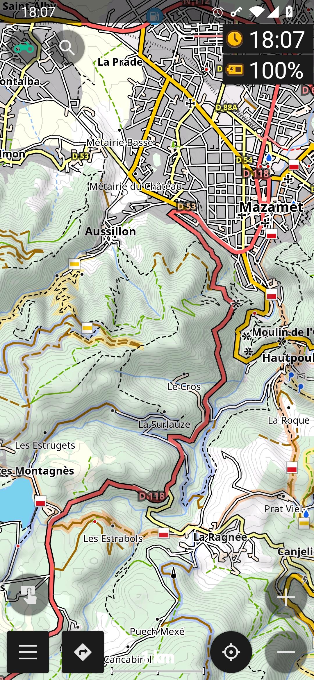
- faster road unselectedexample of route calculation for large motorcycle or SUV (only brown roads)