Having problem viewing survey design map
7 views
Skip to first unread message

Ambrose Bockarie Kanneh
May 14, 2021, 8:16:23 PM5/14/21
to distance...@googlegroups.com
Dear distance users,
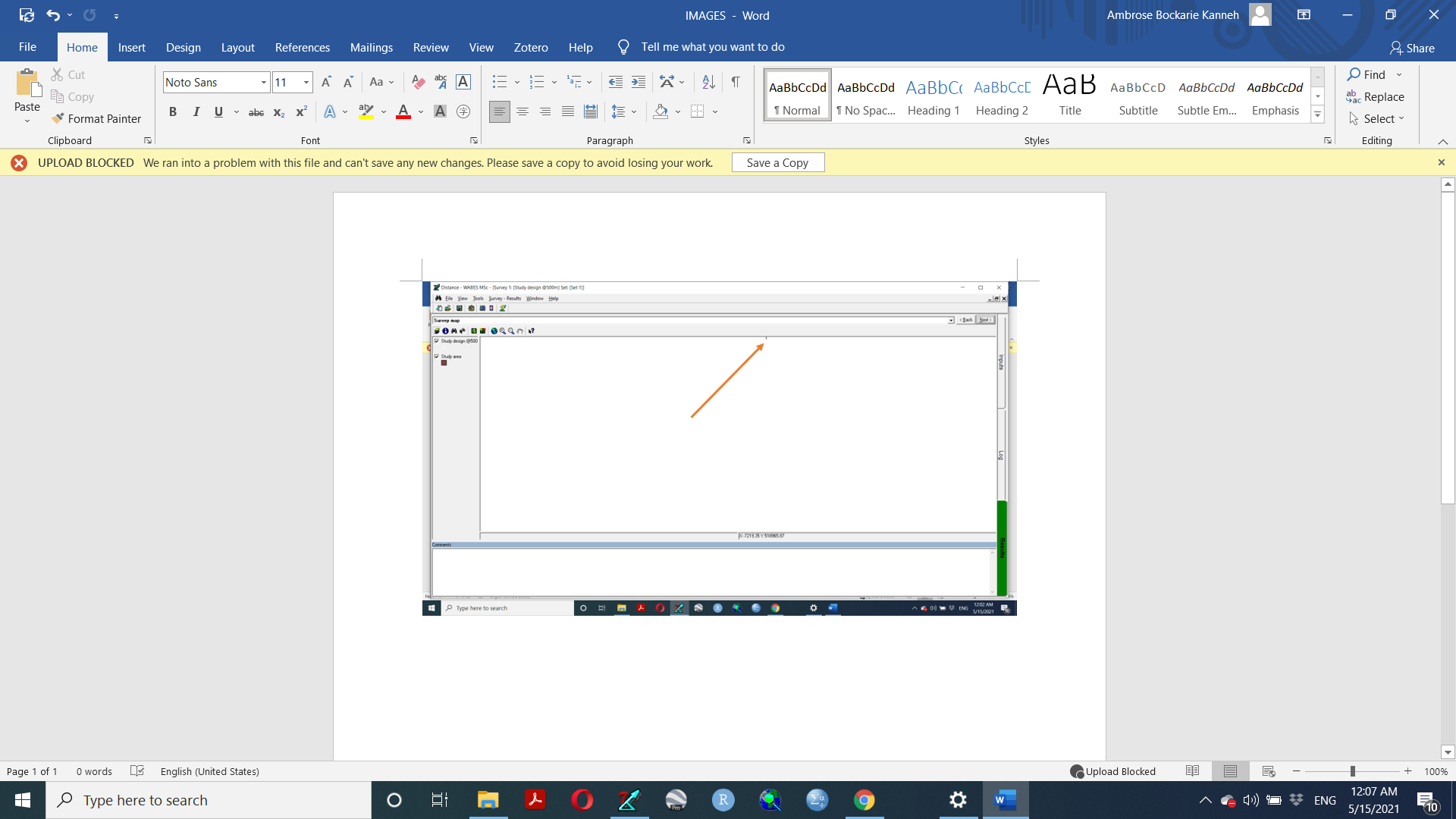
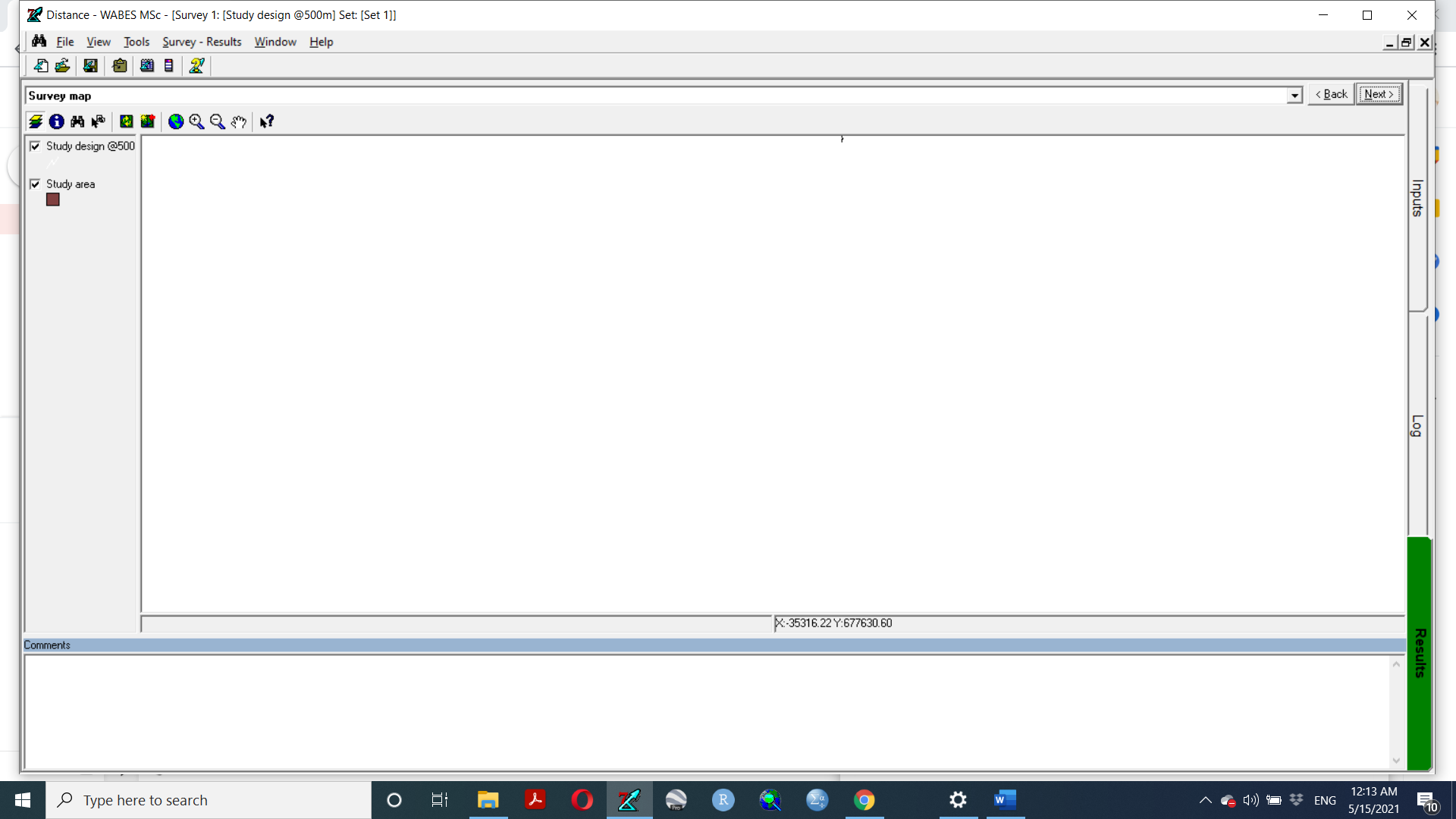
I am new to using distance and I am trying to design a survey, each time I run the design, the survey map is shown but very small at the middle top of the map field as seen below.
I have changed the window display language of my computer from US to UK and either way but still the survey map is not showing full. Also, I have followed the tool option in the distance menu and I have unchecked the ''Store results in compressed format in project database'' under "General" as it was recommended for a similar request when results were not displayed by another distance user. Still no full display of the survey map design. I don't know exactly what to do next regarding this issue.
Please I need help on this from anyone on this platform.
Thanks to whoever is willing to assist.
Kind regards,
Ambrose Bockarie Kanneh.

Eric Rexstad
May 15, 2021, 1:49:39 AM5/15/21
to Ambrose Bockarie Kanneh, distance...@googlegroups.com
Ambrose
I have seen this behaviour before in Distance for Windows. In my experience, this is associated with the projection (or units) used in the shape file. Double check that the shape file of your study area is as you expect; open it in QGIS (free GIS software) to check its properties.
Back in Distance for Windows, you can use the zoom feature to magnify the study area map.
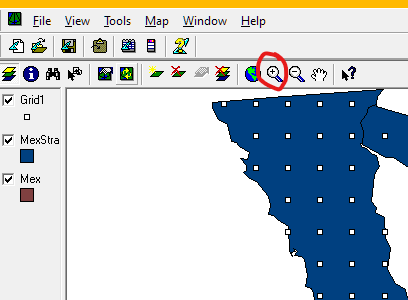
As your cursor moves around the map in
Distance for Windows, the coordinates under the cursor are
displayed in the task bar. Make sure those coordinates are
consistent with your expectations.

--
You received this message because you are subscribed to the Google Groups "distance-sampling" group.
To unsubscribe from this group and stop receiving emails from it, send an email to distance-sampl...@googlegroups.com.
To view this discussion on the web visit https://groups.google.com/d/msgid/distance-sampling/CADuW%3DcifTO-Lpm831YaMsHAtTwjhTWCVuiunCmLcXyOb72jupw%40mail.gmail.com.
--
Eric Rexstad
Centre for Ecological and Environmental Modelling
University of St Andrews
St Andrews is a charity registered in Scotland SC013532

Eric Rexstad
May 15, 2021, 3:45:06 PM5/15/21
to Ambrose Bockarie Kanneh, distance...@googlegroups.com
Very pleased to learn your problem is solved.
From: Ambrose Bockarie Kanneh <bockamb...@gmail.com>
Sent: Saturday, May 15, 2021, 2:07 PM
To: Eric Rexstad
Subject: Re: [distance-sampling] Having problem viewing survey design map
Sent: Saturday, May 15, 2021, 2:07 PM
To: Eric Rexstad
Subject: Re: [distance-sampling] Having problem viewing survey design map
Dear Eric,
Thank you very much for the feedback. The problem has been solved following your recommendations.
Kind regards,
Ambrose.
Reply all
Reply to author
Forward
0 new messages