problem adding geojson feature collection
29 views
Skip to first unread message

Ελένη Γκαδόλου
Mar 30, 2020, 11:20:34 AM3/30/20
to Arches Project
Hello,
I have installed the Arches v5 and I have created several resources models and I have also add some overlays besides the main basemap. Nevertheless. whenever I try to add geojson feature collection in the cards of the model that are related to spatial location:
1. the base map and/or overlays are not loaded
2. there is no tool for adding a point/line/polygon activated so I cannot enter any geometry information
Could you please help me solving this issue?
Best regards,
Eleni

Andrew Jones
Mar 31, 2020, 4:31:09 AM3/31/20
to Arches Project
Have you created a Mapbox API Key and added it to the Arches Map settings?
Andy
Ελένη Γκαδόλου
Mar 31, 2020, 5:11:30 AM3/31/20
to Arches Project
Hi Andrew,
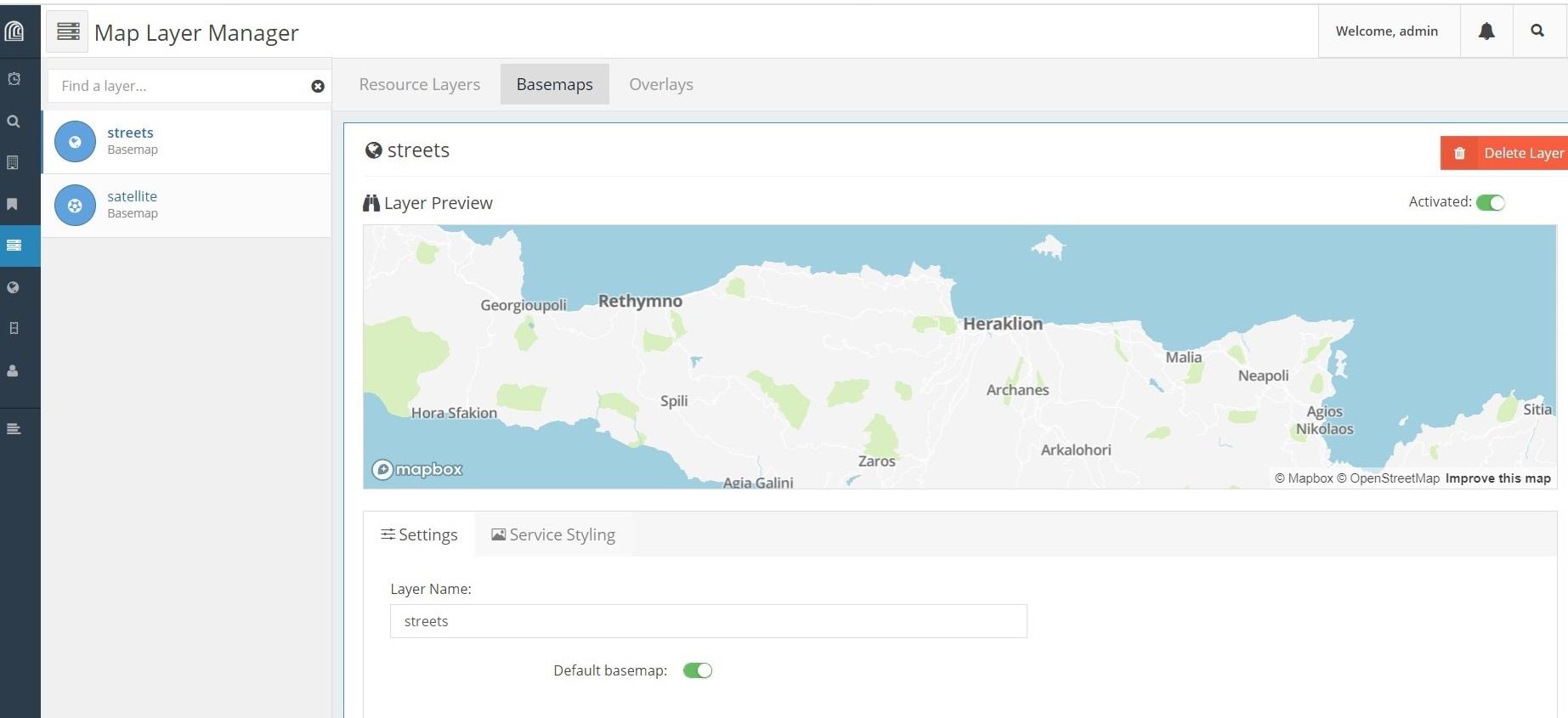
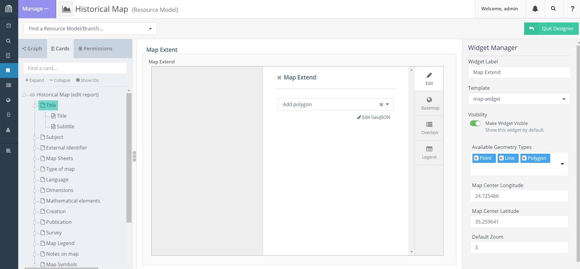
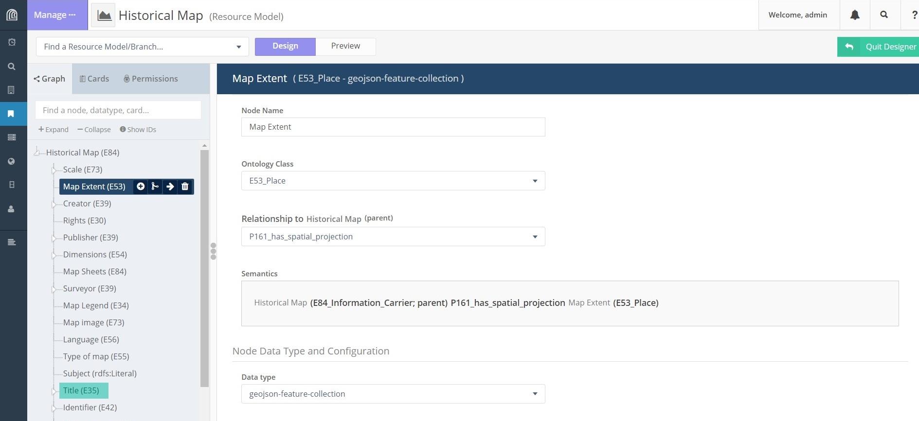
thanks for your reply. Yes, I have created a mapbox api key and added to arches settings. I can see the base map as well an overlay I have also added in Map Layer Manager (screenshot basemap.jpg). Then, I have created a recourse model (graph.jpg) with the properties seen in the screenshot and a card also seen in the screenshot attached. But I cannot see the base map as well the tools for adding geometry (point, line or polygon).
What might have been wrong?
Thanks again,
Eleni

Dennis Wuthrich
Mar 31, 2020, 4:51:42 PM3/31/20
to Arches Project
Eleni,
Have you confirmed that the overlay you created is valid? Your screen shot only appears to show the default Arches basemap. Can you please confirm that the overlays you created are valid? One way to confirm that your overlays are working is to open the developer tools pane in your browser. If you use Chrome, open the "inspect elements" panel, click on console, and then load the page that you expect to see your map and overlays. If everything is working, you shouldn't see any errors.
-Dennis
Eleni Gadolou
Apr 1, 2020, 7:36:02 PM4/1/20
to Dennis Wuthrich, Arches Project
Hi Dennis,
thank you for your reply. You were right. There was an error regarding my overlay created in Mapbox (some kind of dublicates). I created again the overlay using geoserver and following your instructions in a previous post (https://groups.google.com/forum/#!topic/archesproject/vaBMwbYp6IY) and worked just fine!
Another thing I would like to ask is whether cards of a resource can point out to an overlay as datatype. Actually, I have created a resource regarding historical maps and I would like to point out at the referring georeferenced tiff/overlay.
Thank you once more,
Eleni
--
-- To post, send email to arches...@googlegroups.com. To unsubscribe, send email to archesprojec...@googlegroups.com. For more information, visit https://groups.google.com/d/forum/archesproject?hl=en
---
You received this message because you are subscribed to the Google Groups "Arches Project" group.
To unsubscribe from this group and stop receiving emails from it, send an email to archesprojec...@googlegroups.com.
To view this discussion on the web visit https://groups.google.com/d/msgid/archesproject/51e7b906-29a9-4bc5-9bd5-66f14cce1a2d%40googlegroups.com.
Reply all
Reply to author
Forward
0 new messages