Re: Australian Centric Map Projection in MapInfo shapefile

college.atlas
On Friday, 11 March 2016 16:59:04 UTC+11, Cody Phelan wrote:
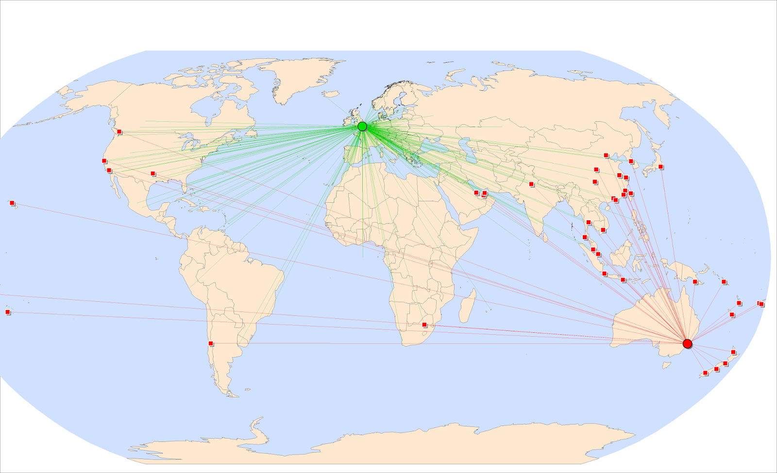
I'm working with the world map below, where Australia/Asia Pacific needs to be centred to show flight paths from capital cities within Australia. At the moment Australia sits to the right and looks odd.Does anyone know how to import a map/change the projections currently in MapInfo to get a centred view of Australia and the rest of the world around it?The view I'm currently working with is attached.

Dave Maunder
Then simply plotting the airlines from Syd/Mel/Bri/Per/Ade etc to the rest of the capital cities around the world.
Sure, bit of work involved, but it would pay off in the end to get a decent map.
I'm working with the world map below, where Australia/Asia Pacific needs to be centred to show flight paths from capital cities within Australia. At the moment Australia sits to the right and looks odd.
Does anyone know how to import a map/change the projections currently in MapInfo to get a centred view of Australia and the rest of the world around it?The view I'm currently working with is attached.
--
--
You received this message because you are subscribed to the
Google Groups "MapInfo-L" group.To post a message to this group, send
email to mapi...@googlegroups.com
To unsubscribe from this group, go to:
http://groups.google.com/group/mapinfo-l/subscribe?hl=en
For more options, information and links to MapInfo resources (searching
archives, feature requests, to visit our Wiki, visit the Welcome page at
http://groups.google.com/group/mapinfo-l?hl=en
---
You received this message because you are subscribed to the Google Groups "MapInfo-L" group.
To unsubscribe from this group and stop receiving emails from it, send an email to mapinfo-l+...@googlegroups.com.
For more options, visit https://groups.google.com/d/optout.

Peter Horsbøll Møller
MapInfo Pro does support certain ”globe views”. Would they work?
The one below has been created using a Azimuthal Equidistant projection focusing on Australia.
I basically added some new projections to the projection file (MapInfow.prj) that can be found in the installation folder of MapInfo Pro.
I added a number of different projections to the group called "--- Azimuthal Systems ---".
The difference is how far they “look”. The one below is looking to 150 degrees
They all have an origin at 130E 30S which of course also can be changed
"Azimuthal Equidistant (Australia, 130E 30S, Range 90)", 28, 74, 7, 130, -30, 90
"Azimuthal Equidistant (Australia, 130E 30S, Range 120)", 28, 74, 7, 130, -30, 120
"Azimuthal Equidistant (Australia, 130E 30S, Range 150)", 28, 74, 7, 130, -30, 150
"Azimuthal Equidistant (Australia, 130E 30S, Range 180)", 28, 74, 7, 130, -30, 180
The good thing about this approach is that you don’t need to modify or transform your data.
You just change your view of the data.

Peter Horsbøll Møller
Pitney Bowes

Warren Vick
Hello Cody,
I faced the same problem many years ago when mapping flight routes. The secret it to (normally) assume that if the distance between origin and destination is shorter by passing over the Pacific Ocean, to direct your route that way. For straight lines, this would involve interpolating the latitude at +/-180 longitude and creating a polyline with two line segments. Even better for flight routes is to use great circles so you see the real shortest path. Of course these are still symbolic routes as they do not take into account air traffic controlled regions (such as NATS: https://en.wikipedia.org/wiki/North_Atlantic_Tracks), avoidance of countries (e.g. North Korea), environmental (e.g. volcanos) and general weather related routing.
There are (or have been) some long distance routes which fly over the north pole… sometime flying to the left or the pole and other times to the right. This might seem like a trivial matter, but on a world projection such as yours that would mean the difference between appearing to fly over the prime meridian (0degs) or anitmeridian (180degs E/W). An example of this was the old Singapore Airlines flight from Singapore to Newark, which I believe was the longest flight in the world while it operated. If, however, your intention is just to show the connected airports (like in in-flight magazine), that probably doesn’t matter too much.
Regards,
Warren Vick
Europa Technologies Ltd.

Tim Rideout
Hi Cody,
You should be able to set the Central Meridian. It would be 0 degrees for the map you sent, but you could change that to say 135 East. This is one of the numbers in the list of parameters in the MapInfow.prj file list of projections. You will have to read the help file to see which one as I can’t remember off-hand.
Just cut and paste in a copy of the projection you want and change the parameter in the copy. Give it a name so you will recognise it! (and put it in a relevant section, e.g. World Projections).
If you want to actually get distances or calculate the routes then you need a Stereographic or Azimuthal projection centred on the airport. Your routes will then look like the spokes of a wheel and the world will look rather strange. However each spoke is part of a great circle and thus the shortest distance and the spokes are true scale so lengths are accurate (but only on the spokes!). If you densify the lines with nodes and then reproject to a normal World view you will get a curved route. So for example you would see right away that being off Newfoundland was indeed the shortest route for the Titanic to get from Cork to New York.
Regards
Tim
Dr Tim Rideout
Director
Why not make sure you get our latest offers and announcements? Subscribe
 You
can design your own map
now – choose from World Maps, UK Maps, Postcode Maps, Health Maps, Historic Maps, National Geographic and more.
You
can design your own map
now – choose from World Maps, UK Maps, Postcode Maps, Health Maps, Historic Maps, National Geographic and more.
![]() XYZ
Maps
XYZ
Maps
32/9 Hardengreen Industrial Estate
Dalhousie Road,
Dalkeith,
EH22 3NX
Tele: +44 (0) 131 454 0426
Mobile: +44 (0) 7766 825937
Fax: +44 131 454 0443
Email: tim.r...@xyzmaps.com
Web: www.xyzmaps.com