Fixing las files
715 views
Skip to first unread message

Max Musterman
Jun 20, 2018, 2:00:15 AM6/20/18
to LAStools - efficient tools for LiDAR processing
Hi all,
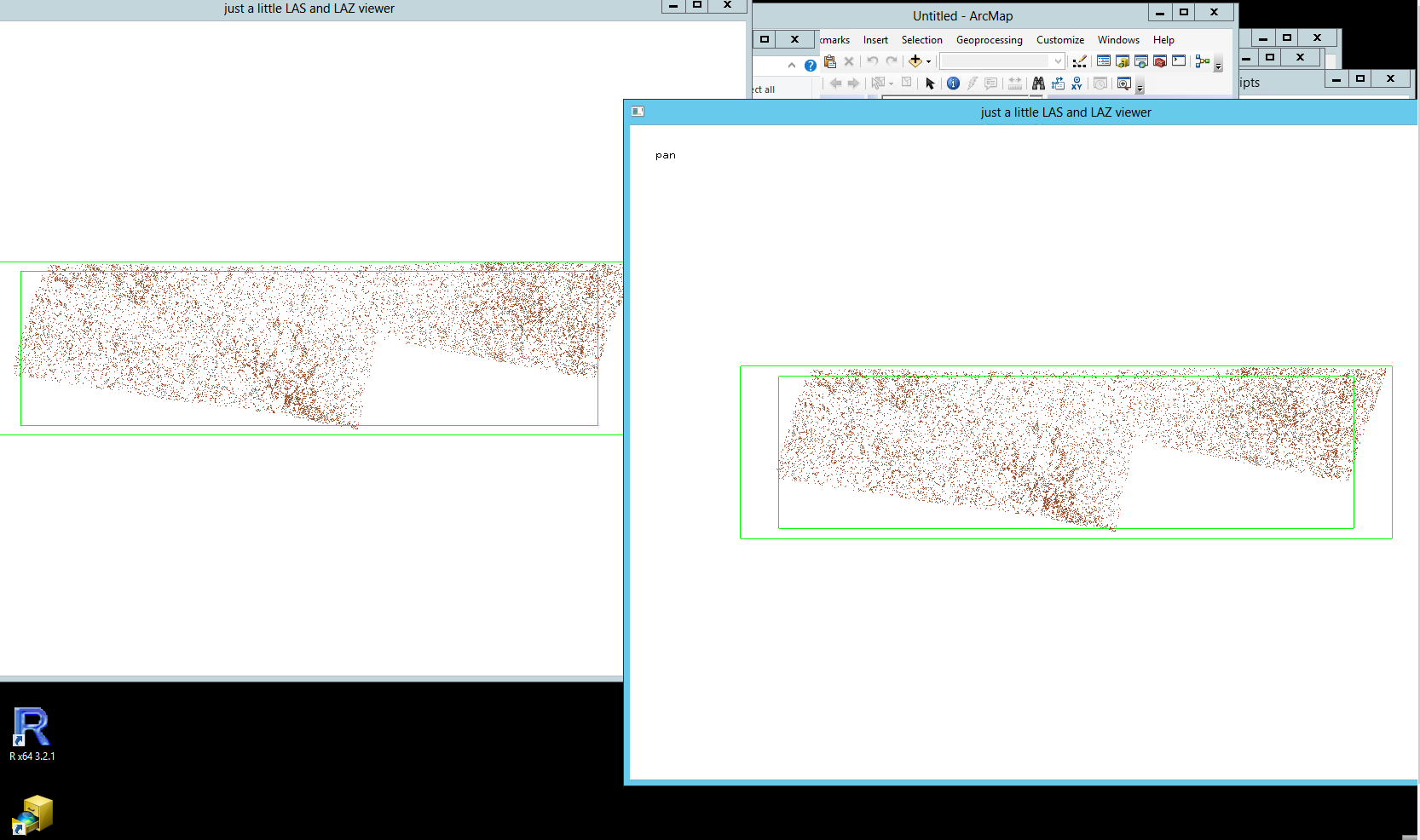
I am trying to repair a las file that doesn't look right in lasview. From what I see in lasview the bounding box is way off towards the south.
However, apparently "the bounding box is correct".
The warnings that do come up are:
WARNING: there are 875 points with return number 6
WARNING: there are 33 points with return number 7
WARNING: there are 33 points with return number 7
However, I dropped 6 and 7 and the resulting laz file still looks bad.
I am now assuming that the information on min/max xyz in the header was wrong?
How can I fix such a file?
Thanks! Any input is greatly appreciated!

Martin Isenburg
Jun 20, 2018, 9:57:54 AM6/20/18
to LAStools - efficient command line tools for LIDAR processing
Hello,
the lasinfo reports look correct to me. The WARNINGs about return number 6 and 7 usually mean the data was acquired with RIEGL scanner that occasionally generate more than the usual 4 or 5 returns that you get from the common Leica and Optech systems. Originally the LAS format was only designed to have at most 5 returns per shot (Paul Galla from Leica Geosystems was part of the original LAS design team in 2004). However, enumerating returns from 0 to 7 is possible in the LAS format (there are 3 bits) and the 1 to 7 range is commonly used (the 0 is usually assigned only to either synthetic or non-LiDAR points such as those generated by dense-matching ) I should probably reformulate the WARNING to raise less concern.
Regards.
Martin
--
Download LAStools at
http://lastools.org
http://rapidlasso.com
Be social with LAStools at
http://facebook.com/LAStools
http://twitter.com/LAStools
http://linkedin.com/groups/LAStools-4408378
Manage your settings at
http://groups.google.com/group/lastools/subscribe
Max Musterman
Jun 20, 2018, 11:09:24 PM6/20/18
to LAStools - efficient tools for LiDAR processing
Thanks Martin!
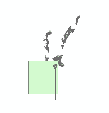
However, it still doesn't explain a) Why in lasview there is no data showing up other than the frame or some data in the far corner only, and b) Why when integrated with all the other lasboundaries I have from this data set it looks as shown in "CaptureBoundaries.png" attached.
Is it possible that the lasheader xyz min max are wrong?
Thanks!!
Martin Isenburg
Jun 21, 2018, 12:52:06 AM6/21/18
to LAStools - efficient command line tools for LIDAR processing
Hello,
I do not have enough info to make that call. The screen shots from lasview looks fine and for the screen shot from lasboundary I am not sure what I see. I You can repair a LAS header boundary (caution: replacement done in place, maybe make a copy first) with
lasinfo -i file.laz -repair_bb
you can report points outside the bounding box with
lasinfo -i file.laz -report_outside
or
lasinfo -i file.laz -ro
http://lastools.org/download/lasinfo_README.txt
or try to create some histograms of the x and y coordinates to see if they are clustered in multiple places:
lasinfo -i file.laz -histo x 100 -histo y 100
or else maybe create a density map of where the points are with
lasgrid -i file.laz -density_16bit -step 5 -false -odix _density_5m -opng
http://lastools.org/download/lasgrid_README.txt
gives you another clue.
Regards,
Martin @rapidlasso
Reply all
Reply to author
Forward
0 new messages