Missing data in Field Boundaries layer
19 views
Skip to first unread message

Jennifer Reiman
Jan 9, 2023, 5:21:02 PM1/9/23
to ACPF Forum
Hello!
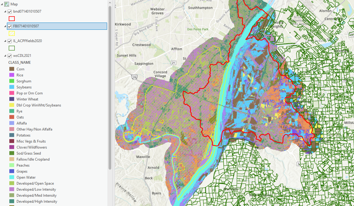
I'm working with a watershed in Monroe County and St. Clair County, Illinois (071401010507, red outline in the image below) and I'm missing field boundary data.
The ACPF download included crop data (multicolor raster, doesn't follow the HUC boundary very closely) and a so-called field boundary layer (yellow hatched lines) that was a very large polygon on the Missouri side of the river, not resembling a typical Field Boundary layer at all -- looks like an error to me. I'm trying to find a better source for Field Boundary data to replace it.
I did some digging and found/downloaded the Illinois ACPF Fields 2020 (green outlined polygons, from https://data.nal.usda.gov/dataset/agricultural-land-use-field-illinois-2010-2020) and found that my watershed is a hole in the data. This is a predominantly agricultural area so there should be field boundary data there. Any suggestions on where to look or who to contact?
Thanks for your assistance!
Jenny Reiman
Reply all
Reply to author
Forward
0 new messages