Error Hydrological component relation with Ocean (GIS)
20 views
Skip to first unread message

jordi palacios
Aug 2, 2022, 1:16:00 PM8/2/22
to wrf-hydro_users
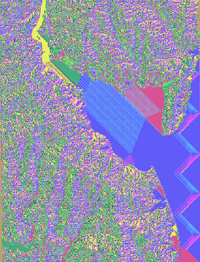
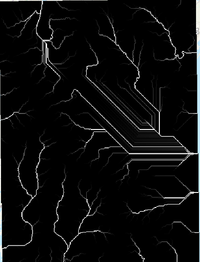
Dear all, I'm trying to run WRF Hydro but Im facing some problems
with the DEM product because there are some interferences related to
the ocean in the whole domain ( The ocean shouldn't be in model).
For example, Flow Direction
Flow Accumulation
Does anyone know how to solve this
problem?
Best,

Kevin
Aug 2, 2022, 3:59:29 PM8/2/22
to wrf-hydro_users, jordi palacios
Jordi,
Kevin
You can avoid these artifacts if you set all ocean elevation values to NoData before using the GIS pre-processor. Typically, sea-level will be 0 in a DEM, and you can set 0 values to NoData using GIS tools such as ArcGIS, QGIS, or GDAL.
Cheers,
Kevin
Reply all
Reply to author
Forward
0 new messages