WRF-Hydro GIS Preprocessing tool
61 views
Skip to first unread message

Jana Corominas
Dec 22, 2022, 7:23:27 AM12/22/22
to wrf-hydro_users
Hello,
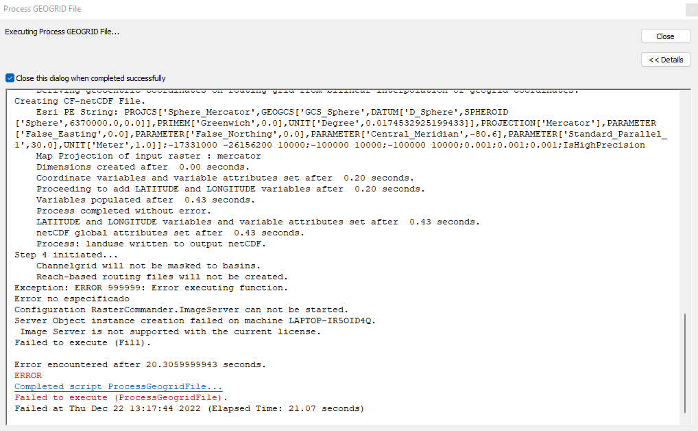
I'm trying to create domain data to run wrf-hydro uncoupled. My input WRF data has 1 km x 1 km resolution. I have ran the tool successfully using 4 as regridding factor (250m cell), but since I have a 5 m resolution DEM i would like to have a finner resolution.
When I run the tool with large regridding factor (more than 20), it breaks with the error shown in the attached file. I don't understand what is going on since I only change this factor between runs.
Thanks in advance,
Jana

Kevin
Dec 22, 2022, 11:16:28 AM12/22/22
to wrf-hydro_users, Jana Corominas
Jana,
If I understand you correctly, the Process GEOGRID File tool worked fine when all other settings and inputs were identical except for the "Regridding Factor"?
I would suggest that you check and make sure that Spatial Analyst extension is on and activated. Next, see if Background 64-bit Geoprocessing option is installed and turned on. This will dramatically increase the memory throughput because it will use 64-bit Python. Your image looks like ArcMap or ArcCatalog. Can you upgrade to ArcGIS Pro? This will also utilize 64-bit architecture and reduce Python-based MemoryErrors.
You may also need to check your output location and make sure to delete any "scratchdir" directories from previous failed runs. Watch your amount of free disk space, and your memory consumption. These could all be reasons for the failure when you move to higher resolutions. Many temporary outputs are written to disk, and the file size stored in memory grows tremendously with every increment of increased regridding factor. Try to use regridding factors that will evenly divide your LSM resolution (e.g. 2, 4, 5, 8, 10, 20).
Let us know how the troubleshooting it goes,
Kevin
Jana Corominas
Dec 22, 2022, 12:31:29 PM12/22/22
to wrf-hydro_users, Kevin, Jana Corominas
Thank you Kevin for your answer.
I have always used ArcMap since I couldn't make GIS Preprocessing tools to work in ArcGIS Pro in the past.
I have tried it now and it worked! Now I just have to choose the most apropiate regridding factor.
Thanks again.
Kevin
Dec 22, 2022, 1:20:30 PM12/22/22
to wrf-hydro_users, Jana Corominas, Kevin
Glad to help! Technically, any regridding factor could work, but in practice it really helps to choose one that divides your LSM grid cells evenly. I'm glad it worked for you!
Kevin
Kevin
Reply all
Reply to author
Forward
0 new messages