smart
17 views
Skip to first unread message

wilmer guerra
Jun 16, 2021, 4:21:33 PM6/16/21
to SMART Community Forum
Hello,
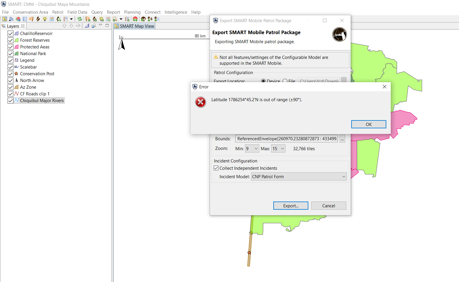
I have been trying to export my patrol package to SMART MOBILE. However, the map automatically exports in the WGS Coordinate System and we use NAD 1927. However, when I change it from WGS to NAD27 in the ''Set Bounds'' option before exporting it gives me this error.
I am unsure why it's giving me this error.

Juan Ignacio Cuhna
Jun 19, 2021, 9:26:16 PM6/19/21
to SMART Community Forum, Wilmer-Eaton Guerra
Hi! Not sure if thisis the correct answer, but try to just set a map in WGS84 for export in mobile. Conversions to local SRCs should happen automatically laterfor analysis...

Leal, Danniely
Jun 20, 2021, 10:34:10 PM6/20/21
to wilmer guerra, SMART Community Forum
Saludos Wilmer, el mapa debe ser creado en smart en formato geográfico WGS 84, la configuración de proyección plana (UTM) debe hacerse en la app, en configuracion
 |
| Danniely Alberto Alvingher Leal Franco |
| Asistente Sistema de Información Geográfica |
| Wildlife Conservation Society |
| Tel: +502 7867 5152 Móvil +502 41307727 |
| web: www.wcsguatemala.org |
| Skype: dannielyleal |
De: wilmer guerra <wilmerg...@gmail.com>
Enviado: miércoles, 16 de junio de 2021 14:21
Para: SMART Community Forum <comm...@smartconservationsoftware.org>
Asunto: smart
Enviado: miércoles, 16 de junio de 2021 14:21
Para: SMART Community Forum <comm...@smartconservationsoftware.org>
Asunto: smart
EXTERNAL EMAIL - Please Use Caution
--
You received this message because you are subscribed to the Google Groups "SMART Community Forum" group.
To unsubscribe from this group and stop receiving emails from it, send an email to community+...@smartconservationsoftware.org.
To view this discussion on the web visit https://groups.google.com/a/smartconservationsoftware.org/d/msgid/community/CAMed_TL8tN3%3DwT_UooCMwJQY4GDZmu6bc7YeZk4ZkGchpQnhVQ%40mail.gmail.com.
Reply all
Reply to author
Forward
0 new messages