CyArks online 3D viewer - a sugar-sweet case study on the creative commons license (and way too many digits)

Martin Isenburg
in utter confusion about the creative commons license I turn to you my
friends. Last August after reading in this LiDAR news article written
by CyArk's Director of Operations
http://www.lidarnews.com/content/view/9138/136/
that CyArk's had a new online 3D viewer I invested some serious time
into understanding their content delivery system and suggested ways to
shorten download times. Hands-on - as I like to be (-: - I created the
several java-based web page (see attached) to demonstrate to them that
with some quantization, simple prediction, and clever JSON scripting
things they could produce much more web-efficient 3D content. I did
this with two of their own data sets to allow an apples-to-apples
comparison: a point model (Tikal) and a mesh model (Rushmore).
I was excited working on this until - after a long purely technical
exchange - the person at CyArk suddenly and - to my surprise -
demanded for me to take down the compressed content. I was perplexed
and wanted a reason for why I should have to delete this content that
was representing a significant time and energy investment during my
free-time.
Me: "What you mean with take down? Delete it from my webpages? But I
am using it as a purely educational example for scanner precision and
coordinate resolution. I am not promoting it in any context that would
interfere with the mission of CyArk. I do not quite follow the
imperative here. Aren't you a non-profit site dedicated to science and
education? And anyone could download those points clouds from your
site just the way I did it. It's not rocket science ... (-:"
person at CyArk: "And, yes, to clarify my request, I would like you to
delete any content from your server or webpages. Sorry if I was vague.
Thanks!"
Me: "I believe I am in accordance with both, Ben (Kacyra)'s vision and
the creative commons license with my educational use of the 3D content
(see http://archive.cyark.org/copyright). Is there something I am
missing?"
Because I never heard back I figured my creative commons argument had
resonated. That was until I tried to access this (hidden) page for a
live demo during a workshop a few weeks ago to demonstrate the
benefits of geometry compression for the purpose of disseminating
archeological artifacts. The demo failed. My page was gone. The web
admin told me he deleted it after receiving an email from a director
at CyArk stating that I was "[...] hosting unauthorized content from
CyArk [...] " and that "Dr. Isenburg gained unauthorized access to our
information and the re-posted it to his webpage [...]". Bummer.
This action seemed to contrast what I have read about CyArk's mission
statement on providing open access to their data for research,
education, and virtual tourism and with all that I had heard about Ben
Kacyra's overall intentions.
http://archive.cyark.org/mission
http://en.wikipedia.org/wiki/CyArk
Today I saw Tom Greaves, executive director at CyArk, comment "Sweeeet
use of CyArk data." on the CyArk blog entry below which describes the
creation of a sugary fudge replica of the Tikal Temple (the very same
data set I had been using) during a launch event of a new sugar series
by British-based multinational agribusiness Tate & Lyle.
http://archive.cyark.org/what-do-3d-printing-cake-and-a-childhood-nickname-have-in-common-blog
I do like to have fun with LiDARs and certainly appreciate the
entertaining factor of this event. But will the Guatemalan people
really be that happy to learn that their ancient cultural heritage is
widely publicized as an overly sugary piece of cake but be in furious
opposition to find it used as an educational example on web-optimized
3D content ...?
(-;
I took this as an opportunity to - once more - inquire about the
"creative commons" license of CyArk and I finally received an answer
from Tom.
-----------------------
Dear Dr. Isenburg,
Please understand that only some of the data we collect and archive is
available for non-commercial use under creative commons. Much of the
data we collect remains the property of the site owner/managers and
should you wish to use this data, you would need to obtain their
permissions directly. I do not understand the business model for
LAStools sufficiently to know if this is likely or even possible.
Cake for Breakfast approached us directly for permission to use our
Ti'kal data in advance and we were able to provide this.
I apologize for the delay in responding to you; I have been traveling
a lot recently. Please feel free to contact me directly if you have
any questions.
Sincerely,
Tom Greaves
Executive Director
-----------------------
So I ask you: What is your experience with "open data". What are the
most and least permitting licenses for such data and what do they mean
in practice? How do I know what is open and what not? The
data-generous public relation image that CyArk is usually present with
is - according to my own experience - far from the practiced reality.
Can you help me to clarify what "creative commons" licensing really
means and what it allows you and forbids you from doing so I don't
violate this license in the future. Please email me at
"piece_of_s...@rapidlasso.com" and be aware that your emails
will be considered "creative commons". Or maybe not ... (-;
Martin @rapidlasso
--
http://rapidlasso.com - fast tools for confused LiDARs
PS: If you want to bake an archeological cheese cake of epic
proportions but miss the secret 3D ingredient then I may be able to
help in exchange for some cheese cake futures. (-;
On Wed, Aug 29, 2012 at 3:25 PM, Martin Isenburg
<martin....@gmail.com> wrote:
> Hello,
>
> Congrats to CyArk for creating this wonderful online experience that
> allows me to inspect amazing cultural treasures all across the world
> in interactive 3D as lidarnews reports:
>
> http://www.lidarnews.com/content/view/9138/
>
> As I am very involved with point cloud formats I was instantly curious
> about how CyArk's 3D Viewer was storing these point clouds - after all
> - users will have to download them. Turns out that each model is
> stored as several gzipped ASCII files that are around 2 MB in size and
> contain a JSON string that describes the point cloud. The "Tikal
> Temple I" model, for example, is stored in 5 files that total 10.8 MB
> (see links at the very end).
>
> On further inspection I saw that each file contained a list of points
> as [x,y,z,"RGBintensity", "RGBcolor"]. Here are the first six points
> from the first file of the "Tikal Temple I" model:
>
> [28.286682500009,-17.910553000169,-22.492218,"00ff13","473618"]
> [-29.050201500009,19.081512999721,-20.314026,"f56400","958b4e"]
> [-29.855194500007,19.4510499998,-20.298309,"f56700","938749"]
> [-29.754943500011,19.124969999772,-20.32785,"f98100","9c9255"
> [-29.297363499994,19.565826999722,-20.301452,"e91700","9a914f"]
> [-29.503723500005,19.244445999851,-20.305786,"fcb500","958b4b"]
>
> I suggested to the CyArk group to be a little less generous with the
> decimal digits and store something more compact instead by rounding to
> millimeters:
>
> [28.287,-17.911,-22.492,"00ff13","473618"]
> [-29.05,19.082,-20.314,"f56400","958b4e"]
> [-29.855,19.451,-20.298,"f56700","938749"]
> [-29.755,19.125,-20.328,"f98100","9c9255"]
> [-29.297,19.565,-20.301,"e91700","9a914f"]
> [-29.504,19.244,-20.306,"fcb500","958b4b"]
>
> Millimeter accuracy should be more than sufficient for a laser scanned
> temple. The answer I got was that they had considered that shaving a
> few digits would give some savings but that they "[...] generally
> don't round anything. Any loss of quality, no matter how academic, is
> usually frowned upon around here."
>
> I would like to take this as an educational opportunity on scanner
> precision. (-: Folks who have seen the first 5 minutes of my LASzip
> LiDAR compression video on youtube (http://www.youtube.com/watch?
> v=A0s0fVktj6U) know that I am on "a mission" to educate folks about
> not storing excessive precision in their scanned data. (-:
>
> Why excessive? The majority of the decimal digits that CyArk stores in
> those files are not actual data. The binary IEEE format that is used
> to represents a double-precision floating-point number often makes it
> seem as if there are many non-zero decimal digits ... but most of them
> are completely meaningless.
>
> How meaningless? CyArk stored the x and y coordinate for the points of
> the "Tikal Temple I" model with picometer (!) precision (see
> illustration below) and let me quote wikipedia [1]: "The picometre's
> length is of an order such that its application is almost entirely
> confined to particle physics and quantum physics. Atoms are between 62
> and 520 pm in diameter." So clearly a bit of an overkill ... (-:
>
> 28.29 = centimeter
> 28.287 = millimeter
> 28.2867 = 0.1 millimeter
> 28.28668 = 0.01 millimeter
> 28.286682 = micrometer
> 28.2866825 = 0.1 micrometer
> 28.28668250 = 0.01 micrometer
> 28.286682500 = nanometer
> 28.2866825000 = 0.1 nanometer
> 28.28668250001 = 0.01 nanometer
> 28.286682500009 = picometer
>
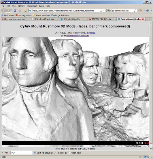
> Here is a link to my version of the "Tikal I Temple" model in good old
> VRML. It is displayed in the ancient Java Engine from Shout3D so it
> may not show on your Mac (but on your Solaris Sparc) but you can still
> download the model.
>
> http://www.cs.unc.edu/~isenburg/pmc/tikal_temple_i.html
> http://www.cs.unc.edu/~isenburg/pmc/media_TIK_20071003_151724.wrl.gz
>
> Part of my "campaign" (*) was the release of pointzip [2] for
> compressing terrestrial scanned data. It features a precision selector
> very prominent in the GUI that "forces" the user to make a choice and
> reflect about the precision in the data.
>
> Regards,
>
> Martin @rapidlasso
>
> (*) This message was brought to you by the people for better 3D
> compression through storing less decimal places by knowing your
> precision.
>
> [1] http://en.wikipedia.org/wiki/Picometre
> [2] http://pointzip.org
>
> The 5 JSON files storing the "Tikal I Temple" model:
>
> http://archive.cyark.org/projects/TIK/area_07-10-02-18-28-52__2335//media_TIK_20071003_151724_ori-0.js.gz
> http://archive.cyark.org/projects/TIK/area_07-10-02-18-28-52__2335//media_TIK_20071003_151724_ori-1.js.gz
> http://archive.cyark.org/projects/TIK/area_07-10-02-18-28-52__2335//media_TIK_20071003_151724_ori-2.js.gz
> http://archive.cyark.org/projects/TIK/area_07-10-02-18-28-52__2335/media_TIK_20071003_151724_ori-3.js.gz
> http://archive.cyark.org/projects/TIK/area_07-10-02-18-28-52__2335/media_TIK_20071003_151724_ori-4.js.gz
>
> --
> Download LAStools at
> http://lastools.org/
> Visit the LAStools group at
> http://groups.google.com/group/lastools/
> Be social with LAStools at
> http://www.facebook.com/LAStools
> http://www.twitter.com/LAStools

Andrew Michael Mickelson (amicklsn)
A point cloud is something that was created by someone, like a work of art. In can be copyrighted. Fair-use should be the case here, but it appears that CyArk has gone one step further to protect their rights by not allowing reproduction in any form unless through obtaining their permission for reuse. CyArk has every right to do this, not matter how distasteful it seems. From an ethical standpoint, they are behaving badly in my opinion because they have produced scientifically important data that should be shared with other researchers (once they have first published it) so that others can use the data to advance the field of study.
From: last...@googlegroups.com [mailto:last...@googlegroups.com]
On Behalf Of Doug Rocks-Macqueen
Sent: Thursday, April 11, 2013 8:21 AM
To: last...@googlegroups.com
Subject: [LAStools] Re: CyArks online 3D viewer - a sugar-sweet case study on the creative commons license (and way too many digits)
Edit based on a comment of clarification to the example-
"I just got word from Tom Greaves (Executive Director at CyArk) that “None of our 3D point cloud is available under Creative Commons. Only some of the 2D image data is covered by this.”
That follows pretty much what I expected. However that still leaves open the issue of Data being covered by any sort of license. The page where the data was retrieved from has a copyright “All content copyright CyArk and Partners 2010″. It is debatable if a point cloud could be copyrighted? If it is data, No way can them stop it. If it is a database, maybe? Europe has some odd laws about copyrighting databases but not their contents however the US does not. IF it is copyright than fair use kicks in and he should be fine.
To determine if a point cloud is copyright or not would actually mean going to court. Someone would have sue someone to see if it is or not. Moreover, if it is covered by copyright Dr. Isenburgh would most likely kick some a$$ on the fair
use aspect. Mainly on point four, how it hurts CyArk. Given that CyArk give out the data for free and as far as I can tell Dr. I. was not distributing the work other than as an example they would be very very hard pressed to show any sort of damage.
Be social with LAStools at
Martin Isenburg
I should mention that the day after sending the first message of this
thread I got (surprising) word from Tom Greaves (Executive Director at
given that heir mission states: "Digital Preservation is 'Preserving
cultural heritage sites through collecting, archiving and providing
*open* access to data created by 3D laser scanning, digital modeling,
and other state-of-the-art technologies,' the CyArk Mission." Looks
like they need to do a thorough reformulation of what it says on
http://archive.cyark.org/mission ...
In conclusion ... the data-generous public relation image that CyArk
has been presented with by lidarnews, wikipedia, its own mission
statement, and other media outlets is - according to my own experience
and CyArk's executive confirmation - rather miss-leading. It seems
their 3D data is neither open nor available to the public by any
useful standard ... so triple-check with them before investing too
much time in generating educational, artsy, or overly nutritious
derivatives from their data ... (-;
Regards,
Martin @rapidlasso
--
http://rapidlasso.com - fast tools for liberating LiDARs
On Apr 11, 8:11 am, Doug Rocks-Macqueen <drocksmacqu...@gmail.com>
wrote:
> I am going to have to respectively differ on the point that, "A point cloud
> rules on it. Hopefully, it never gets to the point were courts would have
> to decide.
>
> I would say a point cloud is data and data can not be under copyright. A
> point cloud is just a series of measurements from one (or more) locations
> to many others. That is data plain and simple and you can not copyright it.
> Just because someone "created it" does not mean it can be under copyright.
> For example, the footage of the JFK assassination was created by someone
> but it is not under copyright because it was ruled in a court case be a
> representation of facts and data. Now, what someone does with the data I
> believe can and should be under copyright, if someone so chooses.
>
> Now I am not saying I agree with copyright just that as the law stands now,
> in certain countries, it could be said that point clouds are data and as
> such not under copyright. Again, I would hope that it never reaches a point
> were the law has to make that distinction.
>
> On Thursday, April 11, 2013 3:06:34 PM UTC+1, Andrew Michael Mickelson
>
>
>
>
>
>
> (amicklsn) wrote:
>
> > A point cloud is something that was created by someone, like a work of
> > art. In can be copyrighted. Fair-use should be the case here, but it
> > appears that CyArk has gone one step further to protect their rights by not
> > allowing reproduction in any form unless through obtaining their permission
> > for reuse. CyArk has every right to do this, not matter how distasteful it
> > seems. From an ethical standpoint, they are behaving badly in my opinion
> > because they have produced scientifically important data that should be
> > shared with other researchers (once they have first published it) so that
> > others can use the data to advance the field of study.
>
> > last...@googlegroups.com <javascript:>] *On Behalf Of *Doug Rocks-Macqueen
> > *Sent:* Thursday, April 11, 2013 8:21 AM
> > *To:* last...@googlegroups.com <javascript:>
> > *Subject:* [LAStools] Re: CyArks online 3D viewer - a sugar-sweet case
>
> > Edit based on a comment of clarification to the example-
>
> > "I just got word from Tom Greaves (Executive Director at CyArk) that “None
> > of our 3D point cloud is available under Creative Commons. Only some of the
> > 2D image data is covered by this.”
>
> > That follows pretty much what I expected. However that still leaves open
> > the issue of Data being covered by any sort of license. The page where the
>
> > Because I never heard back I figured my creative commons argument had
> > resonated. That was until I tried to access this (hidden) page for a
> > live demo during a workshop a few weeks ago to demonstrate the
> > benefits of geometry compression for the purpose of disseminating
> > archeological artifacts. The demo failed. My page was gone. The web
> > admin told me he deleted it after receiving an email from a director
> > at CyArk stating that I was "[...] hosting unauthorized content from
> > CyArk [...] " and that "Dr. Isenburg gained unauthorized access to our
> > information and the re-posted it to his webpage [...]". Bummer.
>
> > This action seemed to contrast what I have read about CyArk's mission
> > statement on providing open access to their data for research,
> > education, and virtual tourism and with all that I had heard about Ben
> > Kacyra's overall intentions.
>
> >http://archive.cyark.org/mission
> >http://en.wikipedia.org/wiki/CyArk
>
> > Today I saw Tom Greaves, executive director at CyArk, comment "Sweeeet
> > use of CyArk data." on the CyArk blog entry below which describes the
> > creation of a sugary fudge replica of the Tikal Temple (the very same
> > data set I had been using) during a launch event of a new sugar series
> > by British-based multinational agribusiness Tate & Lyle.
>
> > PS: If you want to bake an archeological cheese cake of epic
> > proportions but miss the secret 3D ingredient then I may be able to
> > help in exchange for some cheese cake futures. (-;
>
> > On Wed, Aug 29, 2012 at 3:25 PM, Martin Isenburg
> > <martin....@gmail.com> wrote:
> > > Hello,
>
> > > Congrats to CyArk for
>
>
> read more »
Andrew Michael Mickelson (amicklsn)
Andrew Mickelson
I doubt this would hold up in most courts as the argument would be made that LiDAR scans are similar to pictures and we all know that pictures can be copyrighted. I think the idea of free point clouds for all, but the reality is that scans be they airborne LiDAR or MRIs can be and are copyrighted.
On Thursday, April 11, 2013 1:15:12 PM UTC-4, Doug Rocks-Macqueen wrote:I would recommend looking at this white paper on 3D scans and copyright- http://www.publicknowledge.org/Copyright-3DPrinting
"As with scans of useful objects, scans of creative objects do not create a new copyright. Unlike scans of useful objects, scans of creative objects are copies of existing works protected by copyright. That has two ramifications. The first is that anyone scanning a creative object needs the permission of the rightsholder of that object. Scanning makes a copy, and copies are exactly what copyright regulates. Even though the scanner is not creating a work eligible for copyright protection, she is still copying the creative object.
The CyArc scans are of things not under copyright (unless Tikal suddenly was put under copyright) so any point cloud of it would not have issues with copyright. I could be wrong but a brief look of all the scans appear to be of objects that are not under copyright?
They point out the case law is relatively new but scans do not have copyright, the actual object does and in the case of Dr I. none of objects in the scans in question are under copyright.
On Thursday, April 11, 2013 4:33:00 PM UTC+1, Jarlath wrote:At least in the United States the courts have routinely upheld that geospatial data, whether it be parcel boundaries or imagery, can be copyrighted. If this were not the case the business models for commercial satellite imagery companies would evaporate. These rulings have even extended to data collected by government (typically local government agencies), allowing certain organizations to charge hundreds of thousands of dollars to data that were purchased with taxpayer dollars. My personal opinion is that I have no problem with commercial entities copyrighting data, given that they have taken risk in acquiring it. For taxpayer funded data I find the idea of copyrighted data counterproductive and ultimately costly for society. There are countless examples from engineering to life sciences to IT in which me
On Thursday, April 11, 2013 11:11:12 AM UTC-4, Doug Rocks-Macqueen wrote:I am going to have to respectively differ on the point that, "A point cloud is something that was created by someone, like a work of art. In can be copyrighted." First, I should say that we won't actually know until a court rules on it. Hopefully, it never gets to the point were courts would have to decide.
I would say a point cloud is data and data can not be under copyright. A point cloud is just a series of measurements from one (or more) locations to many others. That is data plain and simple and you can not copyright it. Just because someone "created it" does not mean it can be under copyright. For example, the footage of the JFK assassination was created by someone but it is not under copyright because it was ruled in a court case be a representation of facts and data. Now, what someone does with the data I believe can and should be under copyright, if someone so chooses.
Now I am not saying I agree with copyright just that as the law stands now, in certain countries, it could be said that point clouds are data and as such not under copyright. Again, I would hope that it never reaches a point were the law has to make that distinction.
On Thursday, April 11, 2013 3:06:34 PM UTC+1, Andrew Michael Mickelson (amicklsn) wrote:
Martin Isenburg
I had a few notes based on items that came up in the related
discussion. I have a background in software licensing, not because I
am a lawyer, but because when I worked for Sun Microsystems (1995 –
2008) I was involved in moving the Java platform to open source. My
role was as the liaison between engineering and legal for that
project. I also have a background having co-founded a nonprofit based
in San Francisco in 2002 (yes my time overlapped, I was part-time at
Sun while working on the legal open source issues for Java)
It is important to note that being a nonprofit in the US, does not
restrict people from using proprietary licenses or for charging fees
for what they do. It does have other requirements about how the
organization is run, specifically that there cannot be any form of
“profit sharing” and that money that is raised is used to further the
nonprofit mission of the organization. An example is that a ballet
company is almost always a nonprofit in the US, but they can sell
tickets to their performances. Most ballet companies do not make
enough from ticket sales to pay all their costs, so they have to raise
additional funds as well. Nonprofits can pay people salaries – but
those salaries have to be consistent (or less) than what others with
similar experience and duties would be paid in the commercial sector.
There are many other rules too. My point is that just because an
entity is a nonprofit does not mean they have to give everything away.
However, sometimes this can be dictated by a funder. My nonprofit
organization has a principle of working to develop open source
software in computational photography. We do this through
collaboration with a number of research labs and universities. We
state that we’re doing this in our funding proposals, and some of the
agencies we approach for funding only fund open source projects, or at
least require that the software be given away (not necessarily the
source code). In addition we produce user guides and other materials
that are available under a CC license. On top of this work we provide
consulting and training for a fee. I would argue we are more open than
CyArk with our work, but the point is that nonprofits legally have a
lot of flexibility in terms of charging or or giving away their work.
And finally, a general note about copyrighted material. If something
is marked as copyrighted material, (and that copyright holds up if
challenged) then you have no rights to do anything with the material,
unless there is a license that grants you rights. I agree that CyArk’s
website with it’s statement of CC license could easily be
misunderstood. Many individuals and institutions use open source
licenses for code and CC licenses for content. (this includes my
organization) This is because they want to retain copyright, and they
want to allow certain uses with certain rules or limits. This is
different than public domain, which says that no one has rights in it
and anyone can do as they wish. Licenses work in conjunction with
copyright. You have copyrighted material, and then you give people
certain rights to use it (and usually some restrictions as well) The
copyright holder can also license their material under different
licenses to different people as they see fit. That’s the advantage of
being the copyright holder.
At the end of the day, you have to judge a nonprofit on the work they
do, and how they do it.
I hope this information is helpful.
Carla Schroer
Cultural Heritage Imaging
http://culturalheritageimaging.org/
On Fri, Apr 12, 2013 at 7:01 AM, Doug Rocks-Macqueen
<drocksm...@gmail.com> wrote:
> PPS I promise this will be my last post
>
> Meshwerks, Inc. v. Toyota Motor Sales U.S.A., Inc.
>
>
> http://en.wikisource.org/wiki/Meshwerks,_Inc._v._Toyota_Motor_Sales_U.S.A.,_Inc.
>
> "In this copyright law opinion, the Court of Appeals affirmed the district
> court's opinion that 3D models of physical objects, if faithfully and
> accurately representing the original, are not original enough to warrant
> copyright protection."
>
> So I hope that puts to rest the legality of copyright of 3D models (in the
> US) along with the idea lidar = pictures
>
> Apologies, if I am ruffling any feathers, just trying to clarify the legal
> standing of copyright in this case.
> http://rapidlasso.com
> Be social with LAStools at
Martin Isenburg
While CyArk is a non-profit and they claim to have open access to
data, they have actually always acted in a very proprietary manner,
not just with their data, but also with many of their software tools.
They suggest a lot more openness with their data than is there. They
even use the term “open access” in their mission statement which like
an “open source” license for software source code, has a specific
meaning (see http://www.plos.org/about/open-access/) which they
clearly do not meet.
In response to Martin they seem to be hiding behind the requirements
of the sites who deposited data with them, but I suggest this isn’t
quite accurate. CyArk does not publish a copy of the license that
anyone who wants to deposit data with them must sign. I find this
curious all by itself – what are they hiding that they don’t want
people to know the terms required to deposit data with them? I have
heard from more than one source, that it basically requires that CyArk
get all rights to the data, and it is an exclusive license, so the
person/entity who collected/created the data gives up some rights to
their own data. (I have not personally seen the agreement – since they
don’t publish it.) You might try asking them for a copy of their
agreement. It would be interesting to see what they say.
No real repository, like the Archaeological Data Service in the UK,
would have a secret license with the kinds of terms CyArk purportedly
uses. CyArk should also stop using the term “open access” because that
has real meaning, and they don’t even come close to meeting the
requirements of open access with their materials.

Leah Wasser
Thanks!
Leah
-----Original Message-----
From: last...@googlegroups.com [mailto:last...@googlegroups.com] On Behalf Of Martin Isenburg
Sent: Tuesday, April 16, 2013 9:40 PM
To: LAStools - efficient tools for LiDAR processing
Subject: [LAStools] Re: CyArks online 3D viewer - a sugar-sweet case study on the creative commons license (and way too many digits)
While CyArk is a non-profit and they claim to have open access to data, they have actually always acted in a very proprietary manner, not just with their data, but also with many of their software tools.
They suggest a lot more openness with their data than is there. They even use the term "open access" in their mission statement which like an "open source" license for software source code, has a specific meaning (see http://www.plos.org/about/open-access/) which they clearly do not meet.
No real repository, like the Archaeological Data Service in the UK, would have a secret license with the kinds of terms CyArk purportedly uses. CyArk should also stop using the term "open access" because that has real meaning, and they don't even come close to meeting the requirements of open access with their materials.

Marc Schuette
too much uncertainty with their actions and cloudy terms of service.
Leah Wasser
Martin Isenburg
one option would be to use a Java-based solution. Despite it's age the
Shout3D package is still a great performer (when you have the right
DLL installed), Have a look here:
http://www.cs.unc.edu/~isenburg/pmc/artifacts.html
But I am not sure how such java-based solution behave on new browsers
or mobile devices.
Another option would be an open source WebGL based viewer. If I do
interpret the github check-ins of the software engineering geniuses
behind libLAS and PDAL correctly then they seem to be having something
like this in the works ... Howard ...? Would be cool to integrate some
flavor of the ASCII based geometry coder (see [1] [2] for the basic
idea) into Howard's project. Back in August last year I had suggested
this as an improvement into the online 3D viewer of the CyArk folks
who turned out to be less interested in faster web downloads but more
concerned about copyright issues.
[1] http://www.cs.unc.edu/~isenburg/asciicoder/
[2] http://www.cs.unc.edu/~isenburg/ac/
Howard ... do you or compatriots have a WebGL based LiDAR rendering
engine in the works?
Martin
On Apr 17, 9:54 am, Leah Wasser <lwas...@neoninc.org> wrote:
> Thanks for the feedback. Out of curiosity, has anyone else developed some sort of browser based lidar point cloud viewer?
> Leah
>
>
>
>
>
>
>
> -----Original Message-----
> From: last...@googlegroups.com [mailto:last...@googlegroups.com] On Behalf Of Marc Schuette
> Sent: Wednesday, April 17, 2013 9:28 AM
> To: last...@googlegroups.com
> Subject: Re: [LAStools] Re: CyArks online 3D viewer - a sugar-sweet case study on the creative commons license (and way too many digits)
>
> Based on discussions and comments I'd stay far away from CyArk. Far too much uncertainty with their actions and cloudy terms of service.
>
>
> > Hi There -- I have been looking into Cyark's online lidar data viewers. They are really nice. Does anyone know who developed those and if those applications are also open source (to be used by other non profit groups such as the one I work for - NEON).
>
> > Thanks!
> > Leah
>
> > -----Original Message-----
> > From: last...@googlegroups.com [mailto:last...@googlegroups.com] On
> > Behalf Of Martin Isenburg
> > Sent: Tuesday, April 16, 2013 9:40 PM
> > To: LAStools - efficient tools for LiDAR processing
> > Subject: [LAStools] Re: CyArks online 3D viewer - a sugar-sweet case
> > study on the creative commons license (and way too many digits)
>
> > The blog received another comment that I wanted to share here:
>
> > While CyArk is a non-profit and they claim to have open access to data, they have actually always acted in a very proprietary manner, not just with their data, but also with many of their software tools.
> > In response to Martin they seem to be hiding behind the requirements of the sites who deposited data with them, but I suggest this isn't quite accurate. CyArk does not publish a copy of the license that anyone who wants to deposit data with them must sign. I find this curious all by itself - what are they hiding that they don't want people to know the terms required to deposit data with them? I have heard from more than one source, that it basically requires that CyArk get all rights to the data, and it is an exclusive license, so the person/entity who collected/created the data gives up some rights to their own data. (I have not personally seen the agreement - since they don't publish it.) You might try asking them for a copy of their agreement. It would be interesting to see what they say.
>
> > No real repository, like the Archaeological Data Service in the UK, would have a secret license with the kinds of terms CyArk purportedly uses. CyArk should also stop using the term "open access" because that has real meaning, and they don't even come close to meeting the requirements of open access with their materials.
>
> > --
> > Download LAStools at
> >http://lastools.org
> >http://rapidlasso.com
> > Be social with LAStools at
> >http://facebook.com/LAStools
> >http://twitter.com/LAStools
> >http://linkedin.com/groups/LAStools-4408378
> > Manage your settings at
> >http://groups.google.com/group/lastools/subscribe
>
> --
Reuben Reyes
Hi Leah,
Here is a link to a point stream java webGL viewer from Andor Salga. You must have a webGL web browser (will not work in IE) for this to work, FireFox works best:
http://asalga.wordpress.com/2011/10/23/xb-pointstream-0-8-released/
I modified the code just in a few places more than a year ago and came up with this example:
http://www.hitechmex.org/mickey/
Here is a work example from aerial LiDAR that was also made more than a year ago. This one is a bit bigger so if you have a slow connection it may take a while to load in your browser:
http://www.beg.utexas.edu/temp/test/spi/
You may want to check to see if Andor Salga or others have newer working code.
Reuben
Leah Wasser
I sincerely appreciate the feedback on this. :) And I hope that my questions didn't divert another conversation about Cyark's viewer in any way. I will definitely look into all of the provided links and suggestions per these data viewers!
I would love to be able to provide a browser driven data viewer to our lidar data users - our data will all be freely available but I think many people might not know exactly what lidar data are.
Thank you both!